
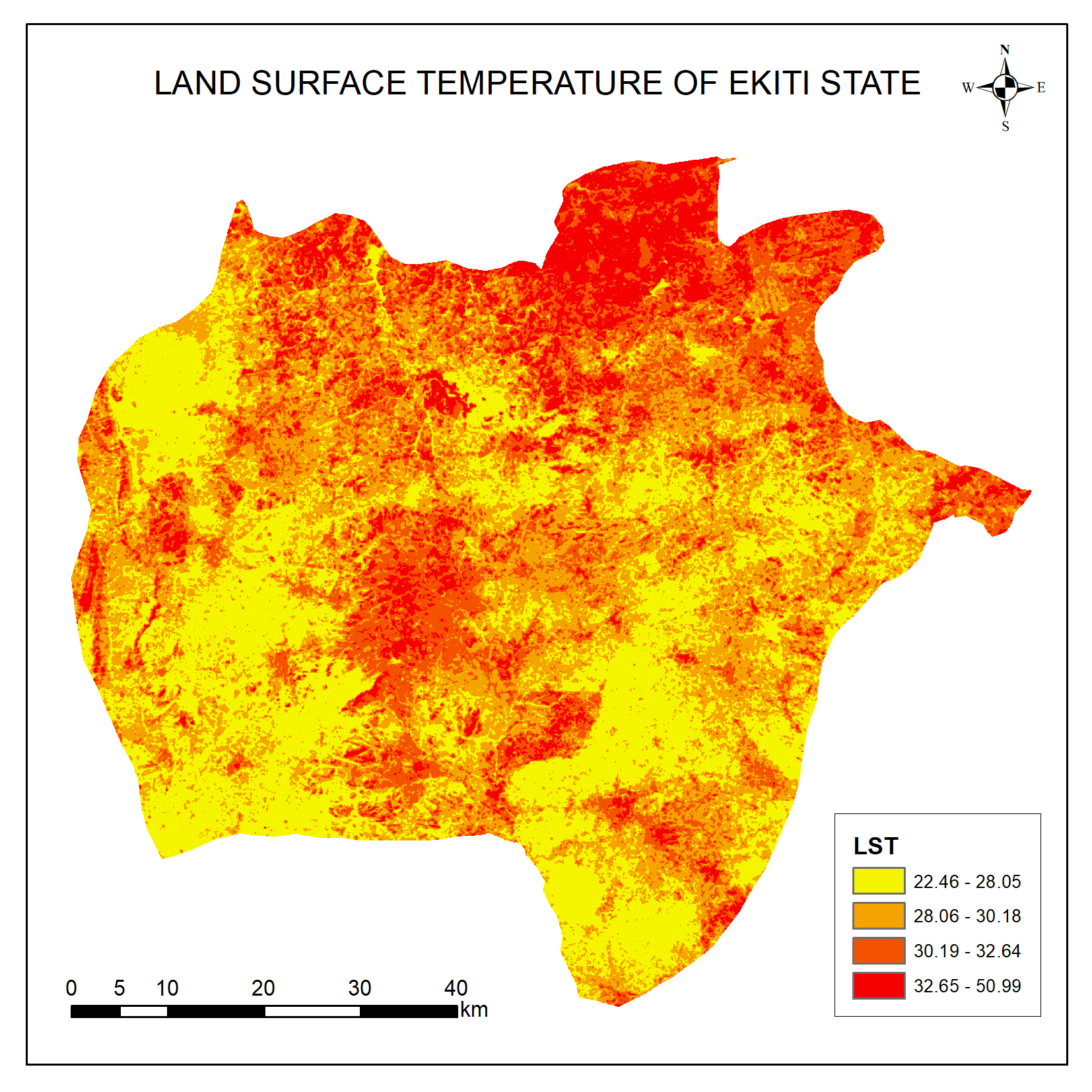
Land Surface Temperature (LST) is the degree of hotness or coldness of the earth's surface at a particular location. LST is important in monitoring climate change, urban heat, etc. LST are estimated from Landsat thermal band. For this project Landsat 9 data that covers Ekiti state was downloaded from USGS Earth Explorer website.
The LST retrieval involved three major steps:
1. Conversion of Digital Number (Band 10) to Spectral Radiance
2. Conversion of Spectral Radiance to TOA Brightness Temperature
3. Conversion of TOA Brightness Temperature to Land Surface Temperature (LST).
From the map produced, the lowest and highest temperature were 22.46 and 50.99 respectively; the northern region of Ekiti has high LST when compared to the southern region.


_1708284.png&w=3840&q=100)


