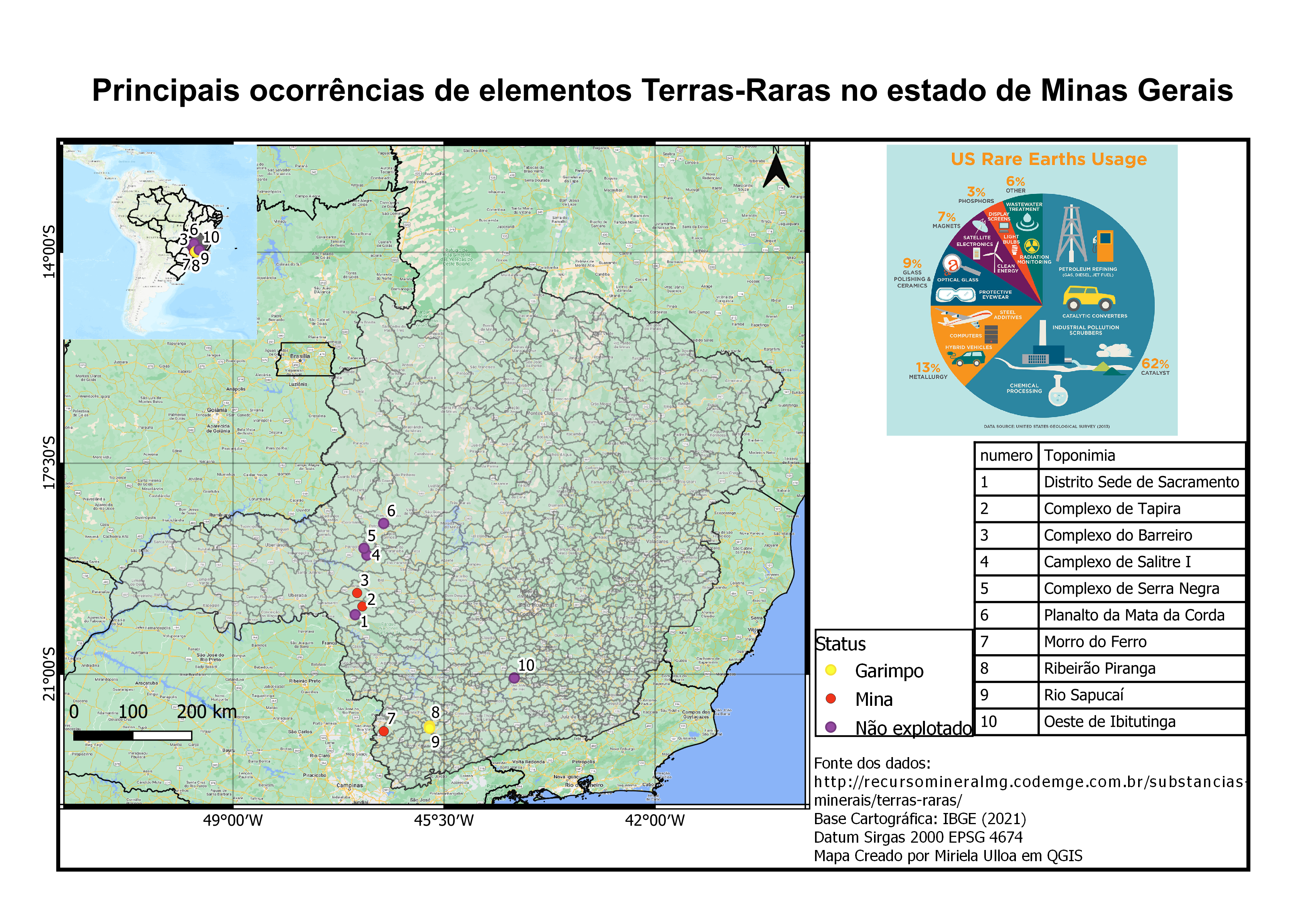
Principais ocorrências Terras-Raras - MG

Tools used
Google MapQGIS
More by Miriela Ulloa Santana


You might also like


Join the community!
We're a place where geospatial professionals showcase their works and discover opportunities.
Principais ocorrências Terras-Raras - MG
More by Miriela Ulloa Santana
You might also like
We're a place where geospatial professionals showcase their works and discover opportunities.