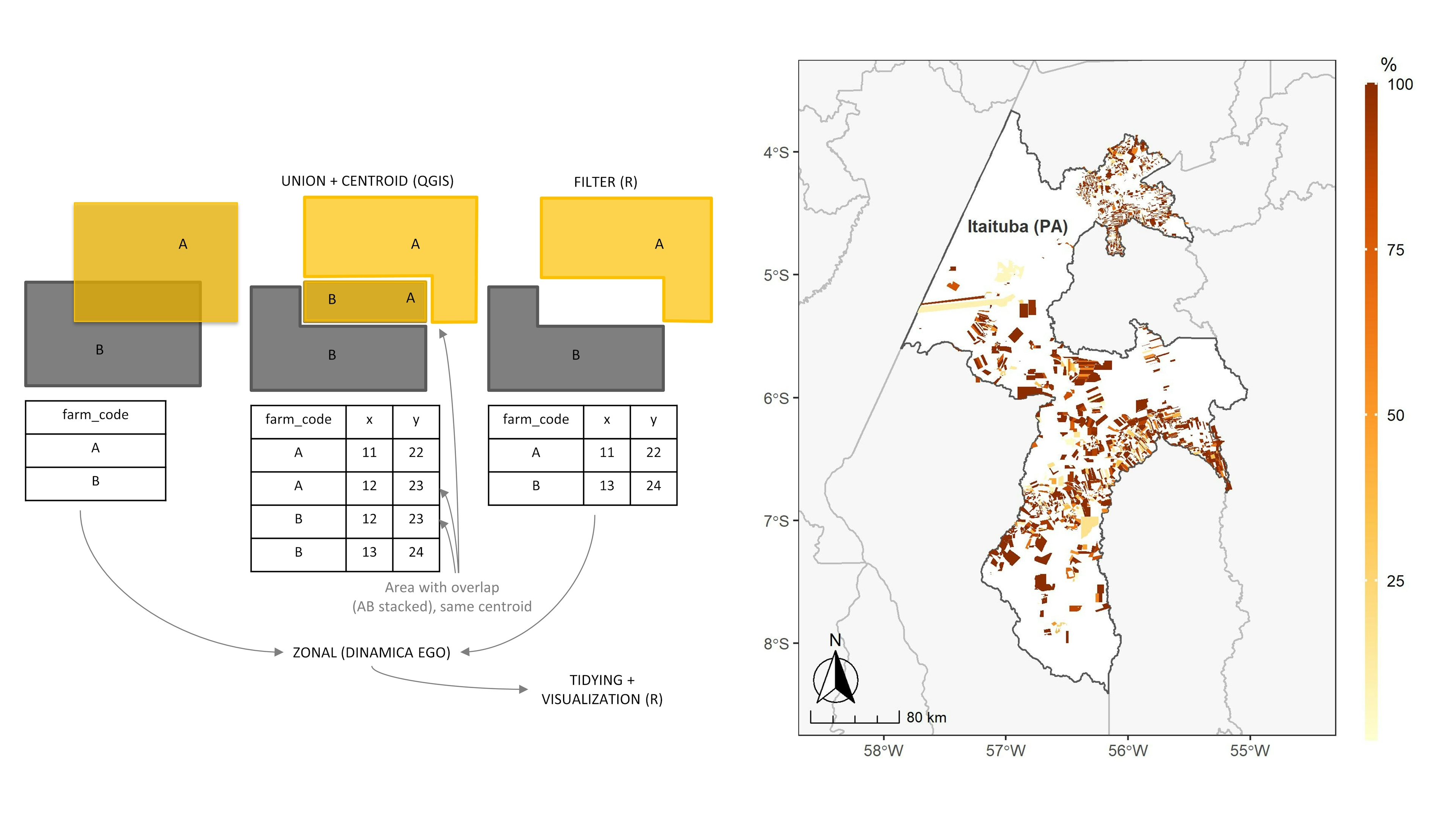
Since the Rural Environmental Registry (CAR) database has a lot of overlap and forest restoration has the potential to occupy post-2008 deforestation areas as compliance with the Brazilian Forest Code, this map presents a strategy to measure the post-2008 deforestation rate outside the overlapping area among rural properties registered in the CAR. To this end, a pilot was run in a municipality in the state of Pará, located in the Brazilian Amazon.
Source: Deforestation - PRODES (INPE, 2021), Rural Environmental Registry - CAR (SFB, 2021) and municipalities (IBGE, 2021).


.jpg&w=3840&q=100)