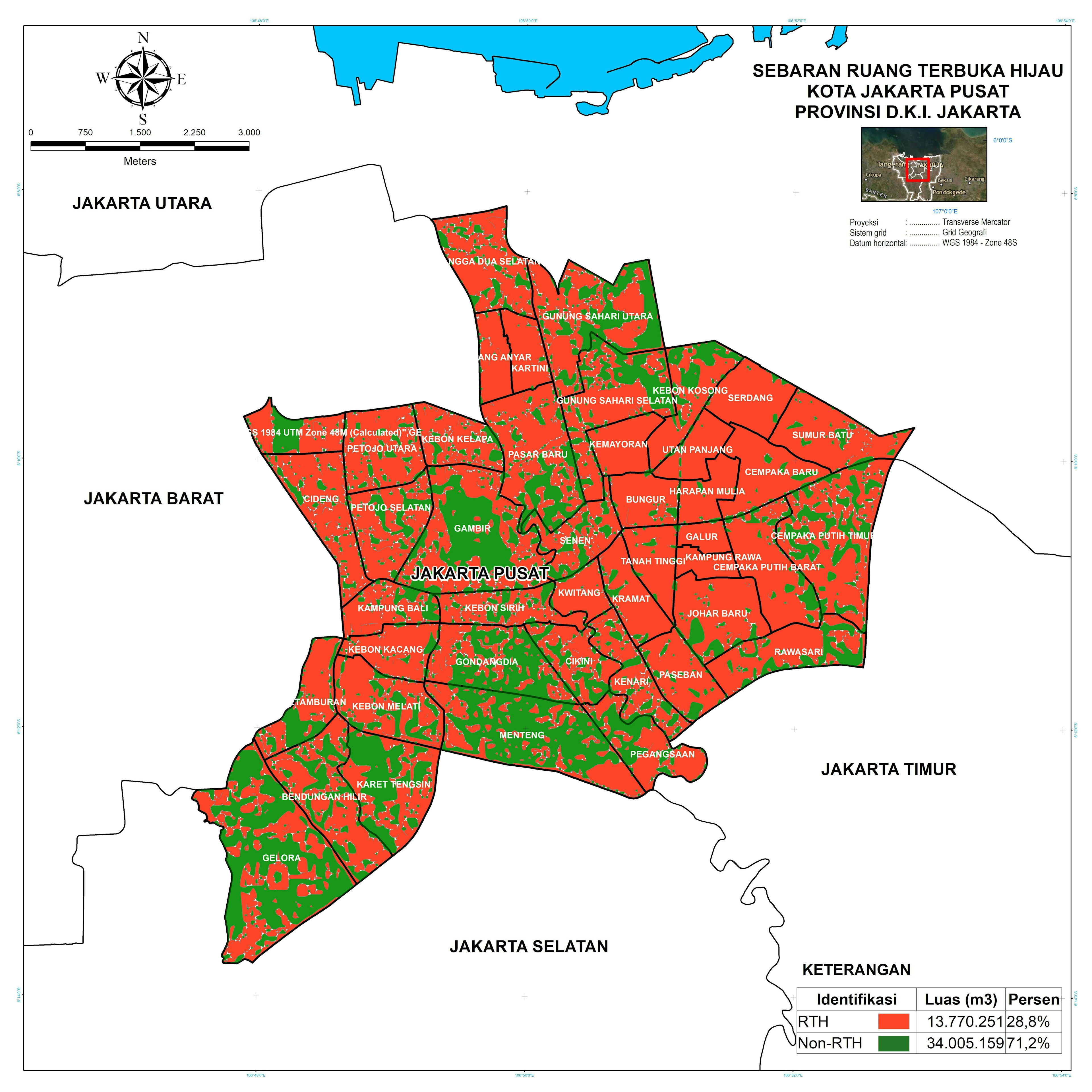
Created using Image Classification, Interactive Supervised Classification in ArcGIS.
Based on 09-12-2021 Landsat 8 OLI/TIRS satellite imagery
Open Green Space Distribution Map
Created using Image Classification, Interactive Supervised Classification in ArcGIS.
Based on 09-12-2021 Landsat 8 OLI/TIRS satellite imagery
More by Adhira Riza Muqtadir
You might also like
We're a place where geospatial professionals showcase their works and discover opportunities.