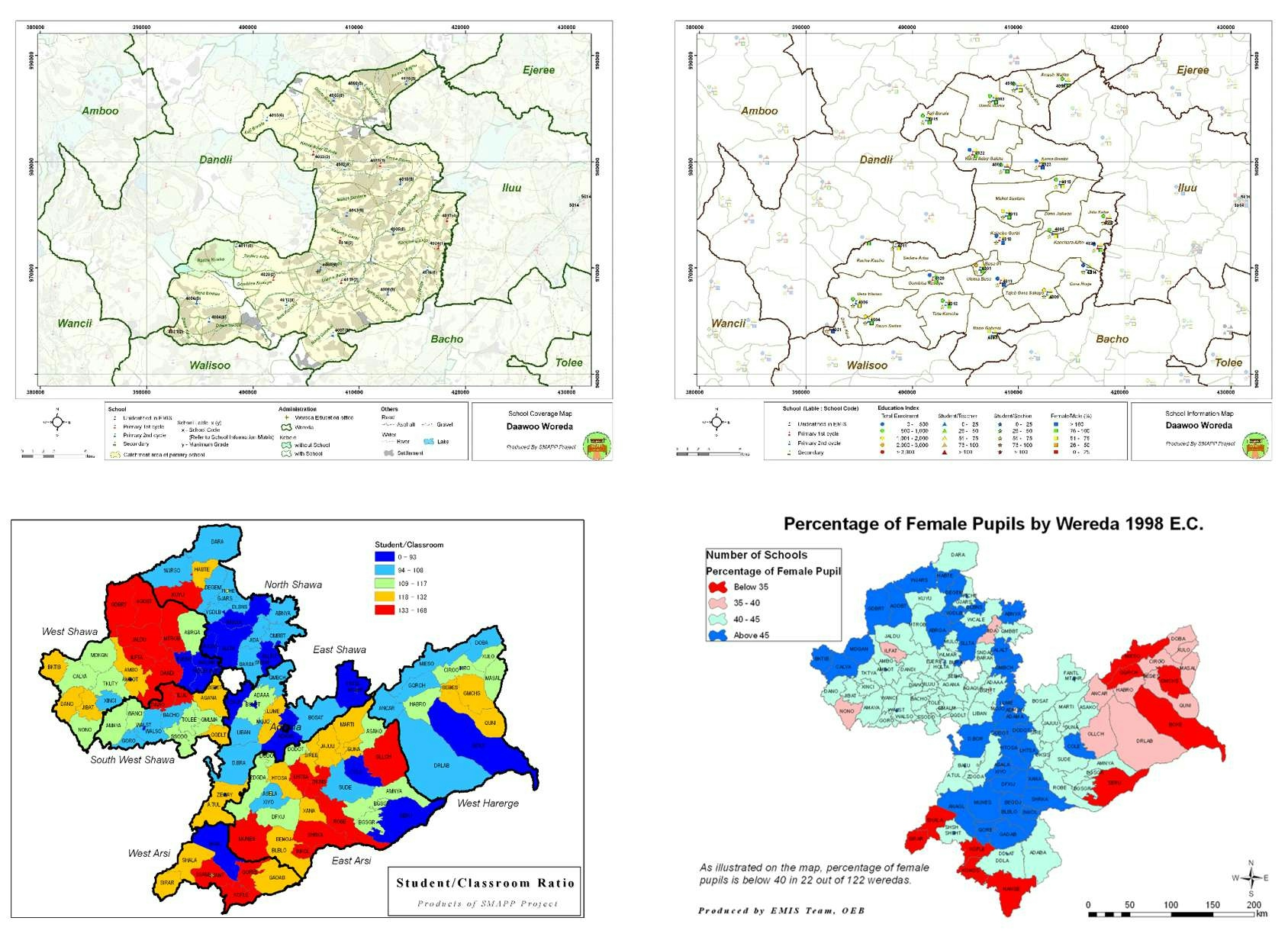
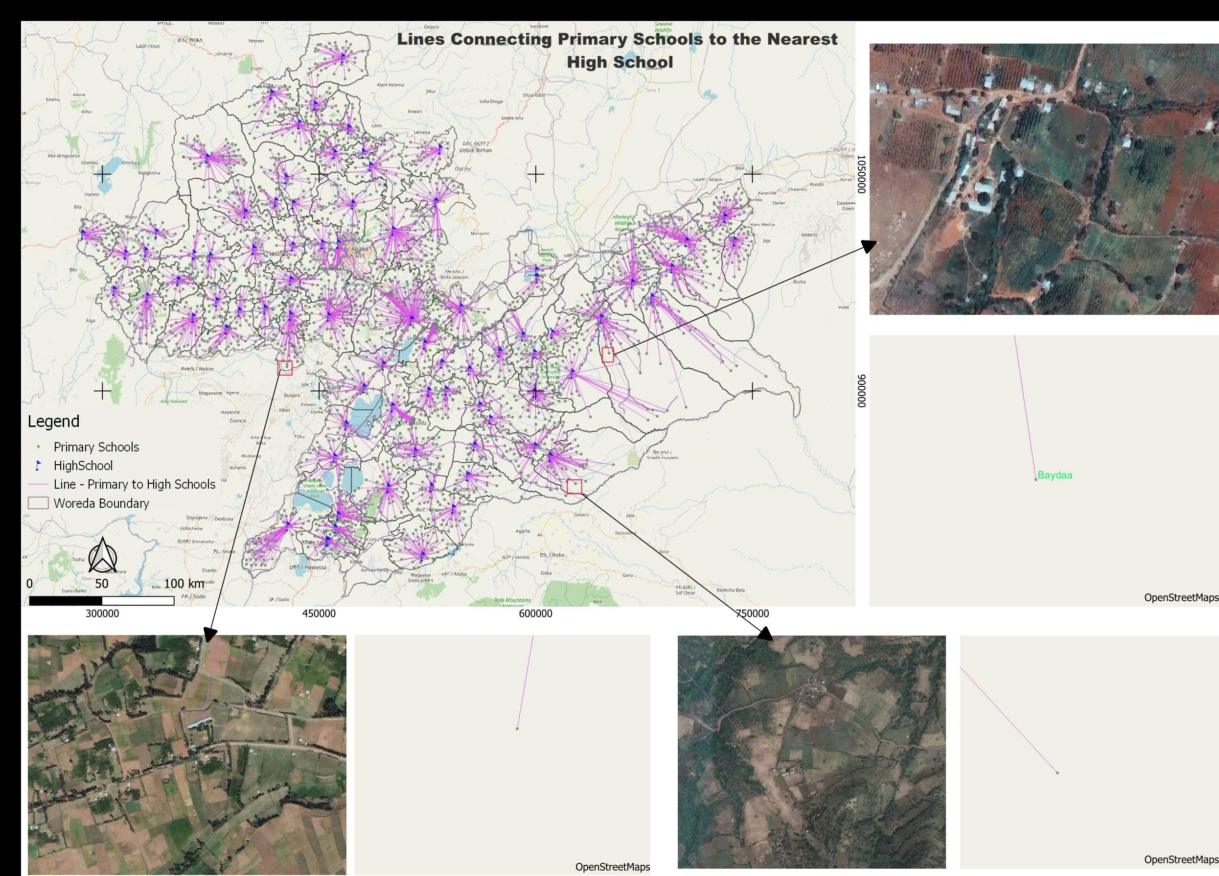
The Project on Increasing Access to Quality Basic Education through Developing School Mapping and Strengthening Micro- Planning – SMAPP.
I was involved in the project as a GIS expert. I worked closely with domain experts to create maps and school information matrices that guide the woreda, zone, and regional education experts to make decisions on prioritizing new school construction and classroom expansion in existing ones. I also did several capacity-building pieces of training on GIS for Education Sector experts within the framework of the project.
On the Sample maps above, the first two maps show the situation of school coverage and indicators at the school level for a woreda. The first map on the second row shows the aggregated information on the student/teacher ratio (the need to hire new teachers) and the second map illustrates the gender gap (the need for women empowerment).


.jpg&w=3840&q=100)