
Table of Contents
Introduction
Getting Started with Satellite Imagery
Online Satellite Imagery Data Sources
USGS EarthExplorer
Sentinel Hub
Copernicus Data Space Ecosystem
Google Earth
NASA EarthData
Conclusion
Introduction
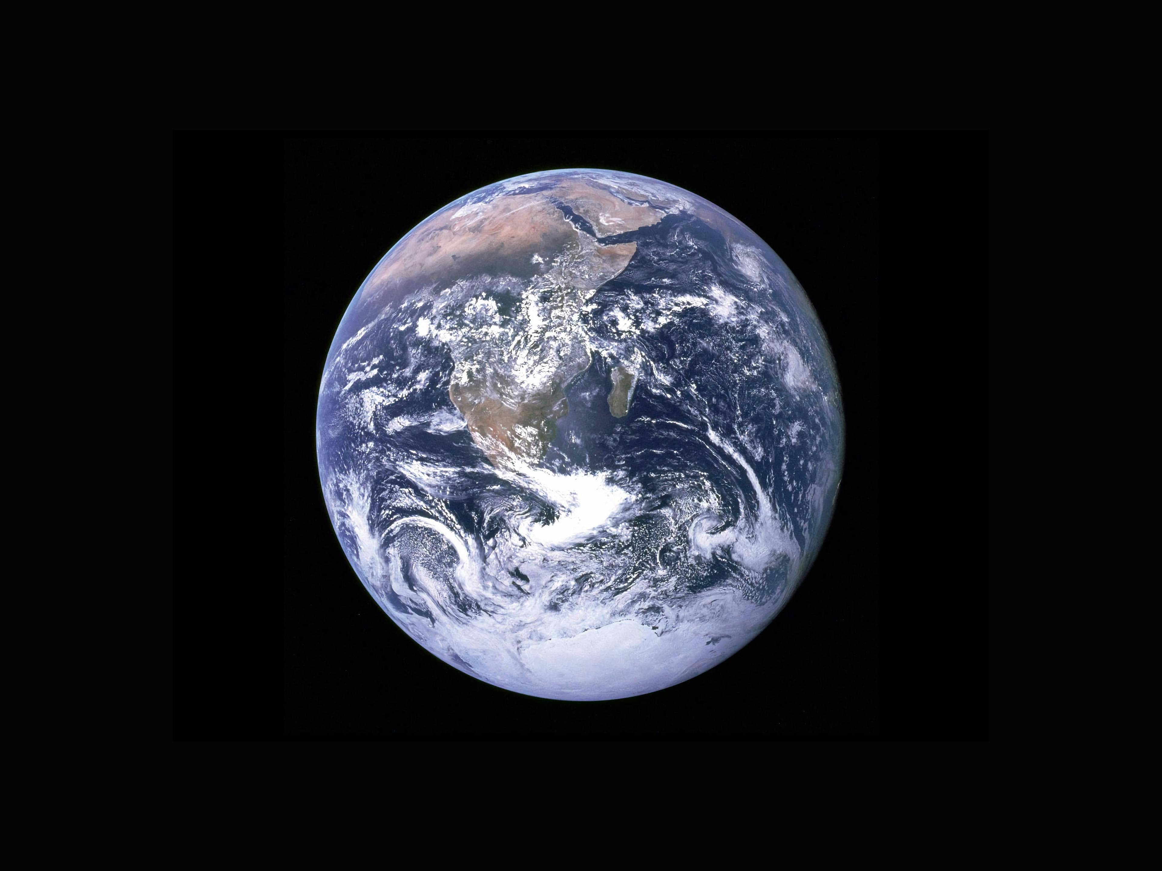
Satellite imagery is an important technology for revolutionizing the way we perceive and understand our planet. These images captured by the satellite provide invaluable insights into Earth's features, changes, and patterns over time to help plan, route, and respond to various issues.
This article will help you get started with Satellite imagery, walking you through the different online data sources you can explore to view and download satellite imagery.
Before we explore different online Satellite Imagery Data Sources, you might want to check out the article on the basics of Satellite Imagery: what Satellite Imagery is, the different types, its importance, and the matter of Resolution. Click here to read all about it!
Getting Started with Satellite Imagery
There are a variety of data sources from which one can get satellite imagery. Each data source has its own unique capabilities, tailored to specific needs. Whether you just want to view satellite imagery and not download it, or you need very high-resolution satellite imagery to download and process for your projects and research, there is a platform suited to your needs. However, it is essential to note that while there are various accessible sources, there are also sources focused on making high-resolution imagery available for purchase.
With a vast number of platforms out there, it can be hard to navigate to the one suited to your needs; hence, this article will help you get started with satellite imagery and help you navigate various accessible data sources.
Online Satellite Imagery Data Sources
USGS EARTH EXPLORER: YOUR ONE-STOP SHOP FOR OBTAINING GEOSPATIAL DATASETS

The United States Geological Survey (USGS) EarthExplorer is an invaluable platform for accessing an extensive archive of geospatial data, including satellite imagery, aerial imagery, and UAVs.
Pros:
USGS EarthExplorer has a vast and diverse collection of data. You can access datasets, from optical and radar data to digital elevation maps to weather data, and also from different earth-observing missions (Landsat, Sentinel, ASTER, Terra and Aqua MODIS, etc.).
EarthExplorer has a history of collecting geospatial data spanning decades, so you can access an extensive historical record of the Earth's surface, making it a treasure trove for long-term research and the study of land-use change.
Navigating through EarthExplorer is remarkably user-friendly. The platform offers intuitive search options; you can precisely define your search criteria by setting a specific location, date range, or sensor type, allowing users to define their search criteria with precision.
It also has advanced search capabilities, including options to filter by cloud cover, sensor type, collection tier, and more. These features ensure that researchers and professionals can access high-quality imagery tailored to their specific project requirements.
USGS EarthExplorer provides free and open access to a significant portion of its data. You can get free satellite imagery from Landsat, Sentinel, ASTER, etc., and some high-resolution satellite images from IKONOS and historic SPOT for commercial purposes.
Cons:
Despite its user-friendly interface, the advanced search capabilities can get overwhelming for new users to navigate. Users may need some time to become familiar with its search parameters and filters.
Users need to manually sort through the images to select the best ones that suit their needs.
While EarthExplorer provides free access to many datasets, some high-resolution or specialized data may come at a cost. Commercial satellite imagery providers may offer additional data options but at a price.
SENTINEL HUB: CLOUD API FOR SATELLITE IMAGERY.
BROWSE. PICK. ENHANCE. EXPOSE

Sentinel Hub is one of the most popular platforms to access a wealth of satellite and remote sensing data from the European Space Agency's (ESA) Copernicus program. Vast satellite images and data (all Sentinel products, Landsat products, MODIS products, and archive satellite images) are available for a wide range of applications. Sentinel products you can access in the Sentinel Hub include:
Sentinel 1, which is currently the sole freely available Synthetic Aperture Radar (SAR) dataset (C-band), and
Sentinel 2, which currently offers the highest resolution for free satellite imagery (10m resolution with a 5-day revisit time).
Pros:
Sentinel Hub has a comprehensive data repository, from high-resolution multispectral imagery (Sentinel-2 with 10m spatial resolution and 5 days revisit time) to all-weather radar imagery (Sentinel-1 C-band) to Landsat and MODIS products, and to an archive of satellite images, that is suitable for diverse applications.
One of the outstanding features of Sentinel Hub is its capability for cloud-based processing. This means that you can access, process, and analyze data without the need for local computing resources. This streamlines workflows, making it easier to extract valuable information from large datasets.
Sentinel Hub provides access to time series data, which makes it ideal for monitoring changes over time. You can easily monitor various phenomena, including changes in land cover, vegetation growth, and infrastructure development.
Cons:
Sentinel Hub’s interface is powerful but can be complex for new users. New users may need some time to become familiar with its functionalities and scripting capabilities.
Sentinel Hub’s customization options can be challenging for beginners. Writing custom scripts to access and process data may require programming skills, which can be a barrier for some users.
While Sentinel Hub offers cloud-based processing, you may still need data processing skills and software to fully analyze and interpret the data, especially for advanced applications.
COPERNICUS DATA SPACE ECOSYSTEM: GET FREE INSTANT ACCESS TO A WIDE RANGE OF DATA

The Copernicus Data Space Ecosystem is an open ecosystem that provides free instant access to a wide range of data and services from the Copernicus Sentinel missions and more on our planet’s land, oceans, and atmosphere. It went live on January 24, 2023, and at its core is the Copernicus Open Access Hub (previously known as Sentinels Scientific Data Hub), which serves as the primary repository and distribution point for all Sentinel satellite data with new features for visualization and data processing.
Pros:
The Copernicus Data Space Ecosystem offers comprehensive data coverage, including near real-time and historical data. This enables you to monitor long-term changes on the Earth’s surface. Access to near real-time data is crucial for various applications, such as disaster management, environmental monitoring, and scientific research.
The Ecosystem embraces the philosophy of open data, providing free and open access to an extensive range of Earth observation data. This approach fosters transparency, innovation, and collaboration among users, benefiting both research and commercial endeavors.
The Ecosystem’s cloud-based access and processing capabilities enhance users' experiences as they reduce their reliance on extensive local computing resources.
The accessibility of cloud-based processing helps users engage with and derive insights from large datasets, even without advanced technical expertise.
Cons:
You may encounter limitations on data volume and processing capabilities if you are working on a high-demand project that requires extensive data processing, especially when you are on a free or limited-tier service.
The Ecosystem relies on stable and fast internet connectivity, which can pose as a challenge if you are in an area with limited or unreliable internet access.
You may need to have the necessary software and skills for data processing, analysis, and interpretation, which can be a challenge if you don’t have a background in geospatial or remote sensing analysis.
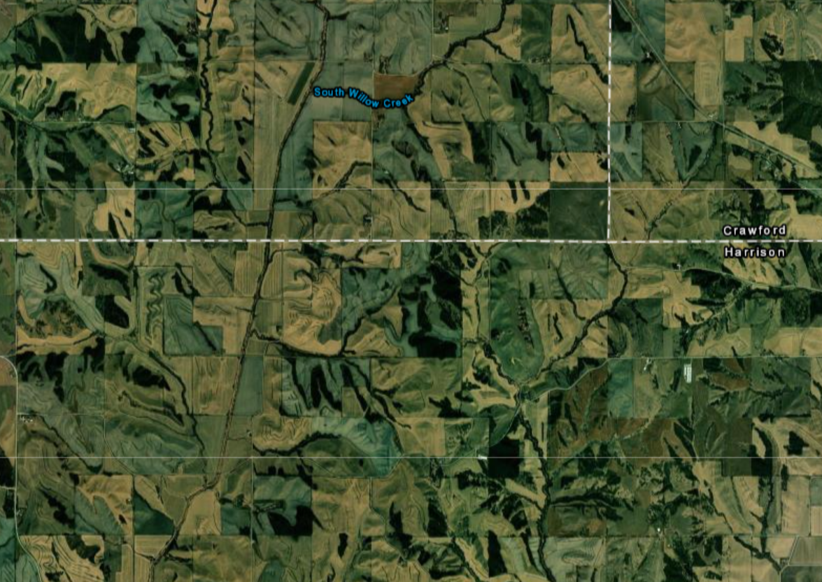
GOOGLE EARTH: GRAB THE HELM AND GO ON AN ADVENTURE IN GOOGLE EARTH

Google Earth is a powerful and user-friendly geospatial tool that renders a 3D representation of Earth based primarily on satellite imagery and is developed by Google. It allows users to explore the Earth and beyond through satellite imagery. Google uses a variety of sources to provide high-resolution imagery. The spatial resolution depends on the area and ranges from 15 centimeters to 15 meters.
Google Earth works on the web, mobile, and desktop (Google Earth Pro works for Windows, macOS, and Linux).
Pros:
You can access high-resolution satellite imagery of virtually every part of the Earth on Google Earth. You can also zoom in to explore landscapes and urban areas in stunning detail.
You can access diverse types of imagery on Google Earth, ranging from multispectral and radar imagery to high-resolution optical and thermal data, which is sourced from various satellite missions, including but not limited to Landsat, Sentinel, TerraSAR-X, and WorldView.
Google Earth allows you to view buildings and terrain in 3D models, which allows you to virtually "fly" over cities and landscapes.
Do you know you can take a virtual tour along streets, through parks, inside museums, and even zoom into your house from a 3600 perspective? Yes, all these are possible with Google Earth Street View.

Google Earth Street View
Google Earth also allows you to access a time-lapse view of locations over the years, which can provide insights into changes in land use, urban development, and environmental conditions.
You can measure distances, calculate areas, and add custom annotations to maps on Google Earth. Google Earth also allows you to import and export GIS data.
Cons:
One of the cons of using Google Earth is that you can not download the imagery for offline use. The images are primarily for viewing and exploration within the platform, which can be a limitation if you need the imagery for processing and analysis.
While Google Earth provides global coverage, some remote or less-developed regions may have lower-resolution or outdated imagery, limiting its usefulness for certain locations.
While Google Earth provides historical imagery, the availability of historical data may vary by location, and you may not have access to extensive historical archives in some areas.
Google Earth's terms of use have restrictions on commercial use, which may require businesses to seek licensing or alternative geospatial solutions for commercial applications.
NASA EARTHDATA: OPEN ACCESS FOR OPEN SCIENCE

NASA Earthdata is a comprehensive platform that provides access to a wealth of Earth science data, tools, and resources collected and generated by NASA's Earth-observing missions and satellites, to understand and protect our home planet. The NASA Earthdata portal is very user-friendly, and even if you are new to how it works, the Data Pathfinders on the portal can help you chart a path on how to select the right data and imagery you need and how you can use them. You can interactively browse and download full-resolution, global satellite imagery from over 1000 data products from NASA’s Land, Atmosphere, Near real-time Capability for EOS (LANCE), and other NASA data providers.
Pros:
NASA Earthdata has one of the most extensive collections of Earth science data worldwide. You can get vast satellite datasets, ranging from Satellite observations to climate data, to atmospheric measurements, and much more, on various topics, including but not limited to the Atmosphere, Biosphere, Cryosphere, Land Surface, and Ocean.
NASA Earthdata platform is user-friendly, even if you are new to the platform, you will still be able to navigate through the various tools they have created to guide you. You can easily find and access specific datasets and information with ease with NASA Earthdata’s powerful search and discovery tools.
Aside from the fact that you can search for datasets by topic, NASA Earthdata also offers you the flexibility to access Earth science data programmatically through Application Programming Interfaces (APIs). As a developer, researcher, and/or organization, this important feature allows you to seamlessly integrate NASA’s data into your own applications, workflows, and projects.
The platform also provides a suite of visualization and analysis tools that enhance your interaction with various Earth science data and help you derive insights from it.
NASA Earthdata offers near real-time data and imagery. Most data products are available within three hours of satellite observation, with imagery generally available 3-5 hours after an observation.
Cons:
While many datasets are openly accessible, some may have specific licensing restrictions or terms of use that users need to adhere to, especially for commercial or redistribution purposes.
NASA Earthdata has a vast repository of Earth science data, and navigating through it can be challenging if you do not have prior experience in remote sensing or Earth science research.
Conclusion
In this article, we have looked at different online data sources where we can view, explore, and even download satellite data and imagery. Each of these data sources has its own uniqueness. We have also looked into the pros and cons of these sources, which should help guide you when you need satellite data and imagery for whatever purposes.
There are a lot more data sources that you can explore, but in this article, we will leave it at just the ones we have discussed above.
This article is in a series titled Satellite Imagery: Exploring All About It!, where we will explore all about satellite imagery: the basics of satellite imagery, the online satellite imagery data sources, the detailed guide on how to download satellite imagery from the various data sources, and how we can make the most of satellite imagery.
If this looks like something you are interested in reading and learning about, kindly check out the series!