Sign up or log in to your Spatialnode account.

Takes less than a few seconds.

3D Map of Idi Hill

Lukumon Lateef
Lukumon Lateef•

April 09, 2023

3D Map of Idi Hill

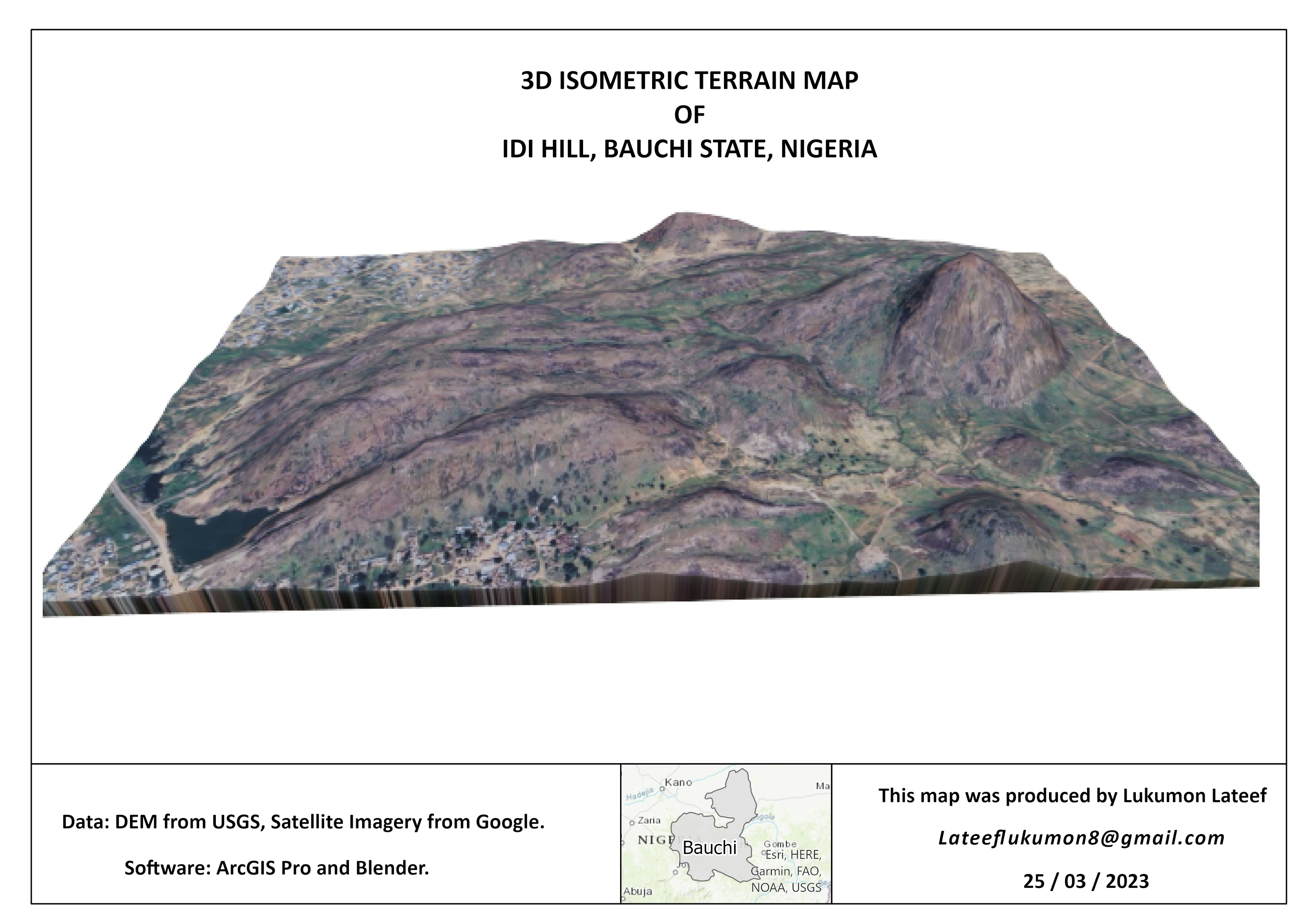
3D Map of Idi Hill in Bauchi State Nigeria. 

Data: DEM from USGS and satellite imagery from Google.


Tools used

ArcGIS ProBlender

Plug-ins used

BlenderGIS

tags

3d map Blender3DIsometricmap

More by Lukumon Lateef

Habitat Suitability Modelling for Owl
19
Hurricanes since 1851
17
Hosp. DIstrbution In North-East Nigeria
21

You might also like

Boundaries of Waters of the US
Harrison Hyatt
Boundaries of Waters of the US
Harrison Hyatt
22
Topographic Analysis
Emilian
Topographic Analysis
Emilian
16
Vegetation Indices on Landsat 1-3 data
Corrine Coakley
Vegetation Indices on Landsat 1-3 data
Corrine Coakley
28
Tree Species Distribution
Satyam Soni
Tree Species Distribution
Satyam Soni
40
Localização de distritos de intervenção
Ajumar Omar Alfaica
Localização de distritos de intervenção
Ajumar Omar Alfaica
17
Mapa coroplético
Jardel Estevam Barbosa dos Santos
Mapa coroplético
Jardel Estevam...
106
Spatial Distribution of Healthcare
Akor, Daniel Enechojo
Spatial Distribution of Healthcare
Akor, Daniel Enechojo
42
LULC and Wind direction map.
Oswald Onimhawo
LULC and Wind direction map.
Oswald Onimhawo
28
MUNICÍPIO DE BELÉM EM 1988
Mapa_Geo
MUNICÍPIO DE BELÉM EM 1988
Mapa_Geo
41
Elevation Map Switzerland Tanaka Method
Viola Schweiger
Elevation Map Switzerland Tanaka Method
Viola Schweiger
60
Coleta de Resíduos Sólidos Urbanos
Matheus Amaral Prates
Coleta de Resíduos Sólidos Urbanos
Matheus Amaral Prates
4
Rainbow Mountain Trekking
Thaís Baêta
Rainbow Mountain Trekking
Thaís Baêta
89

Join the community!

We're a place where geospatial professionals showcase their works and discover opportunities.
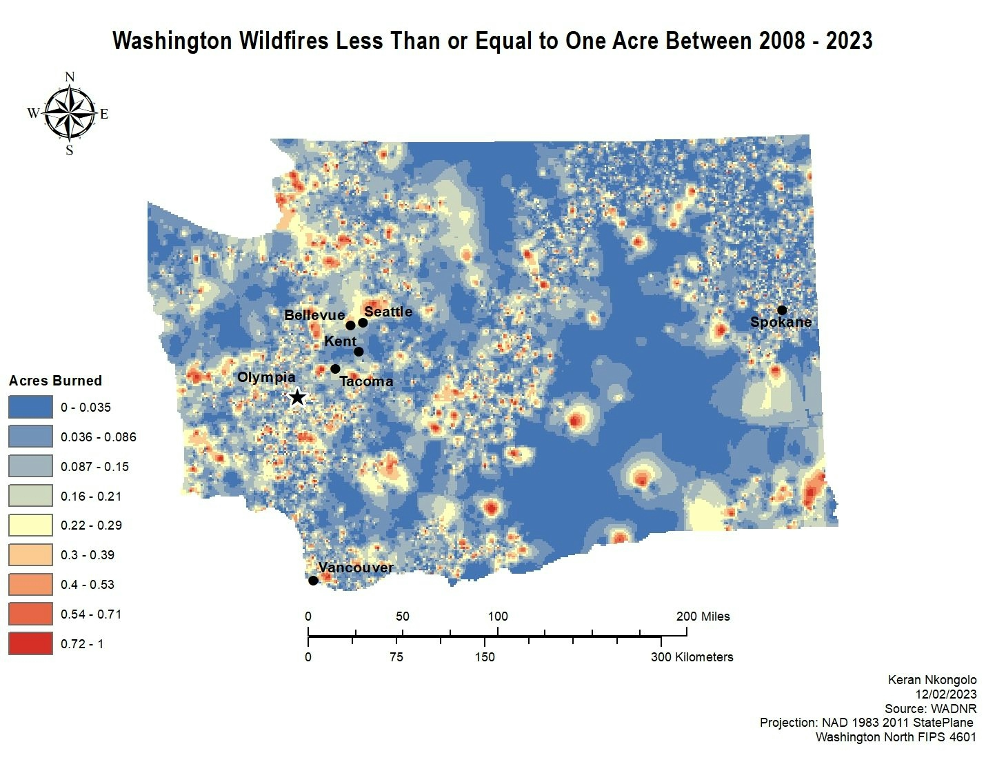
Sign Up for free