_645201.jpg&w=96&q=50 "Eguagie-suyi Precious")
Introduction
Land surface temperature is the degree of hotness or coldness that can be felt from the surface of the earth when touched in any location. It can also be defined as the radiative skin temperature of the land surface. Land surface temperature is a mixture of vegetation and bare soil temperatures. Because both respond rapidly to changes in incoming solar radiation due to cloud cover and aerosol load modifications and diurnal variation of illumination, the land surface temperature displays quick variations too. In turn, the LST influences the partition of energy between ground and vegetation and determines the surface air temperature.
STUDY AREA
Abuja is the capital city of Nigeria. It is located in the north-central part of Nigeria. It has an estimated population of about 2.5 million people. Abuja before becoming FCT was basically known for its farming activities. After the year 1976 industrial activities increased because of the Change in FCT from Lagos to Abuja.
Materials
The satellite imagery used is Landsat 8 Level 1 . Arcmap was used for processing the satellite data and designing the map.
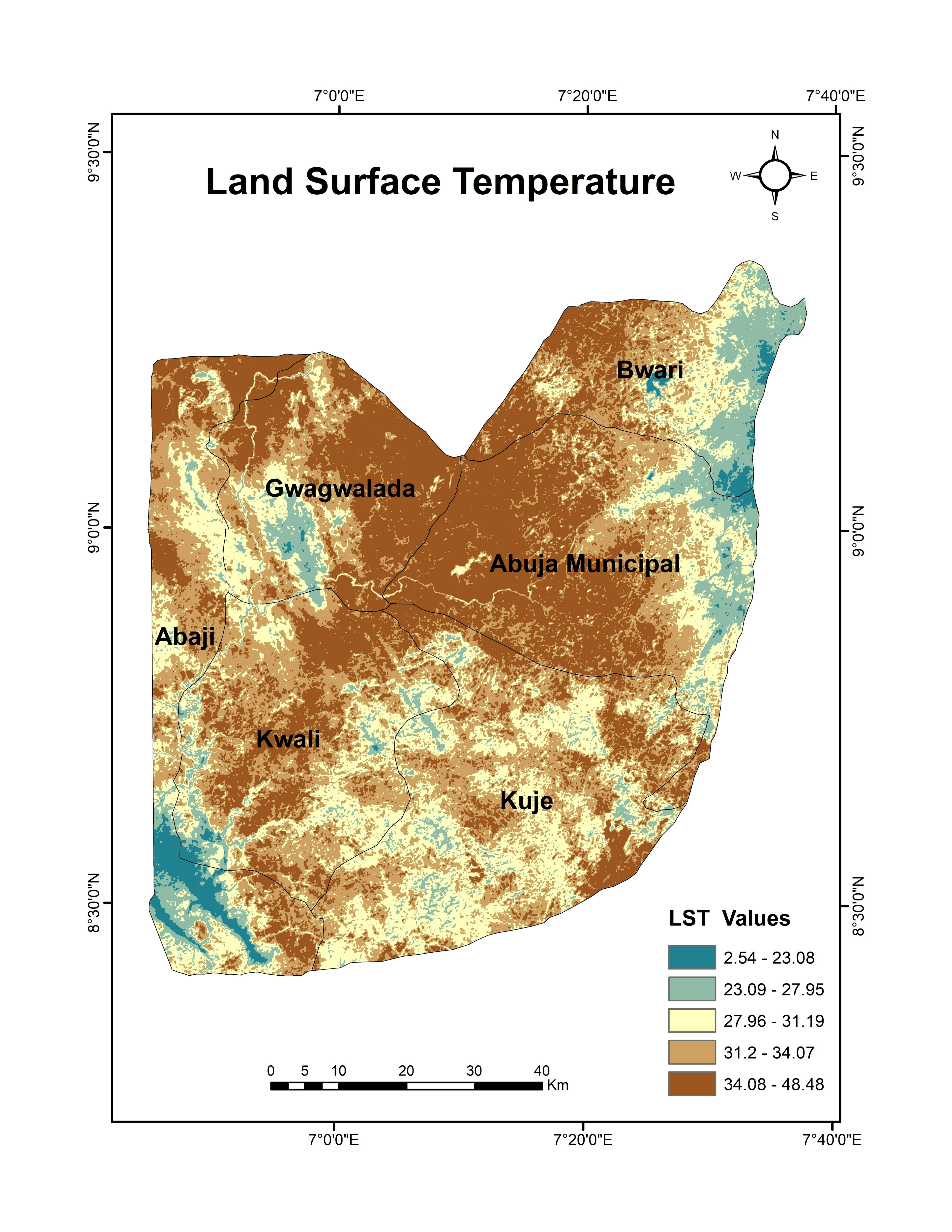
Result
The map shows that the land surface temperature over Abuja in January 2023 varies from 2.4 degrees Celcius to 48.4 degrees Celsius. From the map, we can deduce that the northern part of Abuja has higher LST value than the southern part of Abuja. The northeast and southwest have very low LST values, showing that this region will be a bit cold.
Conclusion
This project shows that the higher land surface temperature is associated with industrial areas in Abuja. The map which shows the different local governments in Abuja shows that gwagwalada and Abuja municipal local governments have the highest LST values. This project justifies that industrial activities have an impact on the land surface temperature.