

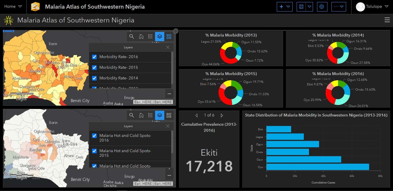
This project involved the analysis of the land use land cover changes and extent along the Abuja-Kaduna railway perimeter. The analysis showed the pattern and extent of changes and the implications on its surroundings.
Analysis of LULC along ABJ-KAD Rail
Tools used
ArcMapRemote Sensing
Plug-ins used
ArcMap
tags
LandsatLULCRemote Sensing
More by Lawrence Akpoterai


_7771518.jpg&w=3840&q=100)


You might also like


Join the community!
We're a place where geospatial professionals showcase their works and discover opportunities.