Sign up or log in to your Spatialnode account.

Takes less than a few seconds.

COVID-19 morbidity cases in Nigeria

Lawrence Akpoterai
Lawrence Akpoterai•

June 21, 2022

COVID-19 morbidity cases in Nigeria

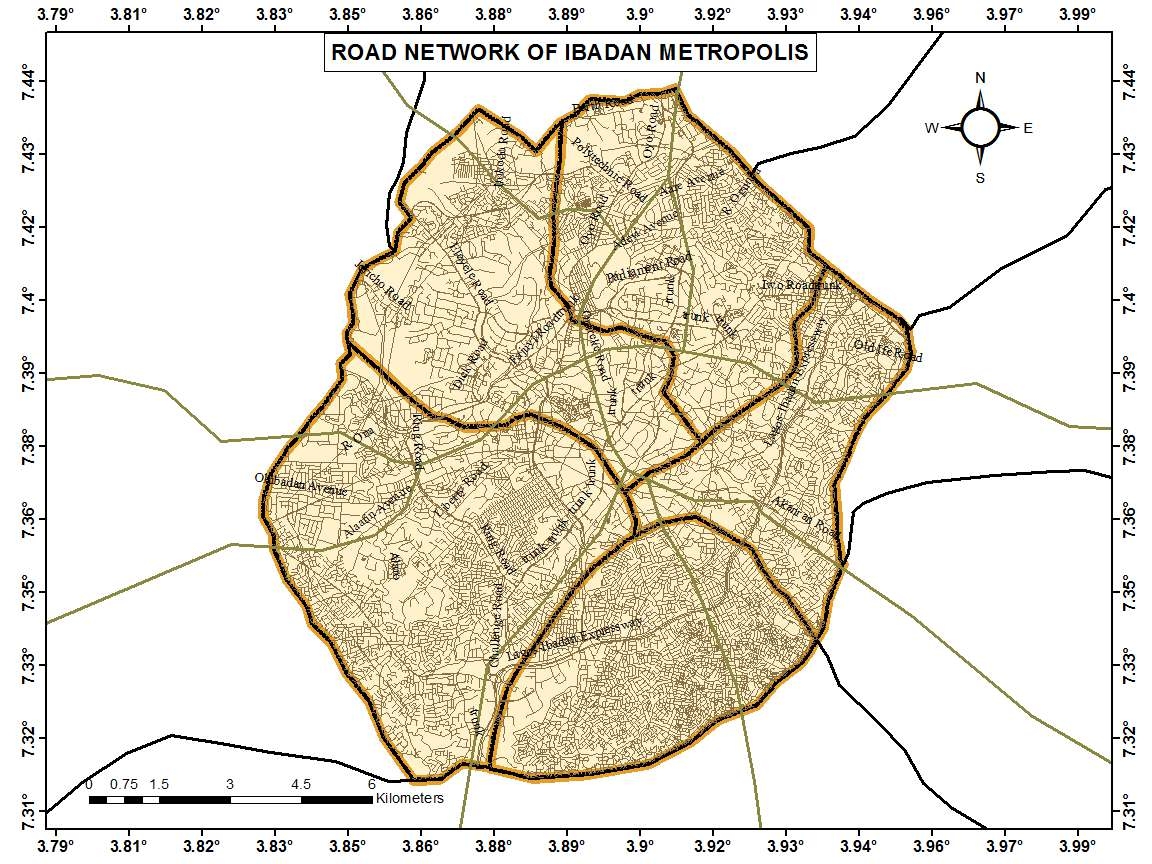
A sample map used to report COVID-19 morbidity cases on the given date. It shows the prevalence of COVID-19 across the country at state level.


Tools used

ArcMap

Plug-ins used

ArcMap

tags

COVID-19maps Nigeria

More by Lawrence Akpoterai

Land Cover Change Analysis over Ibadan
56
Malaria disease atlas for SW Nigeria
85
Spatial visualization of applicants ??
10
Land Surface Temperature Analysis
124
Road network analysis of Ibadan metro
212
CO2 Emissions across Africa, 2018
105
Data presentation on waste collection
28
Analysis of LULC along ABJ-KAD Rail
77
2020 Rainfall Dashboard, Nigeria
236

You might also like

East City - Evaluation and Reassessment
Talvinder Gill
East City - Evaluation and Reassessment
Talvinder Gill
21
Demography of Refugee Camps, CXB
Sukanto Das
Demography of Refugee Camps, CXB
Sukanto Das
194
Biodiversity assessment - Shannon index
Marta Rueda Pasadas
Biodiversity assessment - Shannon index
Marta Rueda Pasadas
32
Municip. São Paulo population density
Miriela Ulloa Santana
Municip. São Paulo population density
Miriela Ulloa Santana
84
Model Builder
Matthew Tomitz
Model Builder
Matthew Tomitz
24
Inundação do Rio Grande do Sul em 2024
Matheus Maciel
Inundação do Rio Grande do Sul em 2024
Matheus Maciel
19
Mapa LICENÇA AMBIENTAL ÚNICA
Simone Malhado da Silva
Mapa LICENÇA AMBIENTAL ÚNICA
Simone Malhado...
4
Schools nears Parks Long Beach, CA
Benny Lopez
Schools nears Parks Long Beach, CA
Benny Lopez
13
Future Ski Resort Sites, Quebec: Part 2
Cedric Phillips
Future Ski Resort Sites, Quebec: Part 2
Cedric Phillips
15
Pantabangan-Carranglan Watershed Landuse
Juan Carlos Gabriel Zacarias
Pantabangan-Carranglan Watershed Landuse
Juan Carlos...
42
Imagery - Steen's Mountain
Sherri Michl
Imagery - Steen's Mountain
Sherri Michl
73
Mapa de Índice Vegetativo (NDRE) do Café
Layanara Faria
Mapa de Índice Vegetativo (NDRE) do Café
Layanara Faria
26

Join the community!

We're a place where geospatial professionals showcase their works and discover opportunities.

Sign Up for free