Sign up or log in to your Spatialnode account.

Takes less than a few seconds.

Land Cover

Vuyani Mondli Buthelezi
Vuyani Mondli Buthelezi•

September 15, 2024

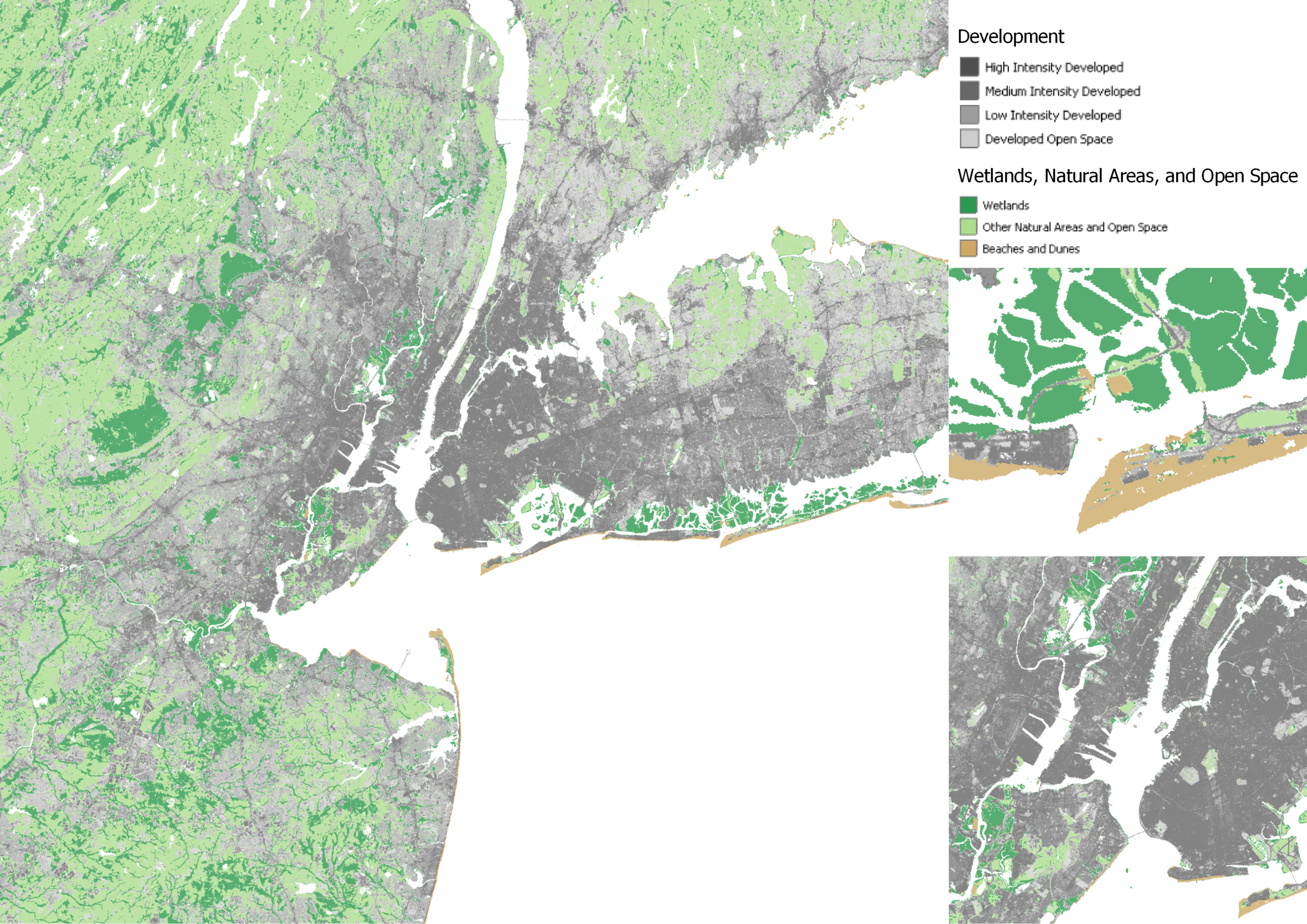
Landcover map for Umngeni district


Plug-ins used

ArcMapMapping

tags

Spatial Analysis

More by Vuyani Mondli Buthelezi

Dump Sites
20
Dumping sites in Potchefstroom
170

You might also like

Sentinel2 Band Combinations
Leonie Engemann
Sentinel2 Band Combinations
Leonie Engemann
88
LANDUSE/LANDCOVER MAP OF KETA LAGOON
Emmanuel Opoku
LANDUSE/LANDCOVER MAP OF KETA LAGOON
Emmanuel Opoku
9
Tectonic & Lithological Map - CTFB & IBR
Niroj Shrestha
Tectonic & Lithological Map - CTFB & IBR
Niroj Shrestha
16
Modelagem de Corredor Ecológico
Paulo Vitor Moraes Estella
Modelagem de Corredor Ecológico
Paulo Vitor...
12
Regression Analysis
Erin Rittenhouse
Regression Analysis
Erin Rittenhouse
25
Create new footways and residential ways
Mohamed Gamal Hassan Mahmoud
Create new footways and residential ways
Mohamed Gamal...
114
Mapa temático/ Thematic map
Ronald Noutcheu
Mapa temático/ Thematic map
Ronald Noutcheu
7
Topographic Map of Pila
Ivo Mihovilcevic
Topographic Map of Pila
Ivo Mihovilcevic
3
6c: Using vector data for Bike Lanes
Patrick Ansell
6c: Using vector data for Bike Lanes
Patrick Ansell
13
Composição RGB - morfometria
anderson rodrigues ribeiro
Composição RGB - morfometria
anderson rodrigues ribeiro
4
LST Map of Akure (North and South), 2020
Ojo Aladesola Monica
LST Map of Akure (North and South), 2020
Ojo Aladesola Monica
45
Diretrizes de altimetria #02
Isabel Freitas Aniceto
Diretrizes de altimetria #02
Isabel Freitas Aniceto
16

Join the community!

We're a place where geospatial professionals showcase their works and discover opportunities.

Sign Up for free