

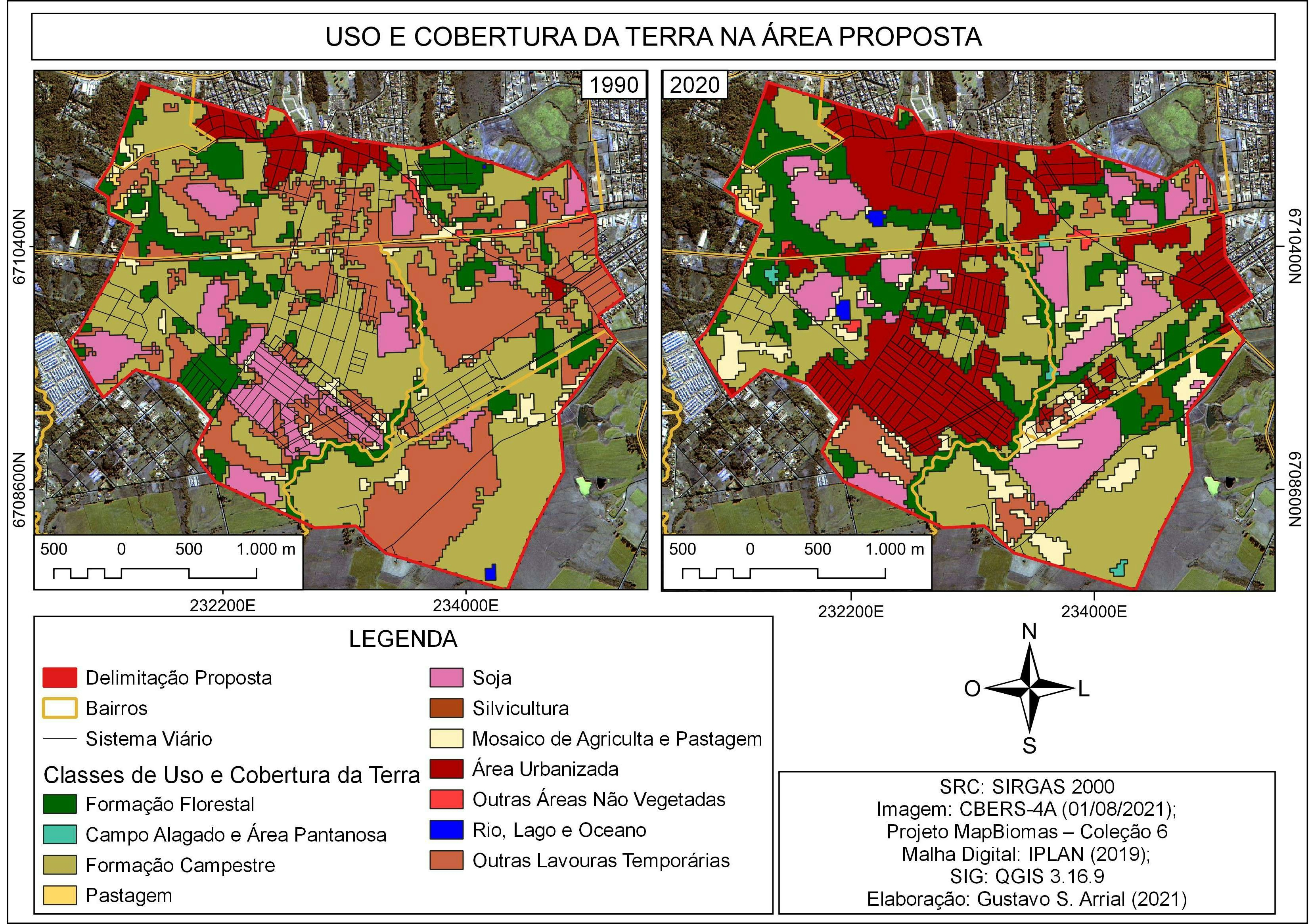
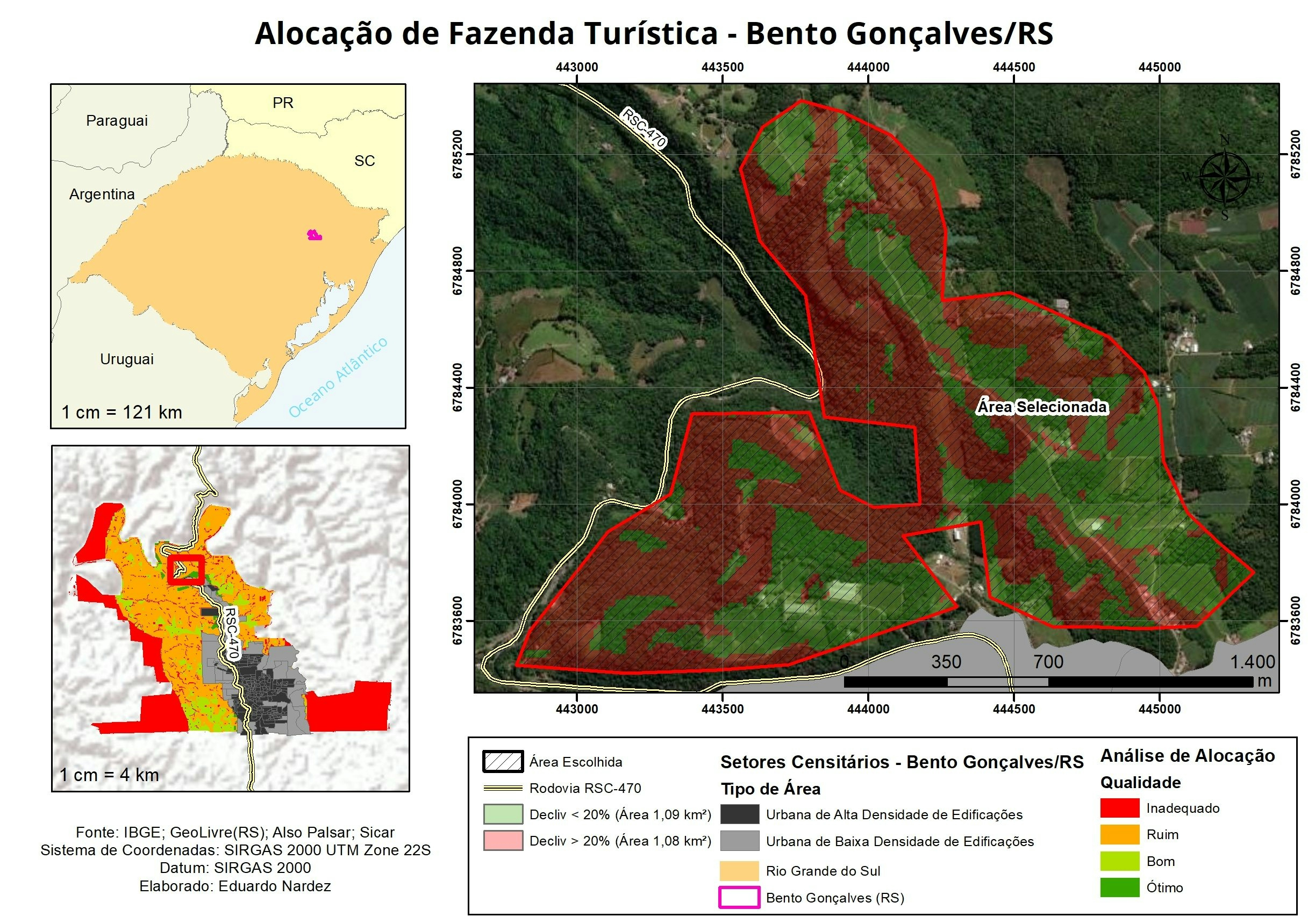
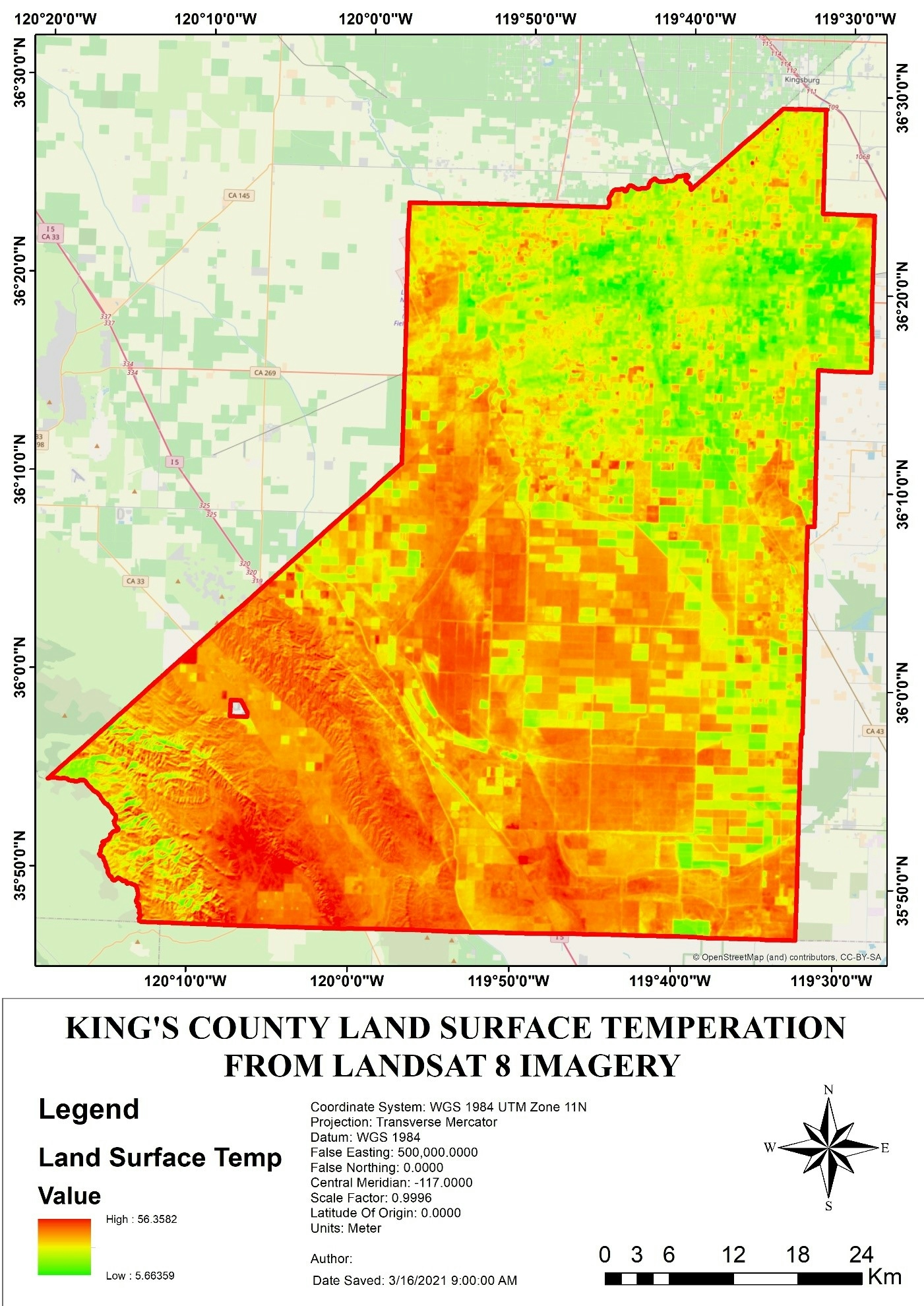
Analysis of a cliff face in North Yorkshire to identify the location of landslides between 2016 and 2017 and diagnose the mechanism by which the cliff failed. Creation of a DEM-of-difference using a DEM obtained by terrestrial laser scanning to identify changes in the rock face attributed to landslides. Validation of this against imagery of cliff face to hypothesise on the possible cause of instability in the cliff.
Landslide identification and mechanism
Tools used
ArcGIS ProCanva DEM Data (Elevation Model)
tags
ArcGIS ProDEMLandslide


You might also like


.svg "Keran Nkongolo")


Join the community!
We're a place where geospatial professionals showcase their works and discover opportunities.