

I made use of the data from Open street maps
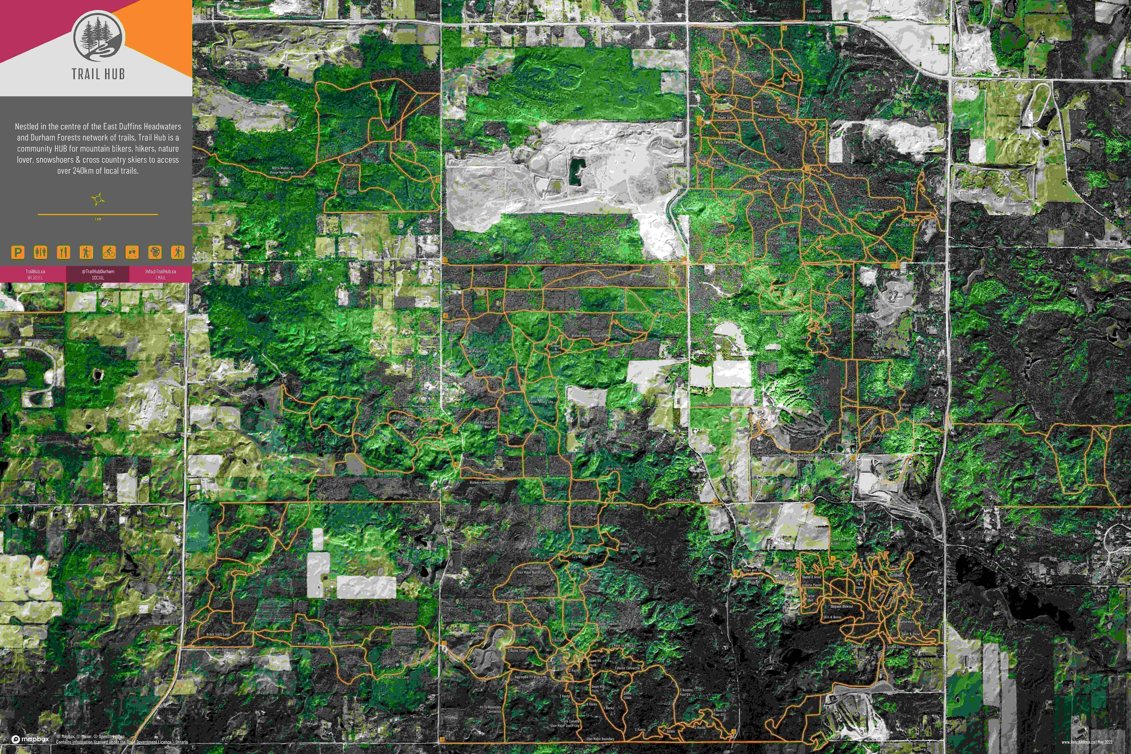
Map of Enugu state showing road network
Tools used
OSMQGIS
Plug-ins used
OpenStreetMap
tags
NigeriaOpen sourceTransport
More by Chukwulobe Martins Ugonna


You might also like


.png&w=3840&q=100)


Join the community!
We're a place where geospatial professionals showcase their works and discover opportunities.