

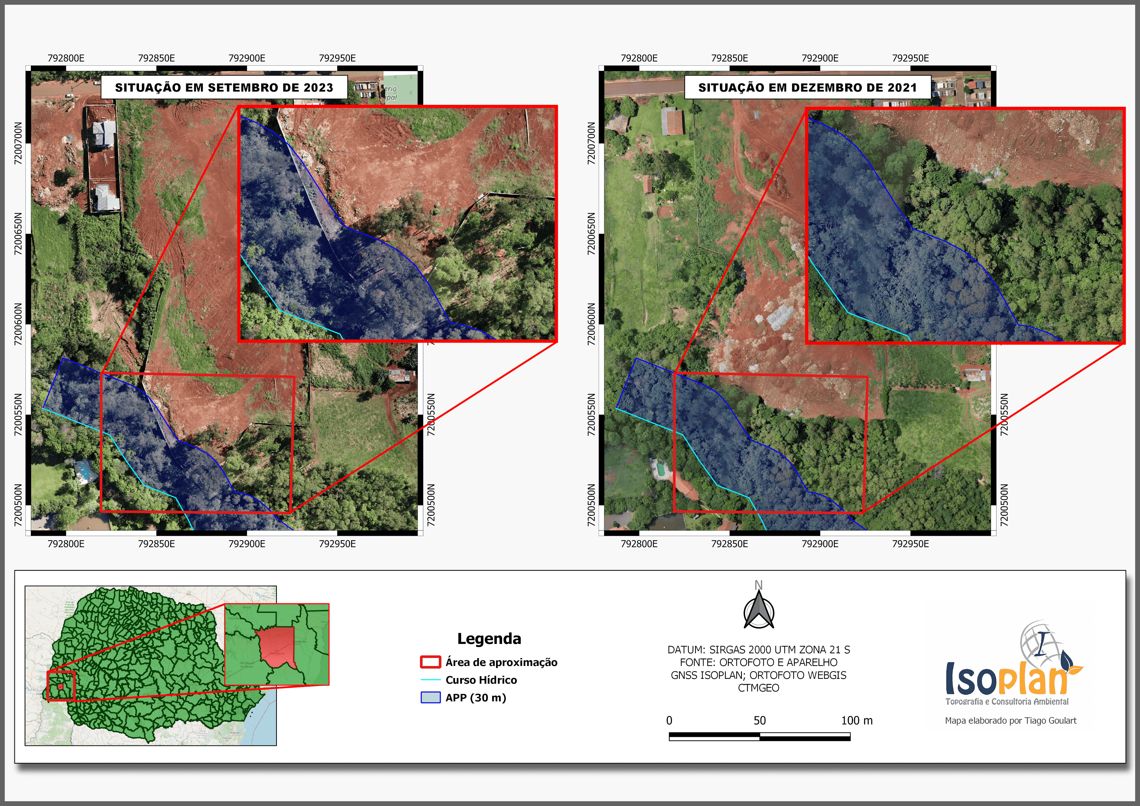
The map represents the area where gravel was extracted for use within the rural property itself, enabling its use in road construction and maintenance, crucial for transportation between rural properties, especially during heavy rains, which are common in this region due to its proximity to a large national forest reserve
Map of Gravel Extraction Area
Plug-ins used
OSMQuickMapServices
tags
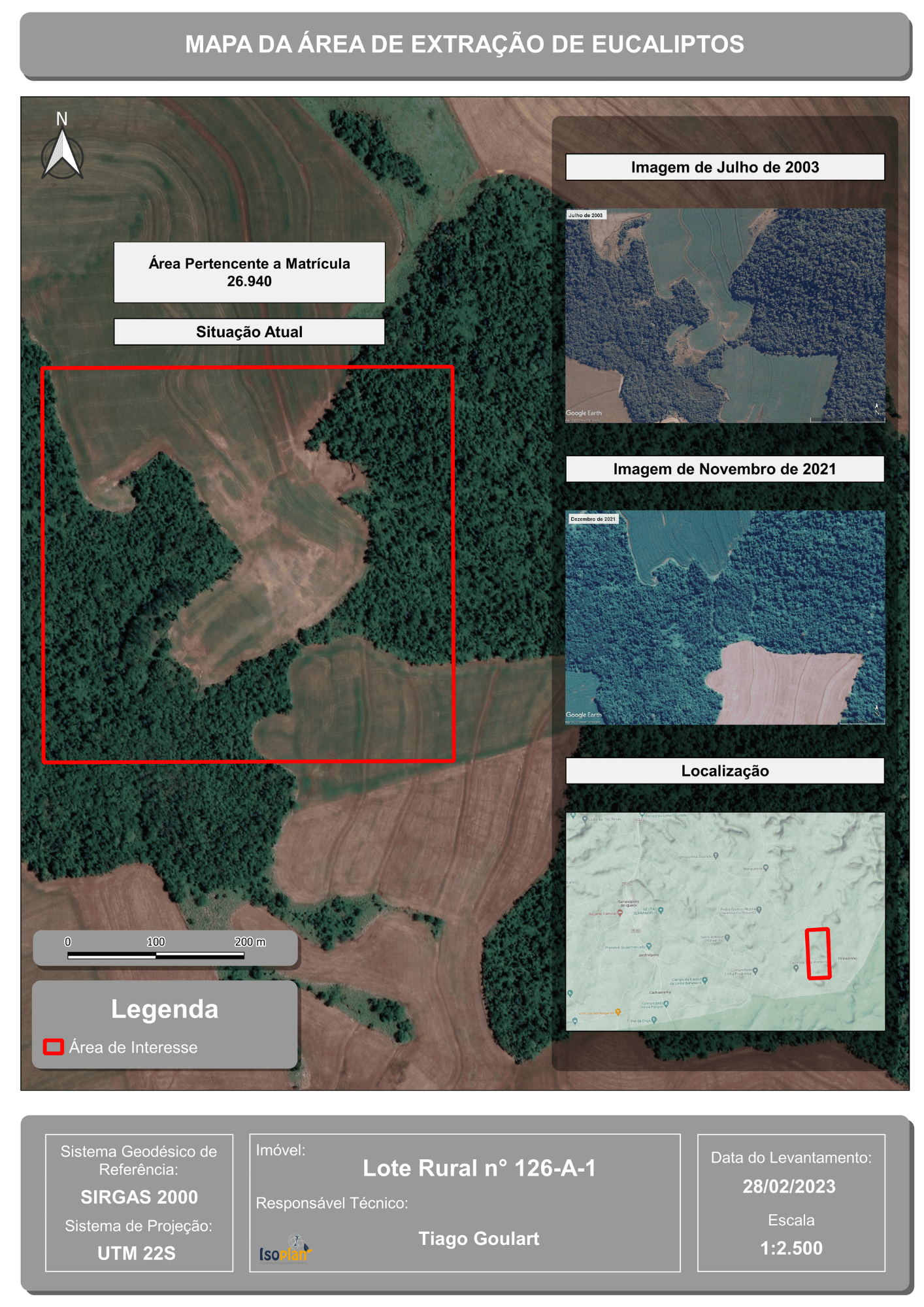
Data ExtractionGISSpatial Analysisvegetation density
More by TIAGO LANDIM GOULART DE OLIVEIRA


You might also like


.svg "Alec Soltes")


Join the community!
We're a place where geospatial professionals showcase their works and discover opportunities.