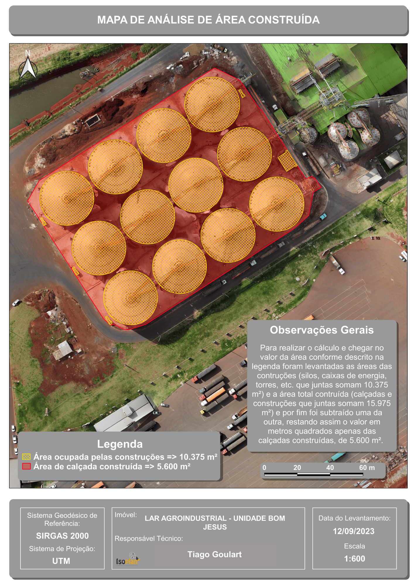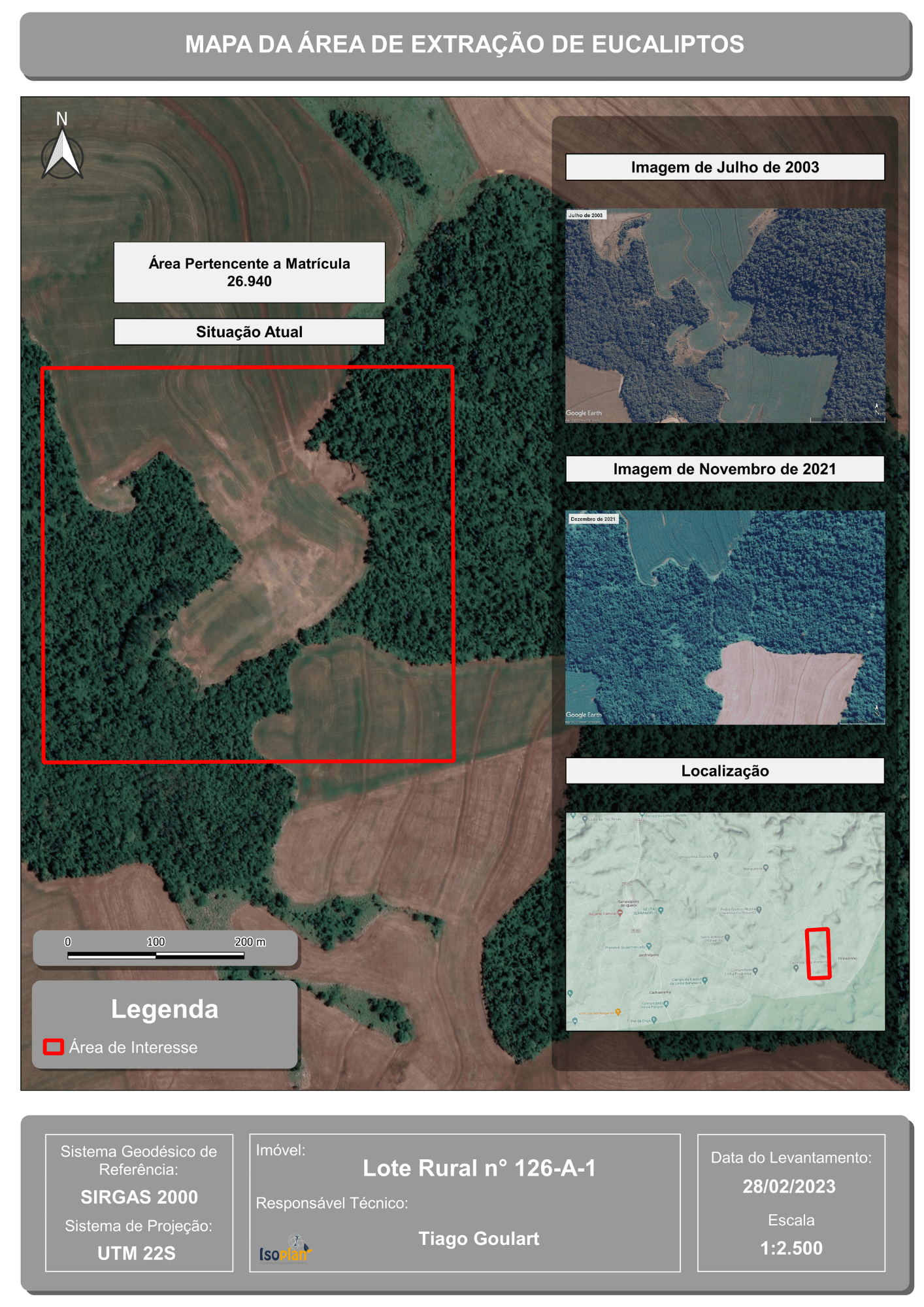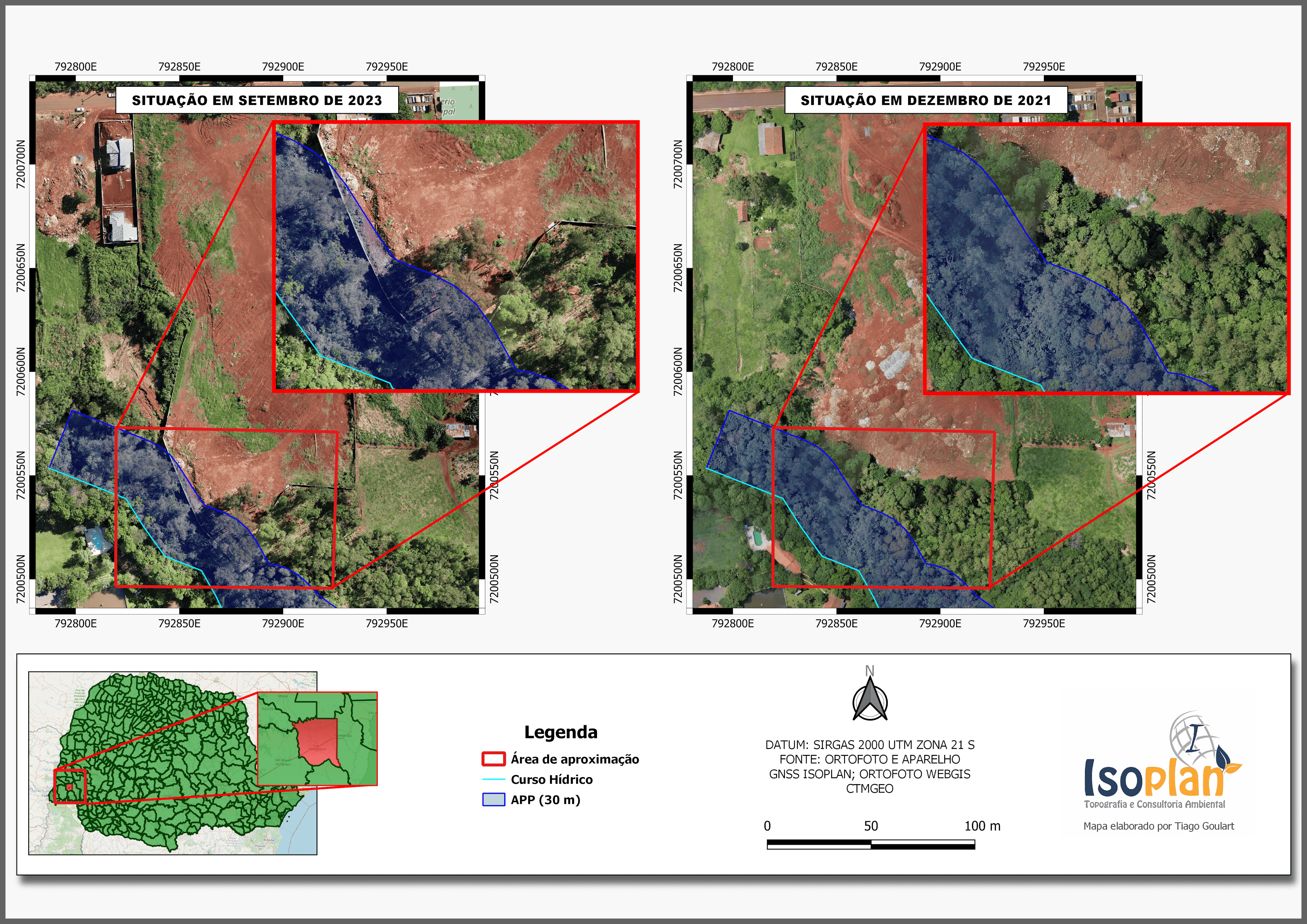
Aerial Drone Survey-Derived Map Compliant with Environmental Regulations
This map, meticulously crafted within the QGIS interface, is the culmination of a project driven by a passion for precision and environmental stewardship. It features imagery sourced from a personally conducted drone aerial survey, skillfully processed through OpenDroneMap (ODM). The result is a comprehensive visual representation that aligns seamlessly with current environmental legislation.
From capturing the data through drone technology to processing it with ODM, every step of this project was meticulously executed. The end product is a detailed map that not only meets but exceeds the requirements of environmental regulations. It's a testament to the power of geospatial technology in ensuring compliance and promoting sustainable practices.
Explore this map to witness the synergy of cutting-edge aerial surveying, advanced software processing, and a commitment to preserving our natural resources. It stands as a prime example of how technology and environmental responsibility can coexist harmoniously.