Sign up or log in to your Spatialnode account.

Takes less than a few seconds.

Projected Time Zones 🌐

Alexa Cristina
Alexa Cristina•

February 11, 2022

Projected Time Zones 🌐

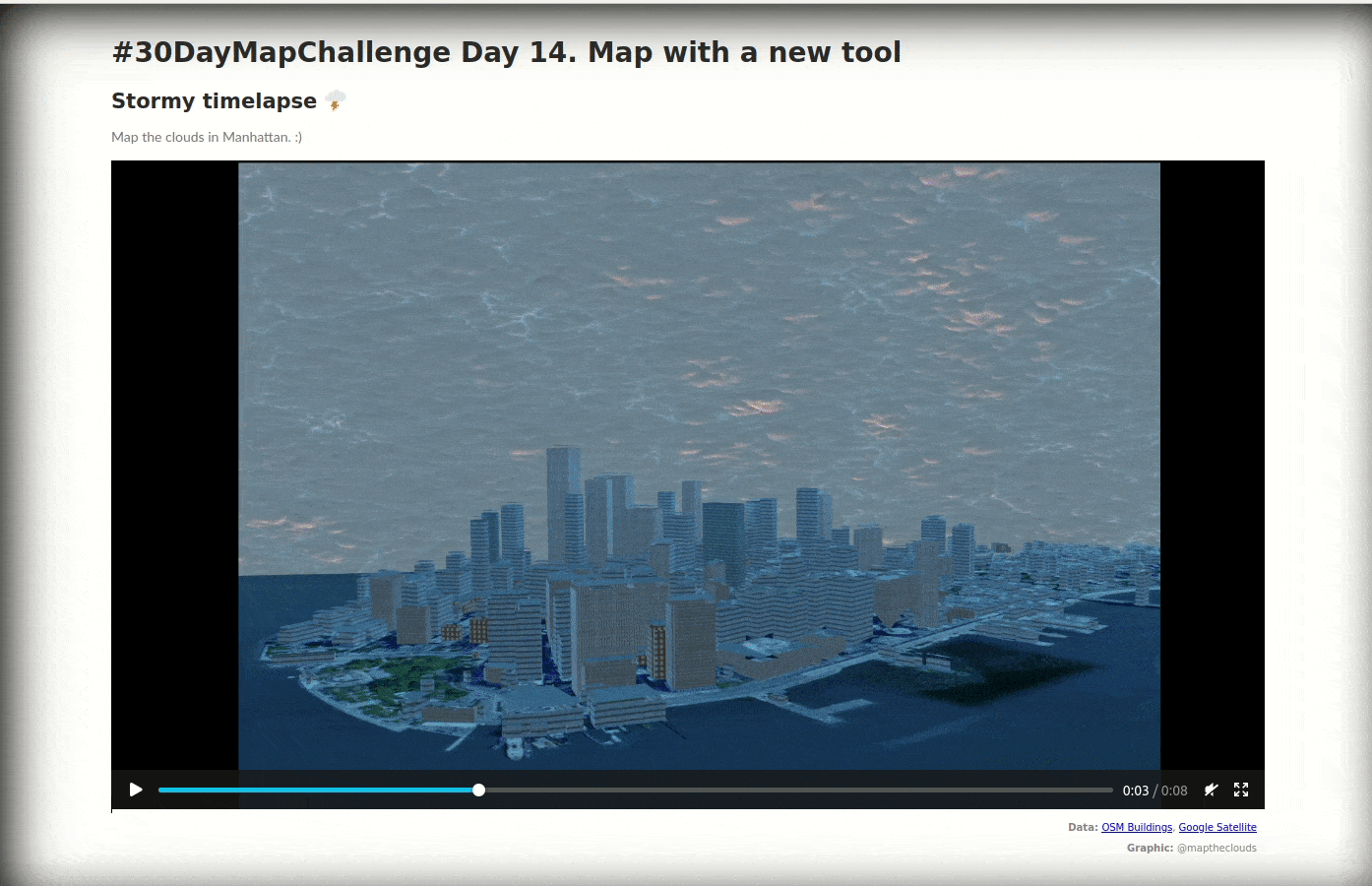
Testing various projections.

Country parts are colored by groups of 6 time zones.

Data: Natural Earth, Timezones

Demo

Tools used

QGIS

Plug-ins used

Leaflet

tags

projectionsQGIStime zones

More by Alexa Cristina

Yosemite Valley ⛰️⛰️
129
Sierra Leone -Travel duration to schools
101
Population per administrative units Map
28
The Hexagonal Nose ⬡⬡⬡
8
People Constellations ✨
52
Corgi Routes 🙂
Corgi Routes 🙂
21
Dancing City
Dancing City
30
Multiple and Flexible Pathways
162
Stormy timelapse 🌩️
Stormy timelapse 🌩️
15
Populated Places on Earth 🌍
95
Cluj County
Cluj County
17
A furry journey 🐾
A furry journey 🐾
86

You might also like

Mapping Childcare Access Perceptions
Armster Edwards
Mapping Childcare Access Perceptions
Armster Edwards
30
Gnatcatcher Habitat Suitability
Salvador Valdez
Gnatcatcher Habitat Suitability
Salvador Valdez
2
Mapa Hidrográfico
Silas Lima
Mapa Hidrográfico
Silas Lima
56
State of Poverty in the Philippines
Francis Emmanuel Calingo
State of Poverty in the Philippines
Francis Emmanuel CalingoPro
757
Saguling Microworld Diorama
Mohammad Farhan Fadillah
Saguling Microworld Diorama
Mohammad Farhan Fadillah
187
Thematic map - Anurans in Paraná, Brazil
Fabrício H. Oda
Thematic map - Anurans in Paraná, Brazil
Fabrício H. Oda
18
Digital Elevation Model of Oyo State.
Olawuyi Abolade Pelumi
Digital Elevation Model of Oyo State.
Olawuyi Abolade Pelumi
45
CADASTRO AMBIENTAL RURAL
Simone Malhado da Silva
CADASTRO AMBIENTAL RURAL
Simone Malhado...
14
New Mexico Wildfires
Keran Nkongolo
New Mexico Wildfires
Keran NkongoloPro
21
Base Map of Akure
Olaoluwa Israel Akinnibi
Base Map of Akure
Olaoluwa Israel Akinnibi
50
Sinalização Vertical Rotas Cênicas DERSP
Matheus Amaral Prates
Sinalização Vertical Rotas Cênicas DERSP
Matheus Amaral Prates
11
Data Visualisation using Matplotlib
Oladeji Muhammed
Data Visualisation using Matplotlib
Oladeji Muhammed
42

Join the community!

We're a place where geospatial professionals showcase their works and discover opportunities.

Sign Up for free