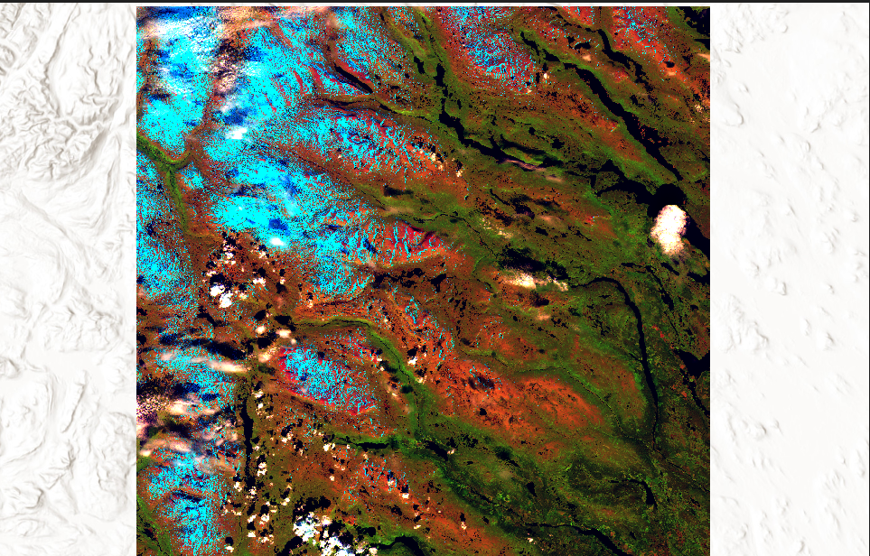
Sentinel-2 is an mission sponsored by ESA of two twin satellites S2A and S2B. These satellites orbit the Earth and complete a full circle every 10 days. Although both satellites fly in the same orbit, they are offset by 180°. As a result, they both work together and deliver new images every five days. Both satellites are equipped with a powerful, high-resolution multispectral instrument. Each spectral band represents a specific wavelength of the electromagnetic spectrum. The data used here comes from the Copernicus Open Access Hub (https://scihub.copernicus.eu/dhus/#/home).
From bands B02 (Blue), B03 (Green), B04 (Red), B08 (NIR 1), B08A (Narrow NIR or NIR 2), B11 (SWIR 1) and B12 (SWIR 2) I created a band composite in ArcGIS Pro. The results are shown below.