

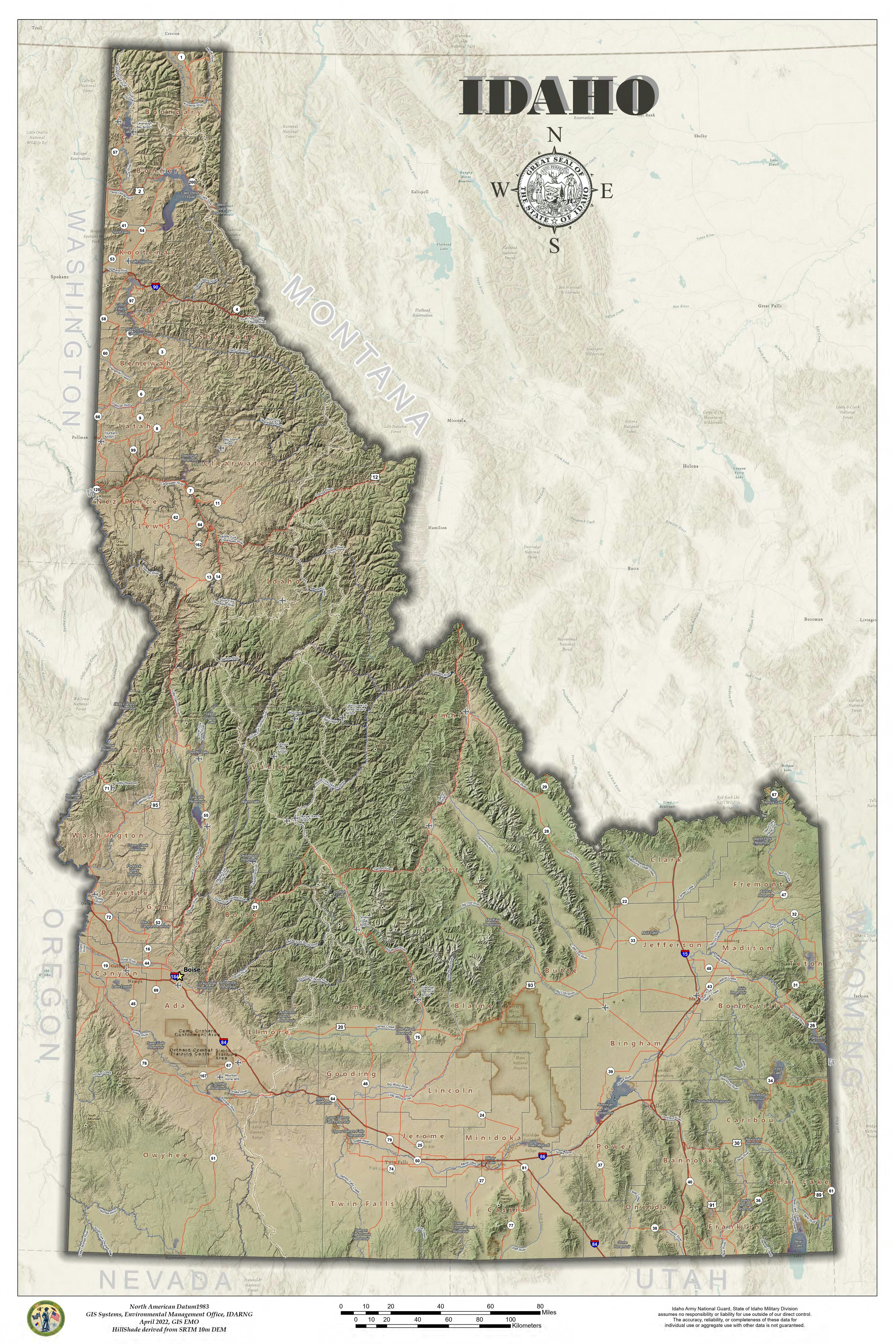
Following along with John Nelson and his amazing videos I used a georeferenced topo from 1909. Created multiple directional hill shades and slope products to make the terrain pop.
USGS Topo 1909 Idaho Modern Hillshade
Tools used
AGOLArcPro
Plug-ins used
raster calculatorSpatial analysis,
tags
hillshadeHistoricalIdahotopographic mapUsgs
More by Michael Nau


You might also like


.png&w=3840&q=100)


Join the community!
We're a place where geospatial professionals showcase their works and discover opportunities.