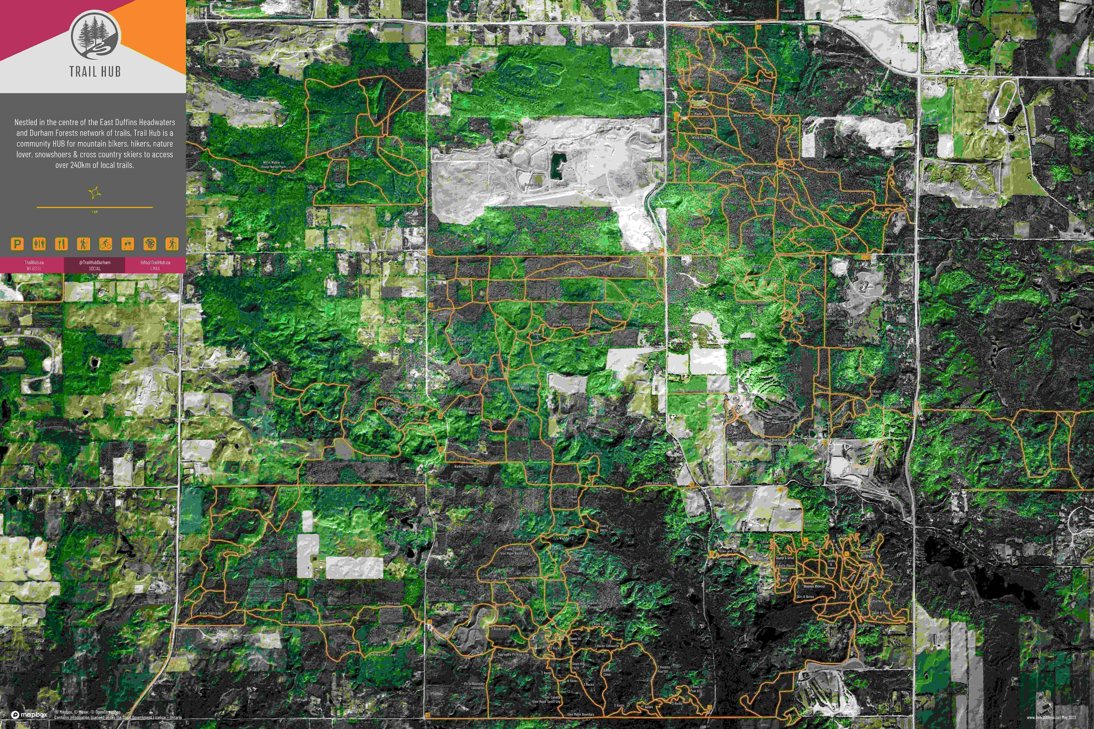
Launched in the summer of 2022, Trail Hub is a community HUB for mountain bikers, hikers, nature lovers, snowshoers & cross country skiers to access over 240km of local trails. I was introduced to the founders of Trail Hub through our mutual involvement in Active Transportation in the Region. As a new business starting out they were looking at ways to showcase the trail system to their visitors and serendipitously we connected as they were undertaking the project. The Map itself is 40” x 60” printed on foam core, which is mounted in the main hallway as visitors enter the facility.
The primary function of the map was not for navigation, wayfinding or quick reference. This map was designed to engage the reader in a way that draws them into the local environment. Their first impression is hopefully “that’s a big beautiful environment”. Second “whoa.…there’s a lot of trails”. Third “lets go explore!” And fourth, if they are returning visitors, “where's that trail? – over there, see that's the hill we climbed”. Engaging the reader trying to draw them in, the labels were left at a minimal size, so that at a glace you can’t tell what the trail name is. Its only when you take a step closer and see the details of the imagery, elevation and then the trail names become apparent.
The data for the map came from three sources, all processed in QGIS and exported to GIMP to create the final layout. The main aerial photo was styled in Mapbox Studio using their Maxar imagery. This was connected in QGIS as a web service. The elevation rasters are a combination of a 0.50cm DSM and a 5m DEM from the Province of Ontario GeoHub. The hillshade, slope and aspect derivates were created in QGIS using Grass. The trail lines are from OSM with updates from myself and community members ensuring they are located and named correctly. Using GIMP, the Trail Hub branding was incorporated including the font, colours and graphic elements. The trail labels and POIs were all manually placed using GIMP as well.
The map has been a great success at Trail Hub. Additional derivates have been created for social as well as post cards for distribution at events.