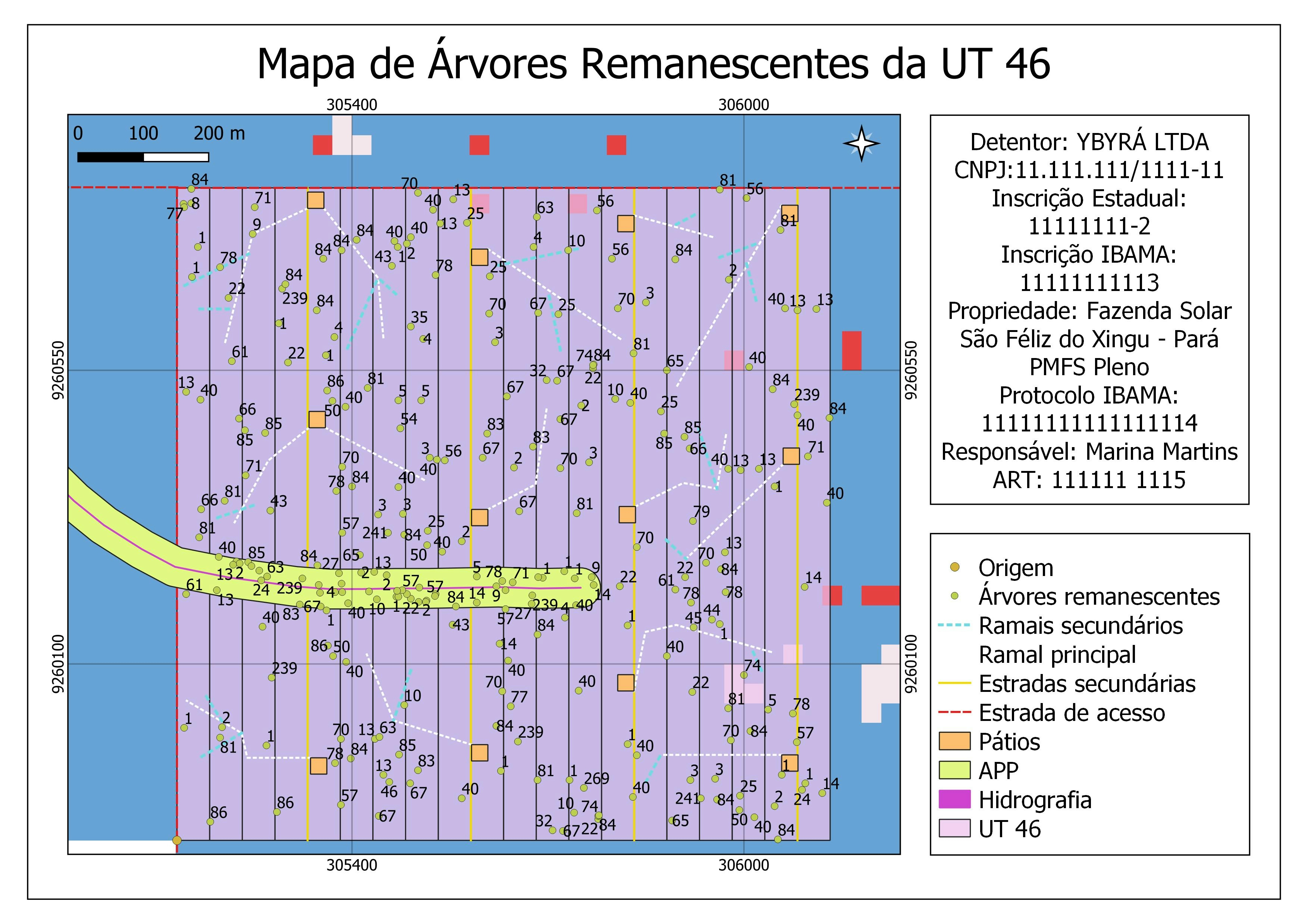
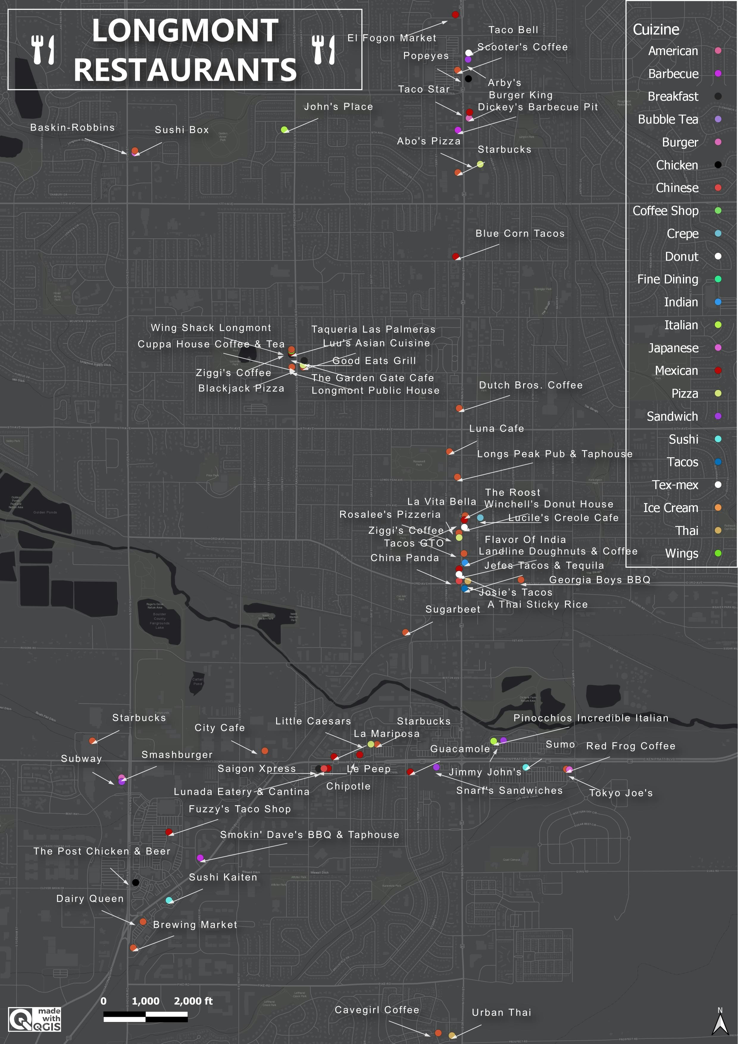
The project entails mapping of facilities and physical structures in the study area.
Some of the data used were collected on the field during field mapping using Mobile Topographer app, and others were digitized from imagery downloaded from Google Earth. The digitizing and the map presentation was done using ArcMap.