

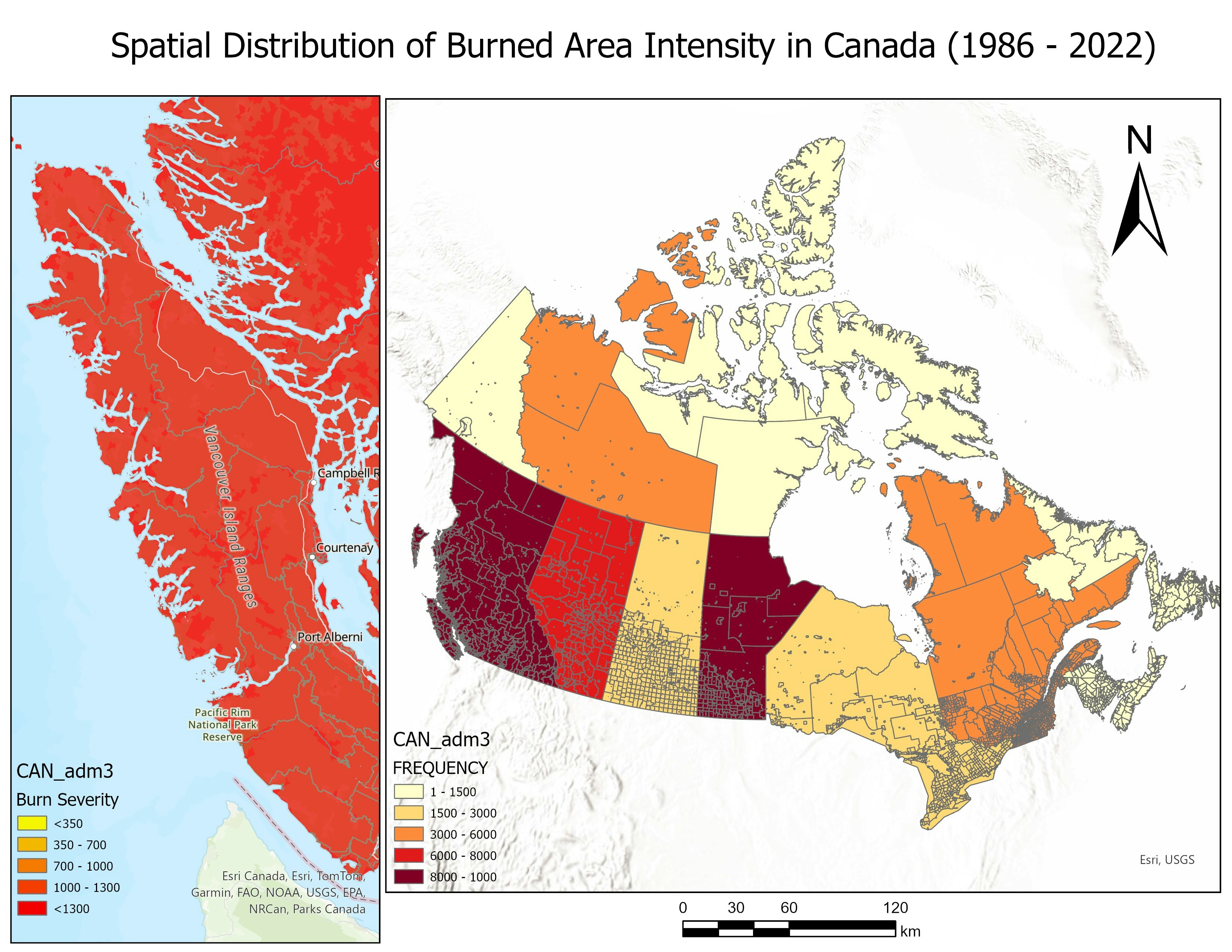
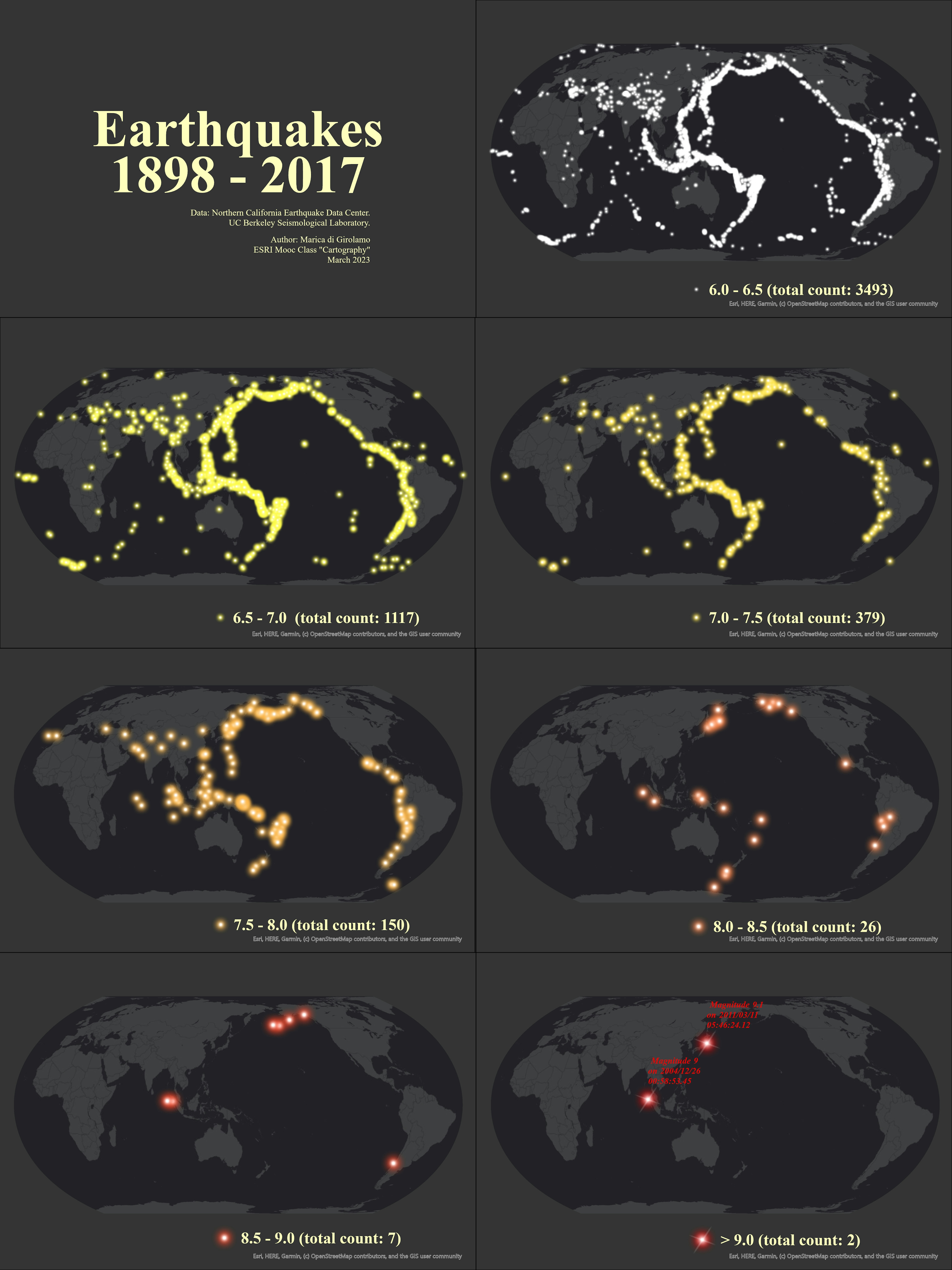
This map is made for the USFS Region 9 Government Affairs office on a recurring basis. The map shows all the names of each states Senators and Representatives where Region 9 units exist. It is a label intensive map that in the past could take considerable time to update. My goal was to create a project that could be easily updated using dynamic text and related tables. I move the data sources to the USFS Enterprise Data Warehouse (EDW) database where I could eliminate the need to update standalone datasets and leveraged related tables to point to the names of each politician. Now the project simply needs to be opened, reviewed, and printed.
Mapping - Congressional Districts Map
Tools used
Adobe Pro DCArcGIS OnlineArcGIS ProEnterpriseGIS
tags
Cartography
More by Jeffrey Erwin


You might also like


Join the community!
We're a place where geospatial professionals showcase their works and discover opportunities.