.jpeg&w=3840&q=100)

The 1854 cholera outbreak in London, mapped by physician John Snow unknowingly laid the foundation for a discipline that transform public health forever. Snow demonstrated that disease transmission was not random it had a spatial pattern. By plotting cholera cases around the Broad Street water pump, that simple but powerful map marked the birth of modern epidemiology and proved the value of geography in understanding health.

Today, beyond that pen and paper cartography, geospatial technology comprising Geographic Information Systems, Remote Sensing, and Spatial Analytics has become a cornerstone of disease surveillance, outbreak response, and health planning worldwide
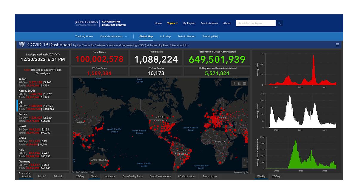
Fast forward to COVID-19 pandemic, the Johns Hopkins University dashboard became a global reference point, updating the world in real time on new cases and deaths. Governments used GIS to identify hotspots, plan where vaccination centers should go, and model how the virus might spread.
Modern systems combine big data, population movement, and health records to guide decisions almost instantly which has metamorphosed from John Snow’s hand drawn maps.
One of the biggest challenges in healthcare are connecting the dots bringing together data scattered across places and time. This is exactly where geospatial technology makes a difference:
Linking health data with environment and lifestyle factors to spot new hotspots.
Using maps and models to ensure medical supplies, vaccines, and clinics reach the right places.
Forecasting where an outbreak might move so action can be taken early.
Showing gaps in access so that vulnerable or remote populations aren’t left behind.
By looking at health through the lens of place, decision makers can see the full picture instead of just isolated numbers.
Geospatial tools don’t only show where diseases are they improve how we respond. Mobile GIS apps guide field workers in real time. Satellites and drones monitor conditions like stagnant water that can trigger malaria. And by combining health and location data, governments can respond faster, cheaper, and smarter. This isn’t just about efficiency. It’s about saving lives.
From John Snow’s cholera map to today’s interactive dashboards, one thing has stayed constant: location matters in health.
As the world faces new challenges climate driven diseases, urban growth, global pandemics geospatial technology must become a standard part of public health. The more we adopt and invest in it, the better prepared we’ll be to protect communities everywhere.