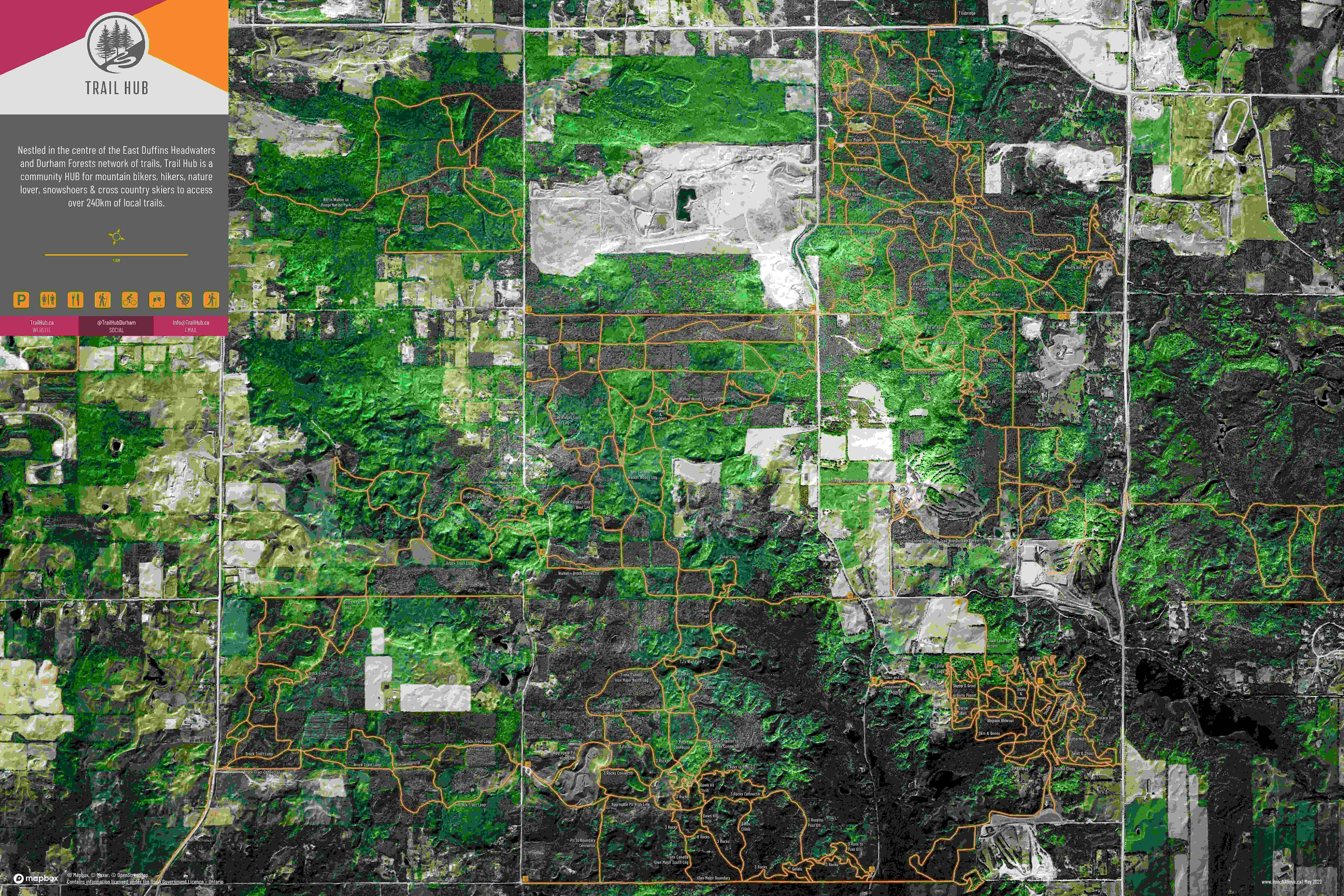
The above map shows % the impervious surfaces per block of 41st Evenue of Vancouver. The legend is separated into
classes of an equal count of Census Dissemination Areas ("An area
bounded on all sides by roads and/or boundaries") of each land cover
present. From this data, it is clear that a majority of the areas of the Focus Area fall within 63.5-83.7% imperviousness.
It is also interesting to observe that parks around the western part of the Focus area have more permeable area than parks on the eastern edge of the park.