.svg "Maggie Zou")
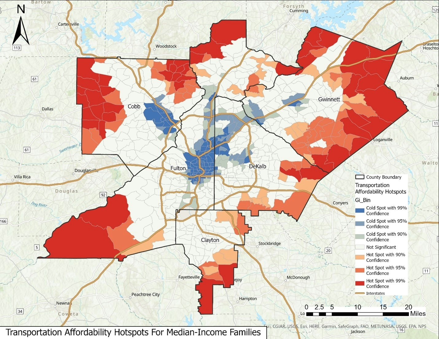
Housing and transportation costs make up the largest expenses for American households, accounting for nearly 50% of total expenditures. Households often make trade-offs between how much they spend on housing and how much they spend on transportation. This project analyzes housing affordability and transportation affordability together for median-income families in the five major counties of the Metro Atlanta area (Fulton, DeKalb, Gwinnett, Cobb, and Clayton) by using the Location Affordability Index (LAI) developed by the U.S. Department of Housing and Urban Development (HUD), which provides standardized household housing and transportation cost estimates at the census tract level. Here are the key insights from this project:
- The findings suggest a trade-off between housing and transportation costs, indicating that areas with lower housing costs may have higher transportation costs, and vice versa.
- Regression models reveal an association between demographic factors such as race and income inequality and location affordability. In contrast, educational attainment is linked to housing affordability.
- The study’s results, augmented by spatial cluster analysis, could provide a roadmap for city planners and policymakers to develop strategies for improving housing and transportation affordability in metro Atlanta.
Please check the link below for more details!