.svg "Maggie Zou")

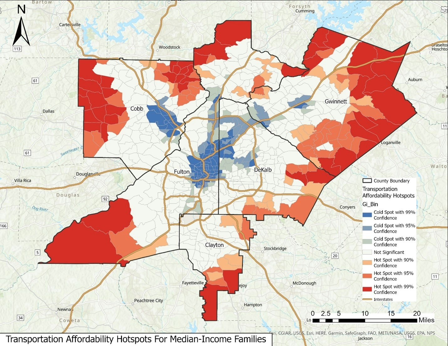
This GIS project analyzes the spatial distribution of public green spaces within the City of Atlanta. The primary goal is to gain a comprehensive understanding of the availability, accessibility, and equity of these green spaces across the city by examining the geospatial data along with census information. Some key findings from this analysis include:
- North Buckhead and Upper Westside exhibit a noticeable deficiency of public green spaces.
- Interestingly, these two neighborhoods are characterized by a lower population density and are among the most affluent areas within Atlanta.
This brings us to an interesting hypothesis - perhaps the affluence of these areas is reflected in private green spaces within their backyards!
For more details, please check my ArcGIS StoryMaps!
GIS Skills: Cartography; Statistical Summary; Buffering; Table Joins; Spatial Joins; Raster Georeferencing