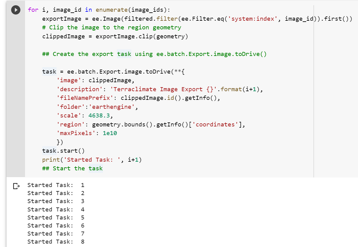
In this exercise, I learned to automate a download for each image from a collection as a GeoTIFF file for further processing.
My workflow out is described below:
- Create and filter an image collection
- Run a "for loop" on your image collection
- Use ee.batch.Export to run the batch export after defining your filtered images
- Start the task
See the demo link below to review and run my script for 12 images of average max surface temperature across Australia per month.