
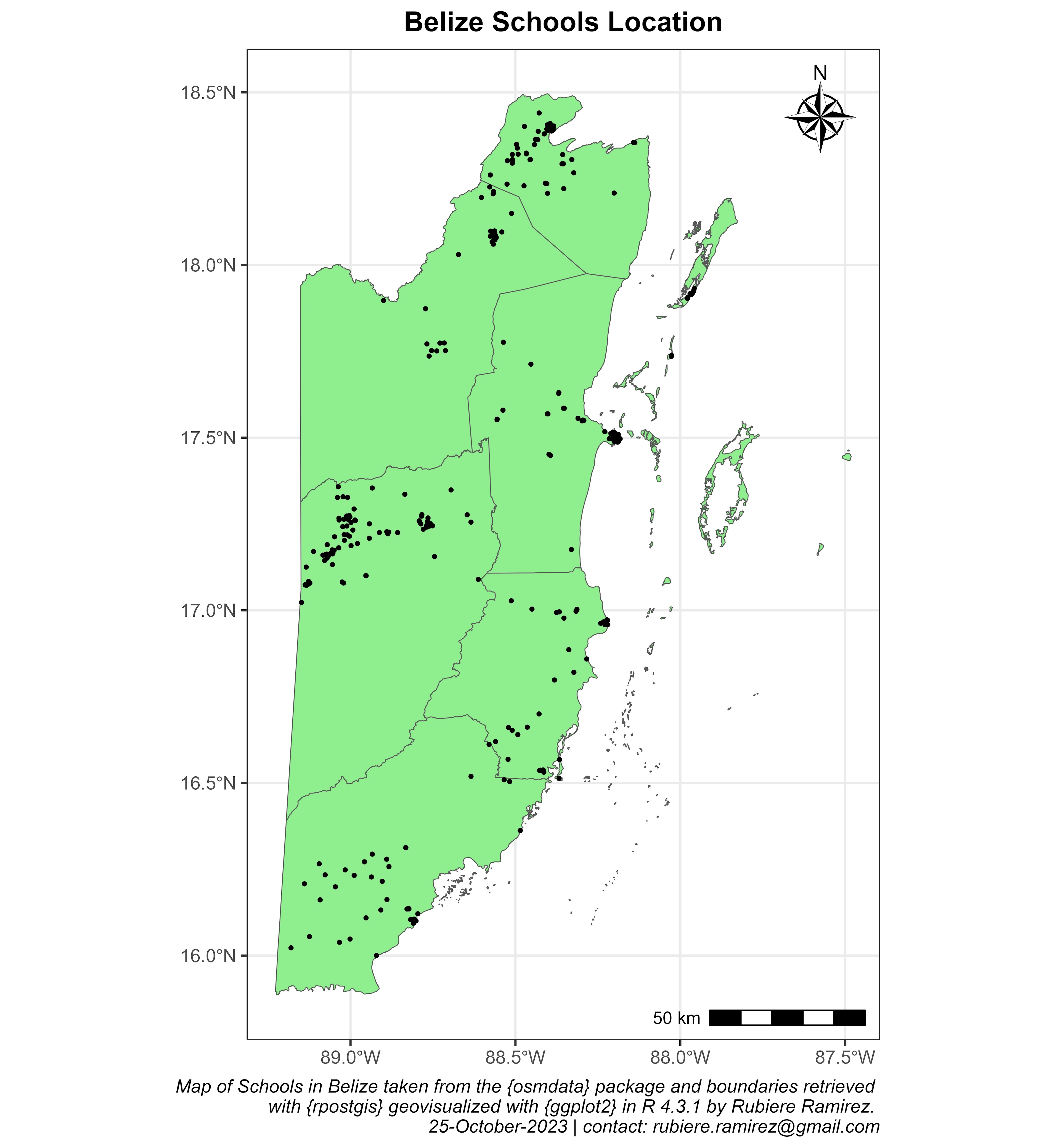
Data was retrived from the {osmdata} R package in Posit. Points outside of Belize were removed and the map was geovisualized with the {ggplot2} package.
Belize School Location Map with R
Tools used
PositRR Studio
Plug-ins used
ggplot2ggspatialosmdatarpostgissf
tags
GIS ProgrammingPositRR SpatialR Studio
You might also like


Join the community!
We're a place where geospatial professionals showcase their works and discover opportunities.