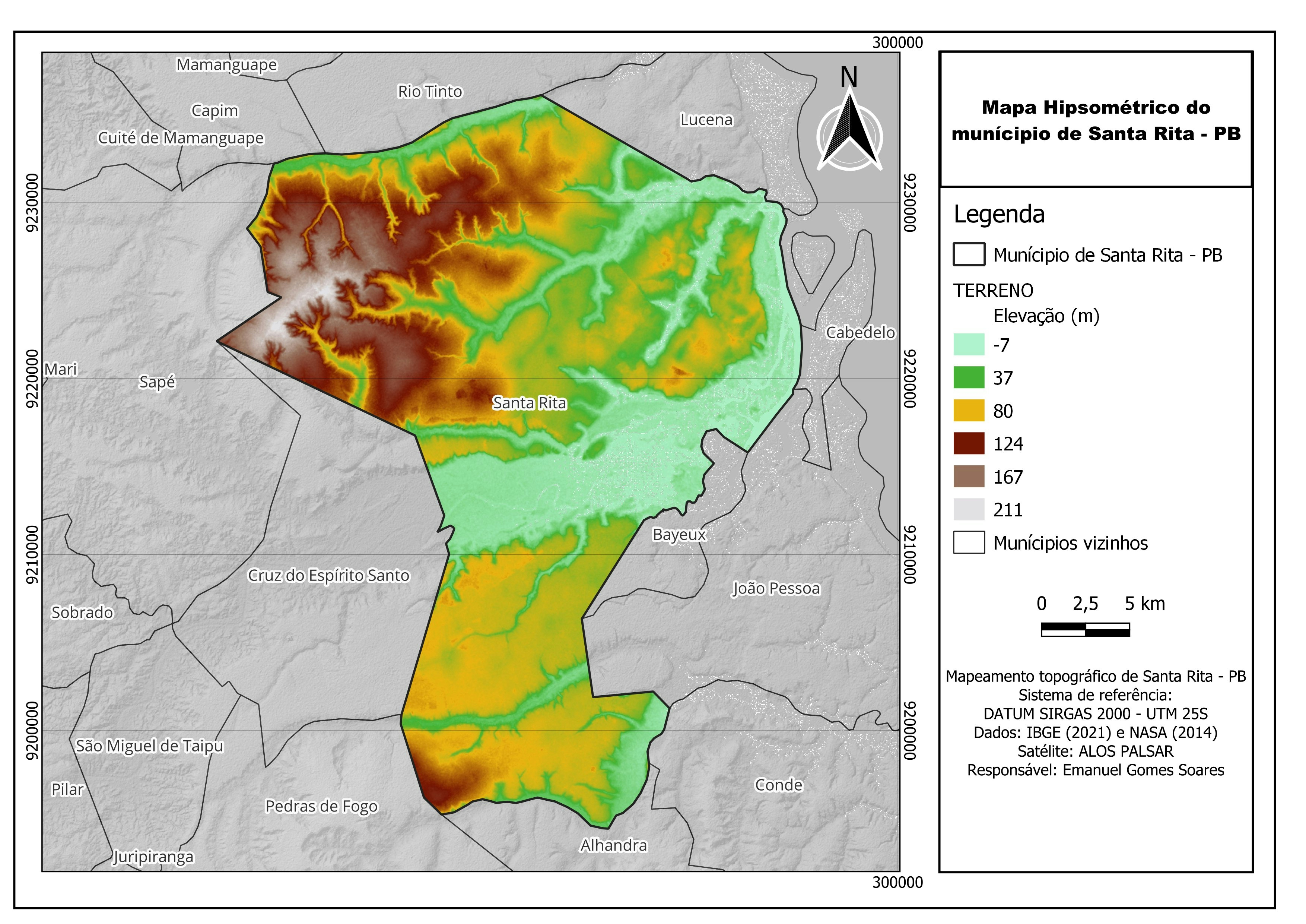
Bend, OR is ranked 14th for highest wildfire exposure in the United States (source). I created this map to examine the wildfire exposure for Bend and the surrounding land. This map focuses on public spaces for recreation to examine which parks and trail systems are at an increased exposure to wildfires.
Bend, OR infrastructure spatial data source: Deschutes County Data Portal
State of Oregon burn probability Raster source: Wildfire Risk to Communities: Spatial datasets of landscape-wide wildfire risk components for the United States (2nd Edition)


.svg "Keran Nkongolo")