

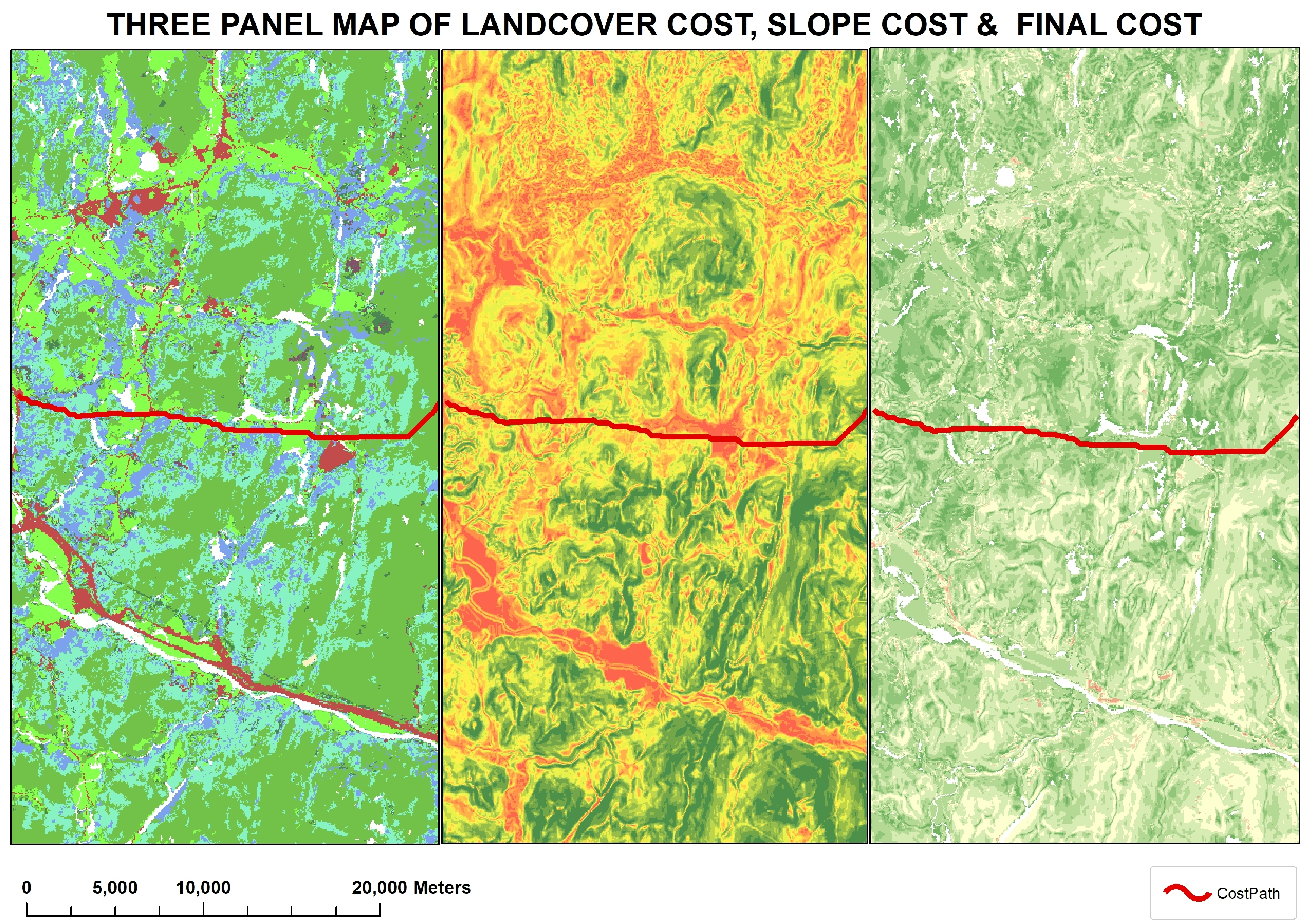
This project uses Washington State census data to compare the cost of renting vs owning by census tract in the Seattle, WA area. Comparing this to OSM data of grocery stores (defined as a facility that offers dry goods as well as fresh fruits and vegetables, a cost surface map was created. This shows the inequity inherent in city planning and challenges faced by low-income renters in the Seattle area.
Cost of Housing vs Distance to Groceries
Plug-ins used
GDALQNEATSAGA GIS
tags
Census DataCity Planning InequitiesCost-Distance AnalysisHeat Map

.png&w=3840&q=100)
You might also like


.jpg&w=3840&q=100)


Join the community!
We're a place where geospatial professionals showcase their works and discover opportunities.