
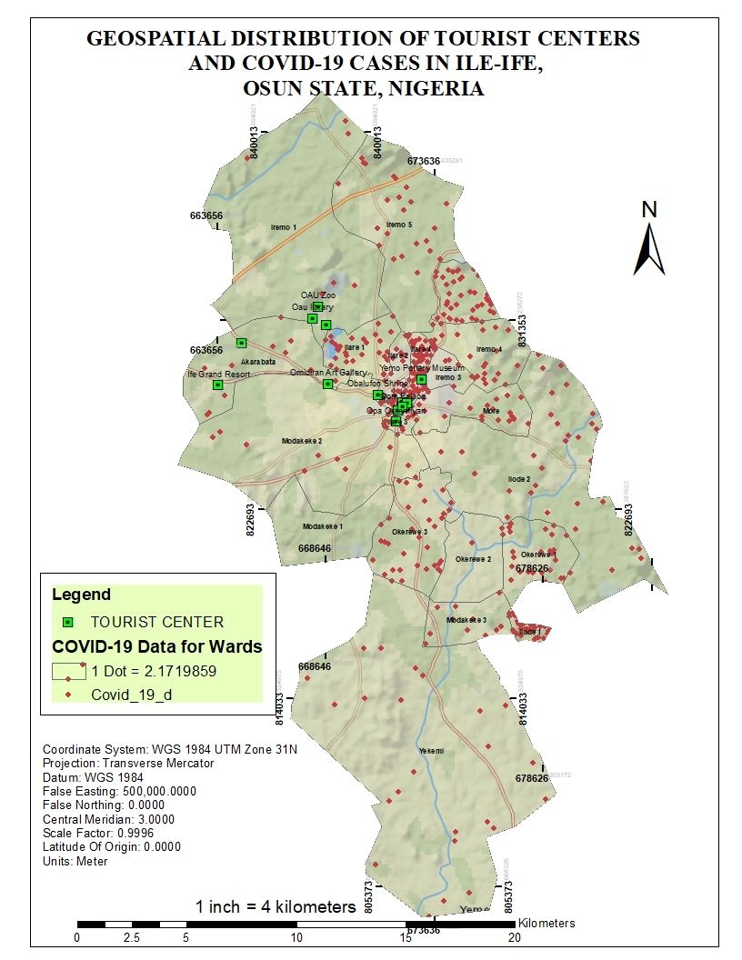
This project investigated the geospatial distribution of tourist centers and COVID-19 cases in Ile-Ife, Osun State, Nigeria. The data was retrieved from the National Center for Disease Control, and the Tourist center data was gotten using handheld GPS and forms. From here, the data was recorded in WPS Excel and joined with the attribute table of a map of Ile-Ife.
COVID-19 Distribution vs Tourist centers
Tools used
ArcMapExcelGPS converter
Plug-ins used
ArcMapGoogle Street Maps API
tags
ArcMapCartographyCOVID-19GIS NigeriaTourist map
More by Oswald Onimhawo


You might also like


_2461995.png&w=48&q=40 "Carmem Lúcia Ribeiro da Costa Soares")


Join the community!
We're a place where geospatial professionals showcase their works and discover opportunities.