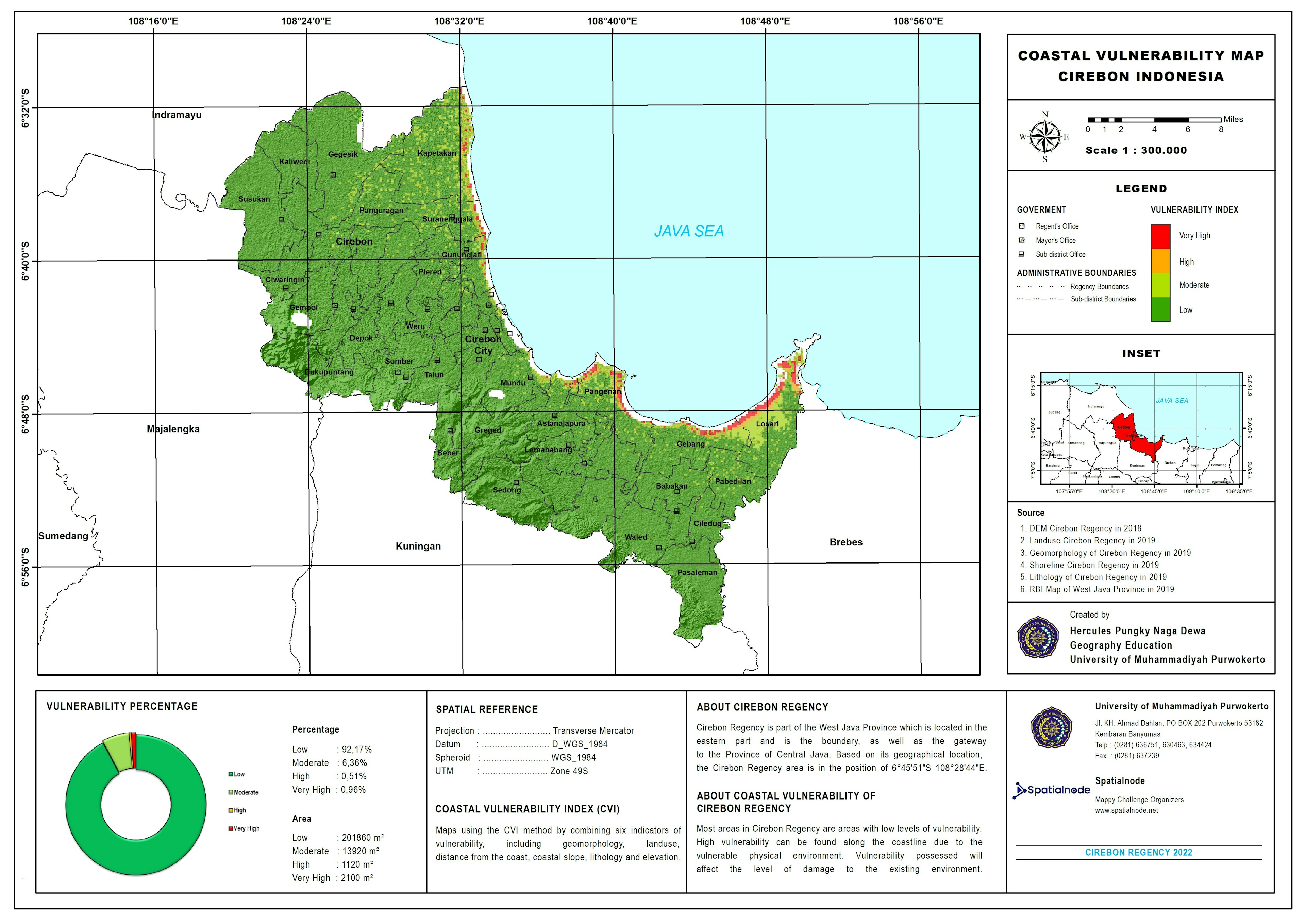
Mapping the 2025 Etosha Wildfire Using dNBR in QGIS
Earlier this year, a significant wildfire event swept across parts of Etosha National Park, leaving visible marks on the landscape. To better understand the extent and severity of the burn, I generated a Differenced Normalised Burn Ratio (dNBR) map using pre- and post-fire Sentinel-2 imagery processed in QGIS.
The dNBR method is a powerful remote sensing approach for quantifying vegetation loss and burn severity, helping ecologists, conservationists, and land managers plan restoration and recovery strategies after fire events.
Data sources:
-Sentinel-2 imagery (pre-fire data acquired between 12 - 15 September 2025 and post-fire data acquired on 5 and 7 October 2025)
-Derived dNBR values classified using the USGS burn severity thresholds