

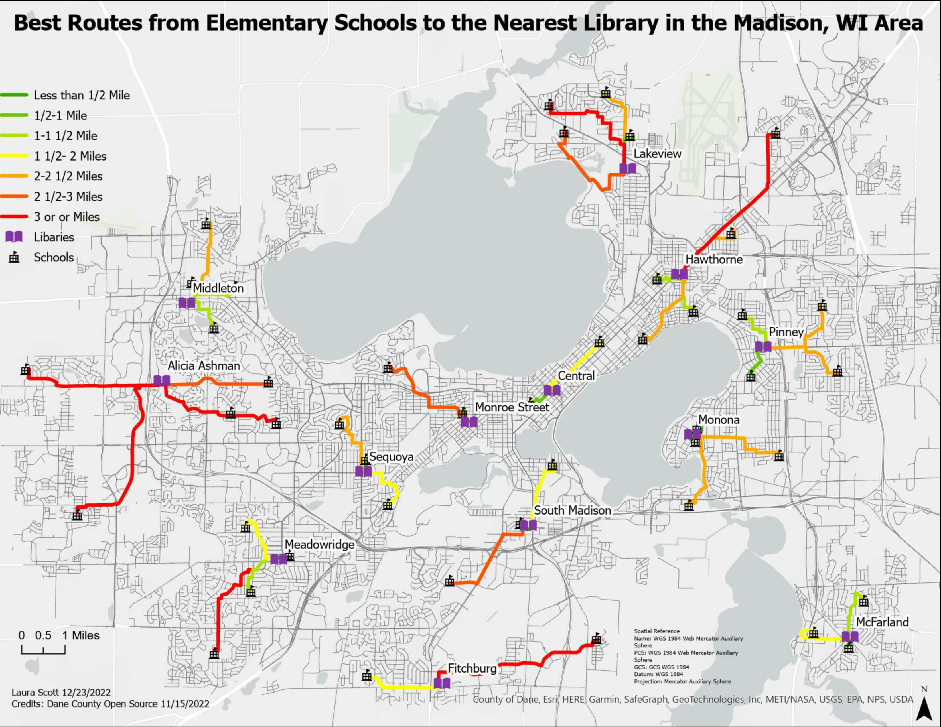
The map features the forest cover change of the area near Vangaži, Latvia, where for the past several years intensive tree logging has been happening. The analysis is based on the NDVI change between 2008 and 2018 within land classified as forest by CORINE Land Cover, using orthophotos provided by the Latvian Geospatial Information Agency. Negative difference is classified as the loss of forest, positive as the gain.
Forest Cover Change analysis
Tools used
QGIS
Plug-ins used
Freehand raster georeferencer
tags
RasterRaster Calculator
More by Polina Rogozina


You might also like


Join the community!
We're a place where geospatial professionals showcase their works and discover opportunities.