
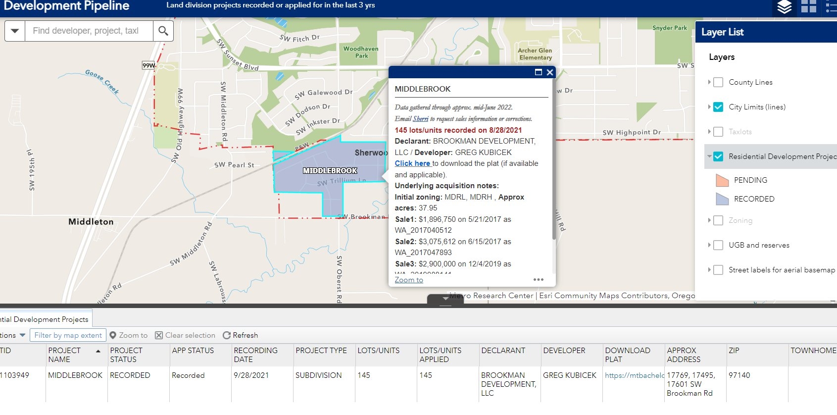
Geo-app created for colleagues and select clients to follow the progress of land division applications through approval, acquisition, and public recording. Data sources include 3 county surveyors' GIS, 2 private sector commercial tabular resources, and a land title research tool.
Users can search by project name, developer, or location.
Need for tool arose because, as taxlots are cancelled and created in the land division process, tracking them for comparable market sale value and general market activity posed considerable headaches for my colleagues. The data for these projects (proposed and completed land divisions, tabular and spatial, 3 different counties) meant many staff hours were spent moving between various resources without consistent unique or known identifiers. This geo-app saves staff hours and delivers more reliable information quicker than could be done without the tool.


.svg "Keran Nkongolo")


