
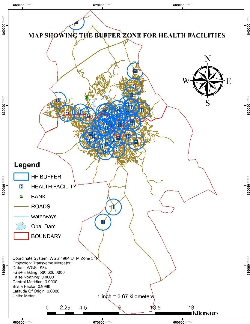
The map delineates buffer zones surrounding health facilities in an urban area, aiming to protect these facilities from specific types of development. These buffer zones, depicted as light blue areas, vary in size depending on the facility's type and size. The map also highlights key geographical features, helping identify potential hazards to health facilities. Stakeholders such as health facility administrators, city planners, and public health officials can utilize this map to enhance safety and planning. Notable observations from the map include two main clusters of health facilities, with larger buffer zones in the north cluster, some areas with overlapping buffer zones, and regions without health facilities within a 5-kilometer radius. Overall, this map serves as a vital tool for understanding and safeguarding health facility buffer zones in the urban context.
Health Facility Mapping and Management
Plug-ins used
ArcGISArcMapNumPyPandas
tags
#Geospatial Analytics #Beginner #Statistics #Geospatial #Spatial Analysis#spatialAnalyst #gis

You might also like


Join the community!
We're a place where geospatial professionals showcase their works and discover opportunities.