
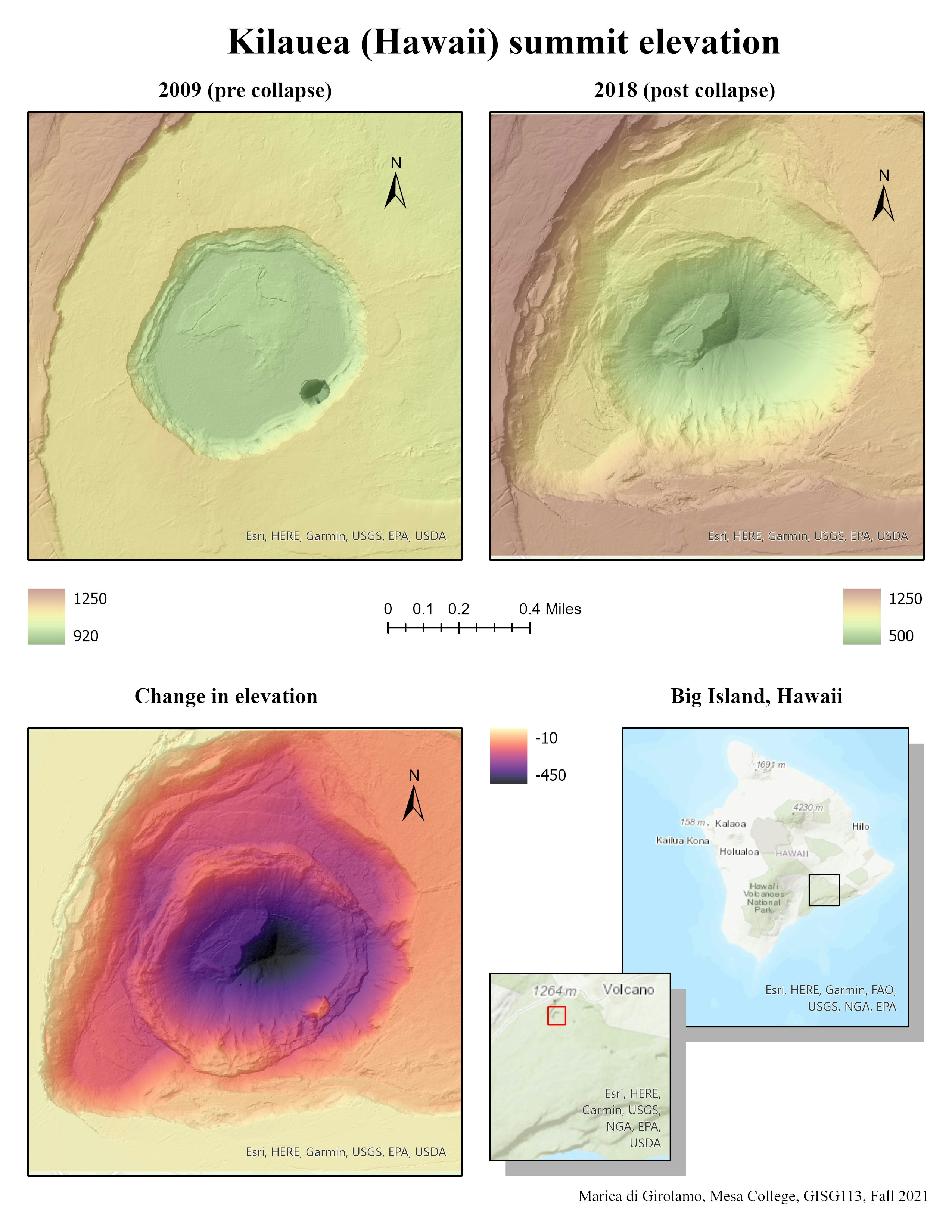
For this projects (that I realized during my Advanced Geographic Information Systems Applications class) I studied the change in elevation at Kilauea Summit following the 2018 collapse.
Kilauea Summit Elevation
Tools used
RASTER PROCESSING
Plug-ins used
ArcGIS Pro
tags
ElevationRaster
More by Marica di Girolamo


You might also like


Join the community!
We're a place where geospatial professionals showcase their works and discover opportunities.