Sign up or log in to your Spatialnode account.

Takes less than a few seconds.

San Dieguito River Watershed

Marica di Girolamo
Marica di Girolamo•

April 27, 2023

San Dieguito River Watershed

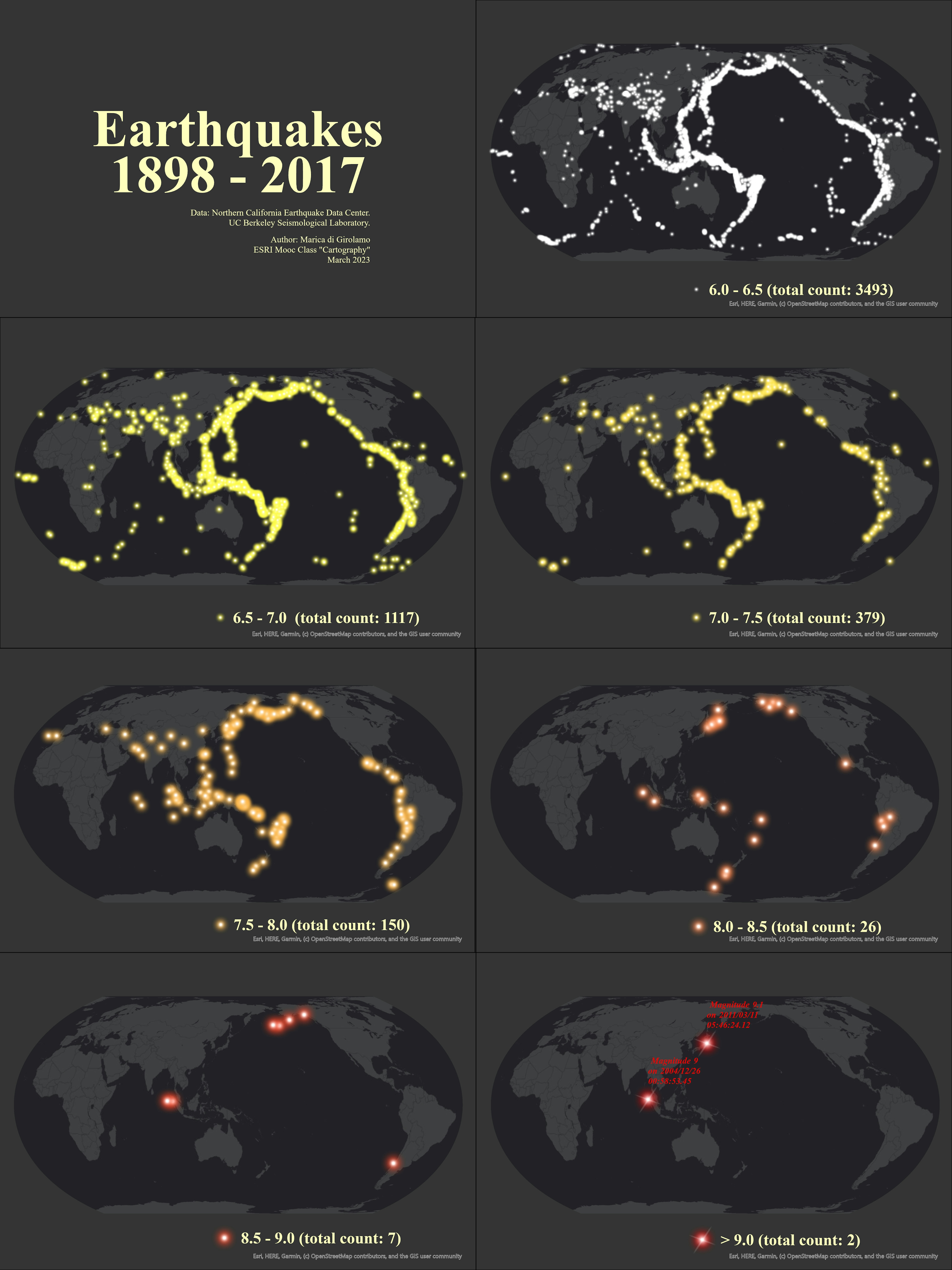
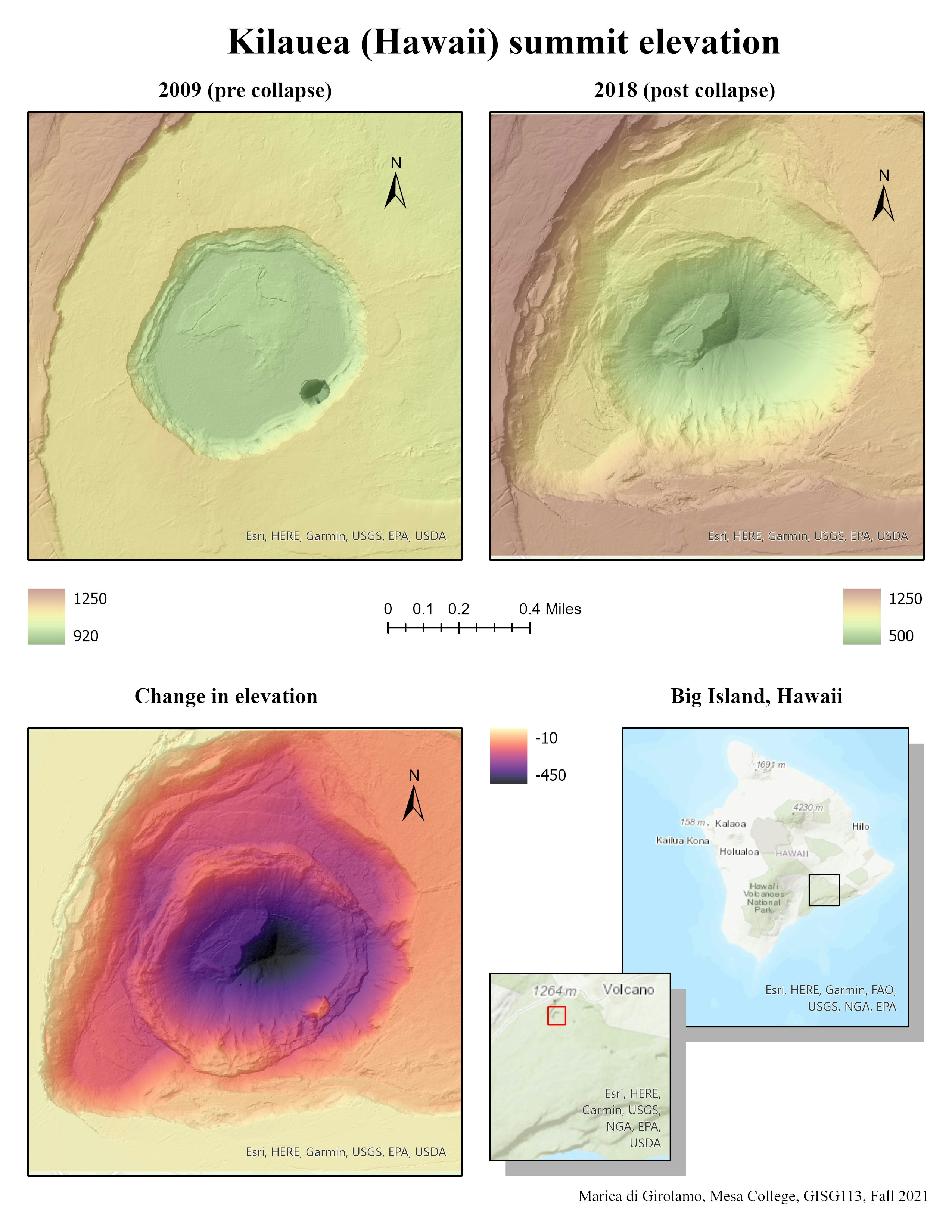
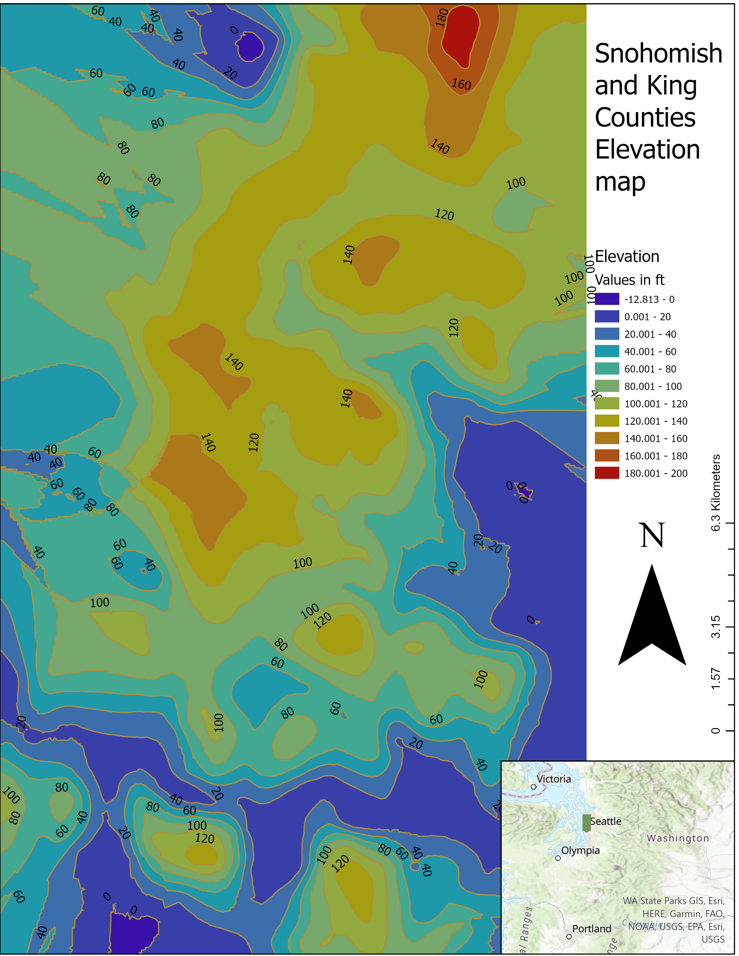
I created a nice model elevation working with DEMs, hillshades, symbology and blending.
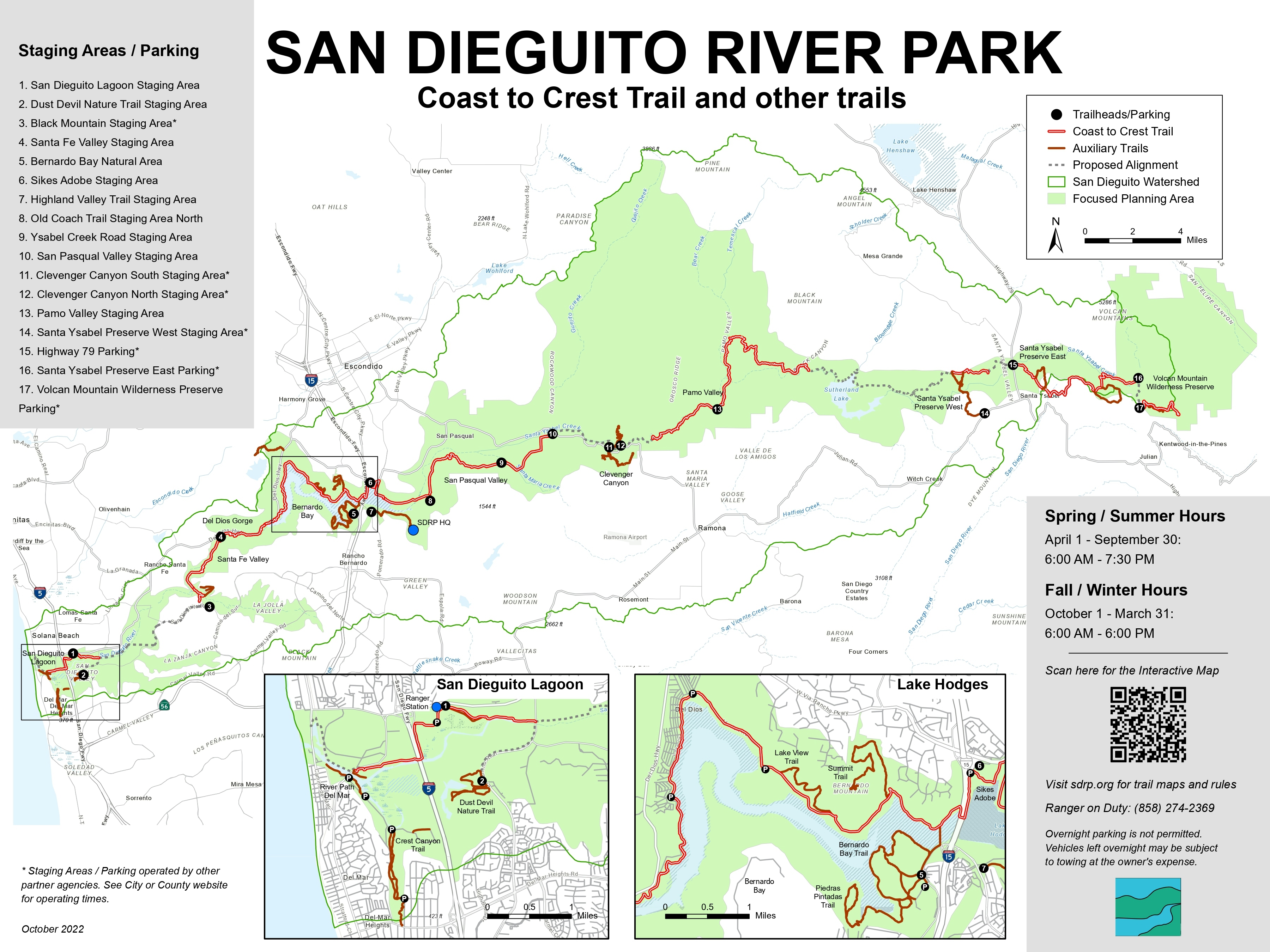

Tools used

hillshade

Plug-ins used

ArcGIS Pro

tags

DEMhillshade

More by Marica di Girolamo

Kilauea Summit Elevation
26
Tracking Feral Horses
17
Wildlife Sightings
Wildlife Sightings
21
Schools rating and Household Income
14
Oceans Map
Oceans Map
17
Earthquakes 1898 - 2017
18
San Dieguito River Park - Map
17

You might also like

Localição do Município de Belo Horizonte
Caroline Ferreira Angelo
Localição do Município de Belo Horizonte
Caroline Ferreira Angelo
16
MANDERA LOCATION CONTEXT MAP (KENYA)
MOSES MWANIA MULYUNGI
MANDERA LOCATION CONTEXT MAP (KENYA)
MOSES MWANIA MULYUNGI
19
LANDFORMS IN KENYA
MOSES MWANIA MULYUNGI
LANDFORMS IN KENYA
MOSES MWANIA MULYUNGI
240
Map of North East Region in Ghana
Annan Kingsford Kobina
Map of North East Region in Ghana
Annan Kingsford Kobina
18
Municipality of Thessaloniki - 3D Vis
Efstathios Lymperis
Municipality of Thessaloniki - 3D Vis
Efstathios Lymperis
85
Wildlife crossings priorities in Guyana
Angela Mejia
Wildlife crossings priorities in Guyana
Angela Mejia
14
Infographic Map - Mining Company
Martin Nuñez Igarzabal
Infographic Map - Mining Company
Martin Nuñez Igarzabal
13
Stormwater Pipe Survey
JAYASHRI KORADE
Stormwater Pipe Survey
JAYASHRI KORADE
47
Contour Map and Topographic Profile
Amira Ramadan
Contour Map and Topographic Profile
Amira Ramadan
56
WA WF & WQ Projects
Keran Nkongolo
WA WF & WQ Projects
Keran NkongoloPro
15
TANI II DEM AND CONTOUR MAP
Gyile Dennis
TANI II DEM AND CONTOUR MAP
Gyile Dennis
8
Mapa de Identificação de Talhões
Layanara Faria
Mapa de Identificação de Talhões
Layanara Faria
68

Join the community!

We're a place where geospatial professionals showcase their works and discover opportunities.

Sign Up for free