

This Project is apart of my class at UNT, were taking a LAS file and turning it into a LASD file, we then add a 3D Powerline layer that was given to us but can be found in a National Lidar Registry. From there we are going to export the Powerline feature and create a new feature layer with the Powerline to run a LAS point by proximity tool, after visualizing this we see the LAS points from the City of Denton as well as Las Points around the Powerlines, I then converted everything to a Local Scene.
Locating 3D Lidar Points near powerline
Plug-ins used
None
tags
Spatial AnalysisSpatial Modelling
You might also like


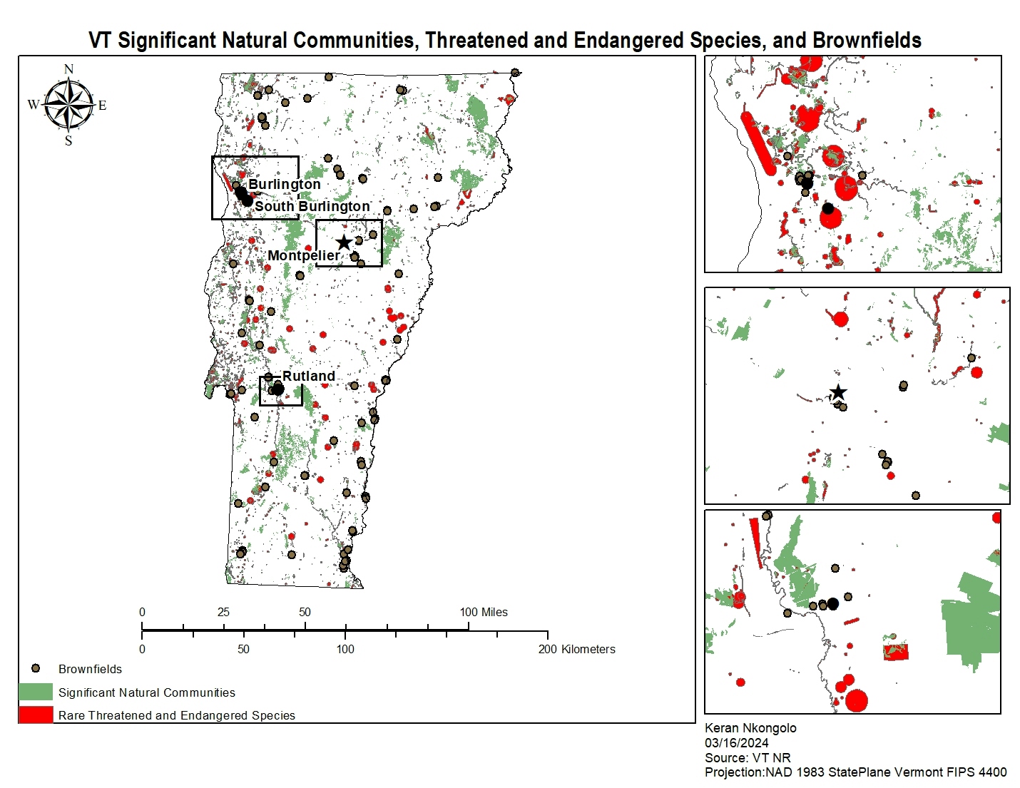
.svg "Keran Nkongolo")


.jpg&w=3840&q=100)


Join the community!
We're a place where geospatial professionals showcase their works and discover opportunities.