

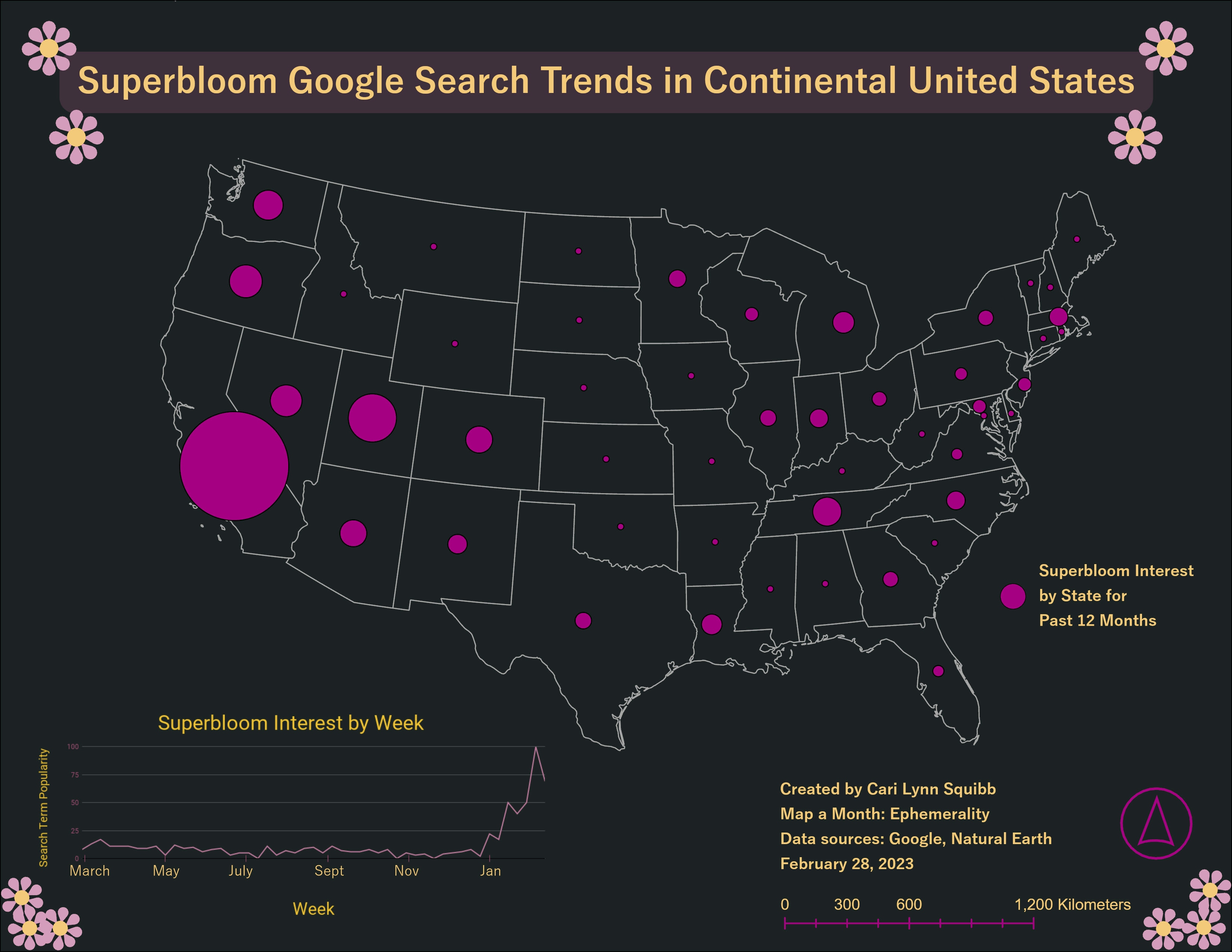
I finally dipped my toes into the exciting world of remote sensing through one my classes. While the majority of the coursework was taught in Google Earth Engine, I still find it easiest to make maps through ArcGIS Pro. Here is a quick exploration (hence the lack of a proper legend or other map layout staples) into NDVI at a site along the Lower Colorado River using NAIP imagery.
Map a Month: March
Tools used
ArcGIS Pro
Plug-ins used
ArcGIS Online
tags
NDVI
More by Cari Lynn Squibb


You might also like


Join the community!
We're a place where geospatial professionals showcase their works and discover opportunities.