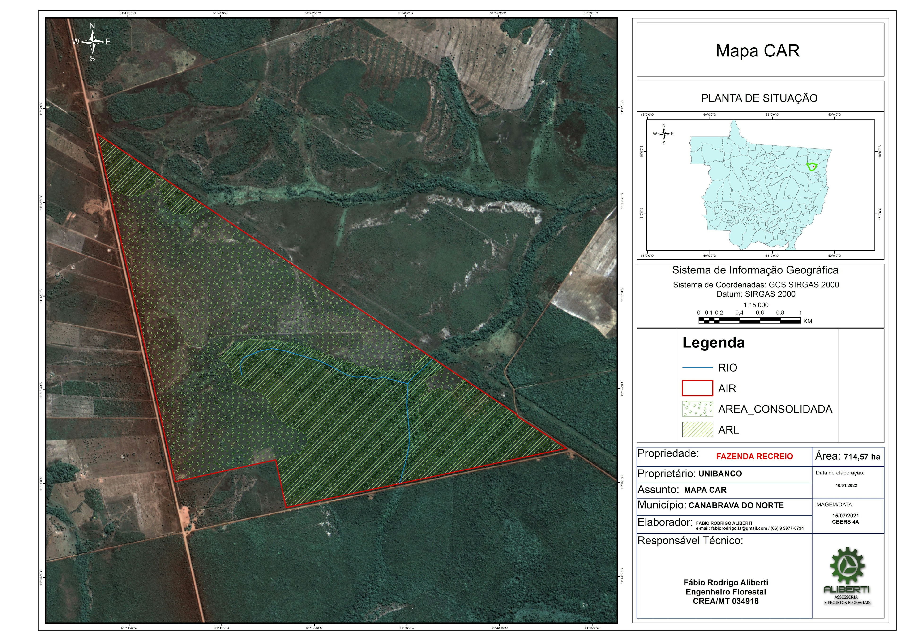
MAPA USO E OCUPAÇÃO DO SOLO


Tools used
ArcMap
Plug-ins used
Blender
tags
ArcMap
More by Fabio Rodrigo Aliberti


You might also like

.svg "Alec Soltes")


Join the community!
We're a place where geospatial professionals showcase their works and discover opportunities.
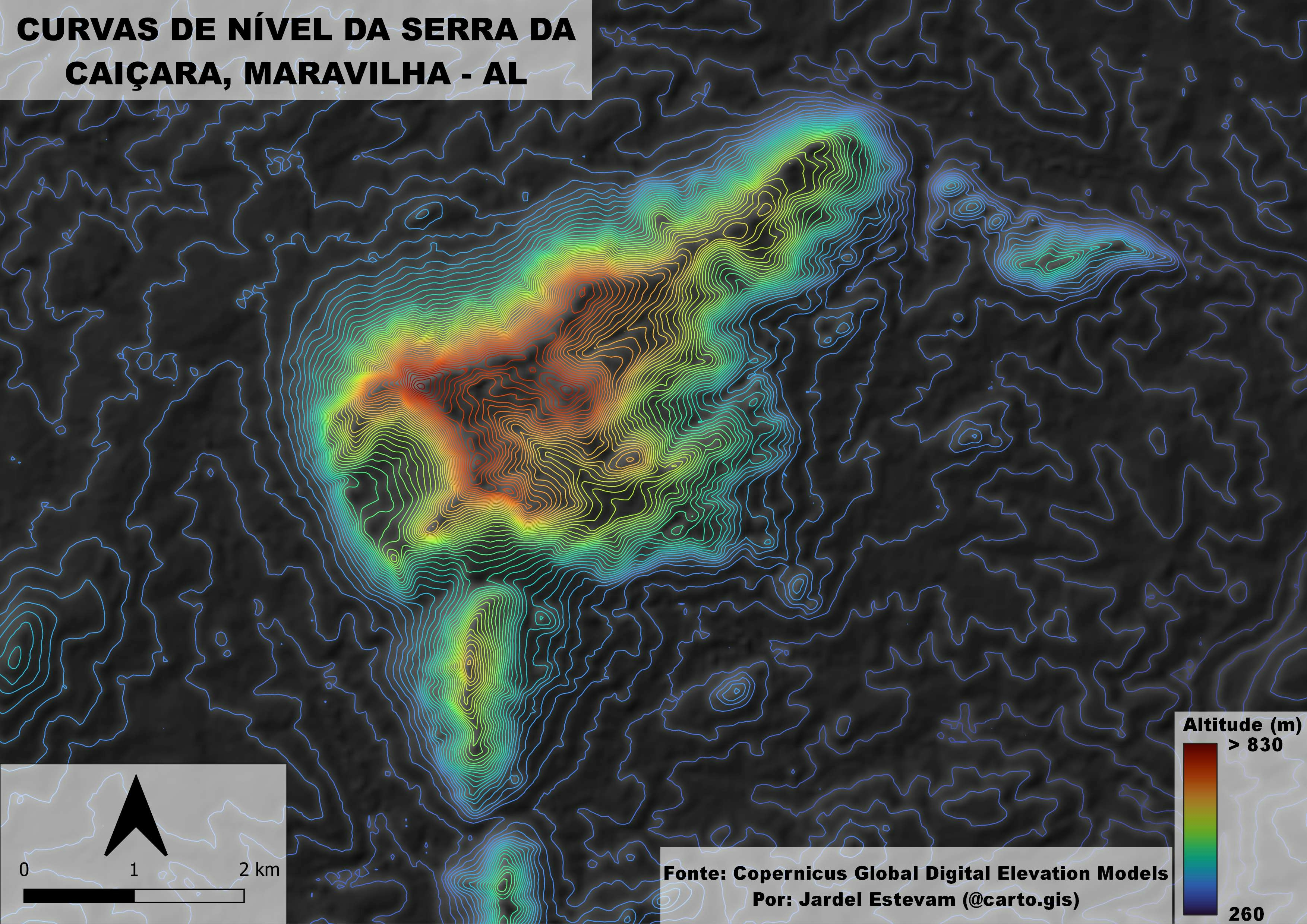
MAPA USO E OCUPAÇÃO DO SOLO
More by Fabio Rodrigo Aliberti
You might also like
We're a place where geospatial professionals showcase their works and discover opportunities.