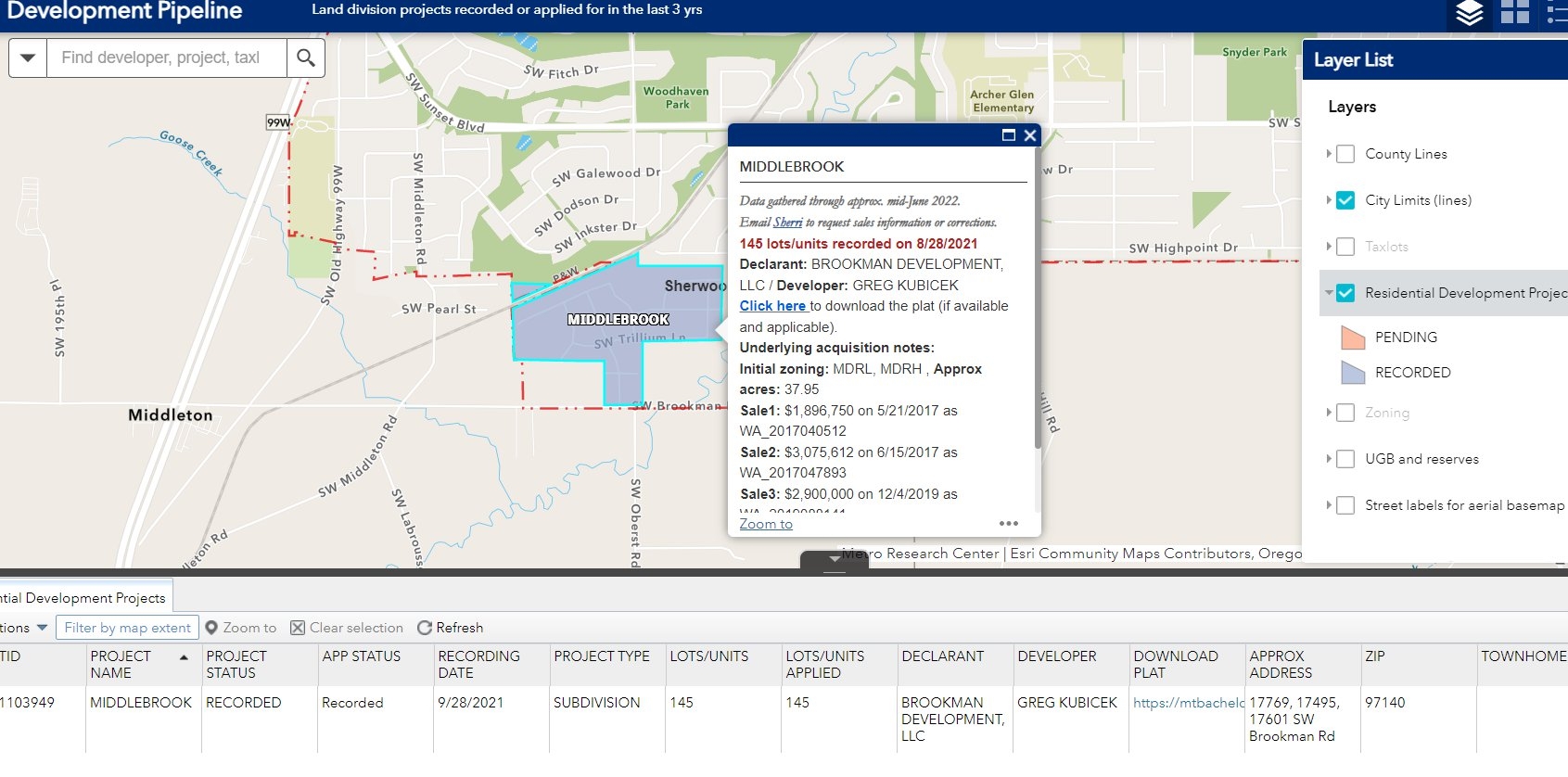
This map demonstrates how maximum entropy (MaxEnt) species distribution models can be applied to identify public lands where probability of that species being present is highest. To create this map, I first generated a species distribution model for the Eastern Slender Glass Lizard (Ophisaurus attenuatus longicaudus) in North-Central Florida and summarized mean probability of presence by wildlife management area (WMA) by using the 'Zonal Statistics as Table' tool in ArcGIS Pro. Values from the resulting table were then joined to the attribute table of the WMA layer. Lastly, I symbolized the WMA layer by mean probability of presence.
A shapefile for Florida Wildlife Management Areas is publicly available through the Florida Fish and Wildlife Conservation Commission.


 He")