
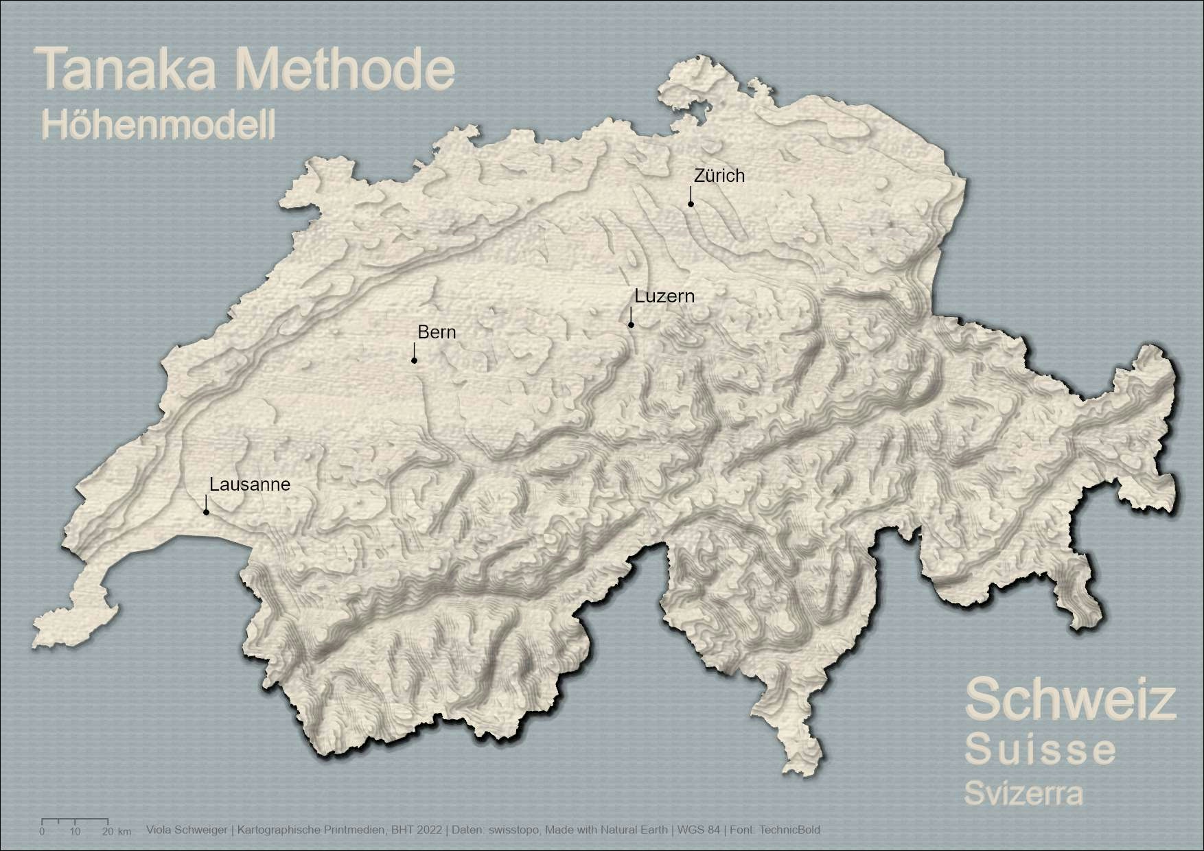
DGM data from swiss open topo.
Tanaka method to show countour lines for elevation. All made with ArcGIS Pro.
And i added a few cities for better localisation.
Elevation Map Switzerland Tanaka Method
DGM data from swiss open topo.
Tanaka method to show countour lines for elevation. All made with ArcGIS Pro.
And i added a few cities for better localisation.
More by Viola Schweiger
You might also like
We're a place where geospatial professionals showcase their works and discover opportunities.


