.svg "Keran Nkongolo")

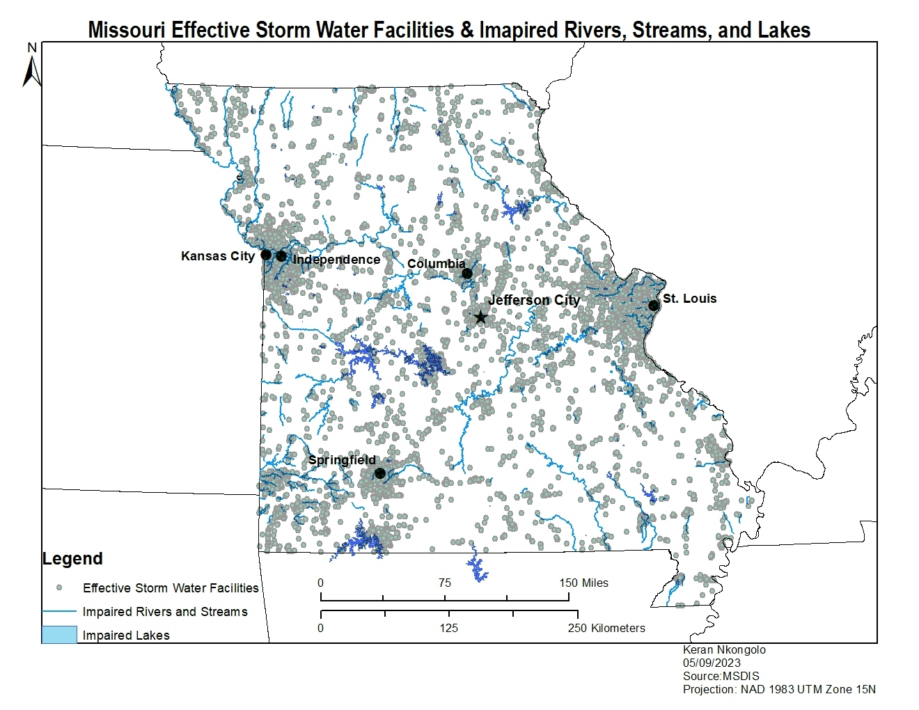
This project explored the relationship between effective mines and impaired rivers, streams, and lakes in Missouri. This map would made using ArcMap, and the results of this map reveal that there is an apartment relationship between effective mines and impaired lakes, rivers, and streams in the state of Missouri.
Missouri Effective Mines
Tools used
ArcMapeditor tools
Plug-ins used
ArcGISArcMap
tags
ArcMap
More by Keran Nkongolo


You might also like
.png&w=3840&q=100)


Join the community!
We're a place where geospatial professionals showcase their works and discover opportunities.