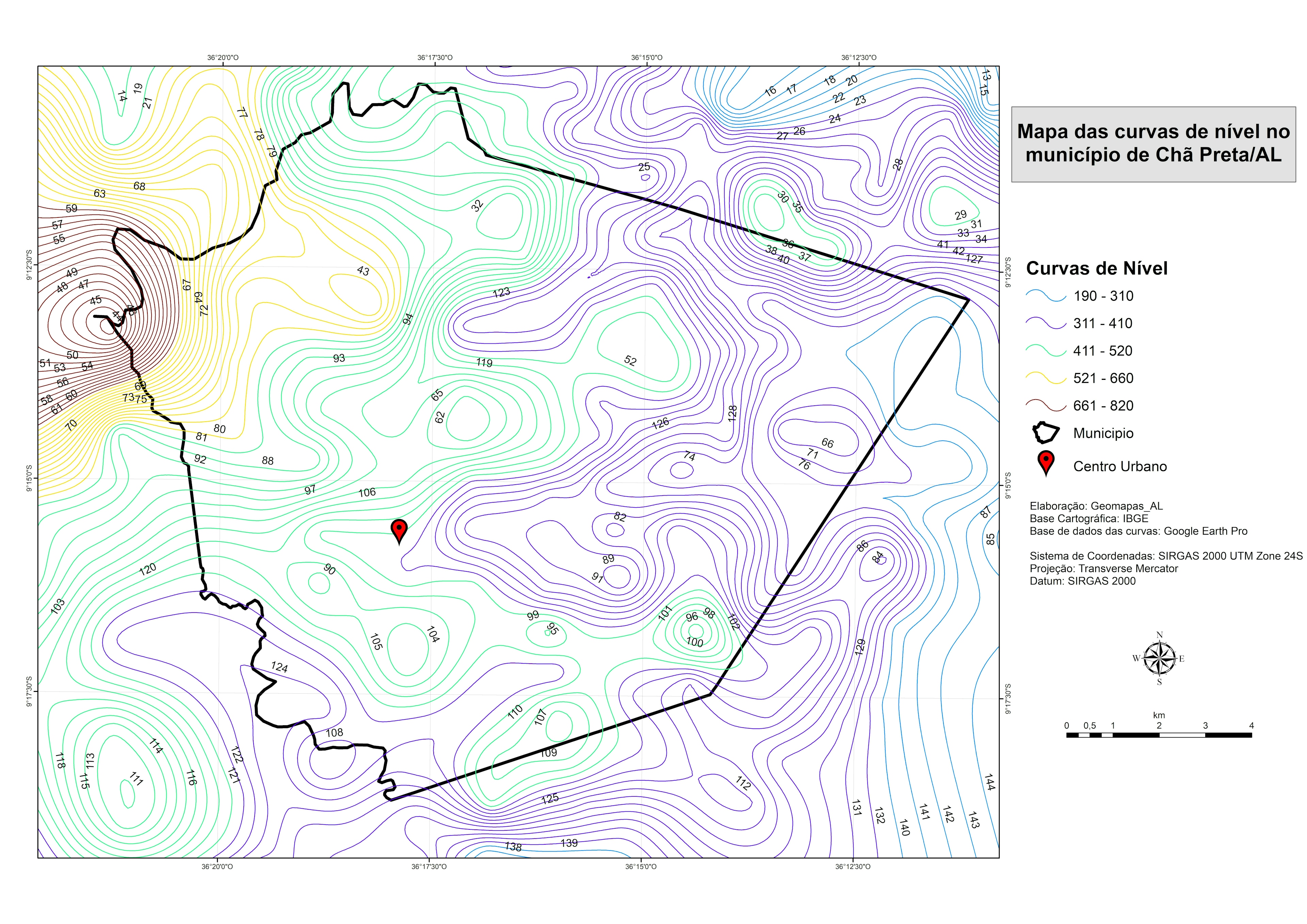
Quadro Natural em Chã Preta/AL


Tools used
ArcMap
tags
ArcMapGeoprocessametoQGIS
You might also like


Join the community!
We're a place where geospatial professionals showcase their works and discover opportunities.
Quadro Natural em Chã Preta/AL
You might also like
We're a place where geospatial professionals showcase their works and discover opportunities.