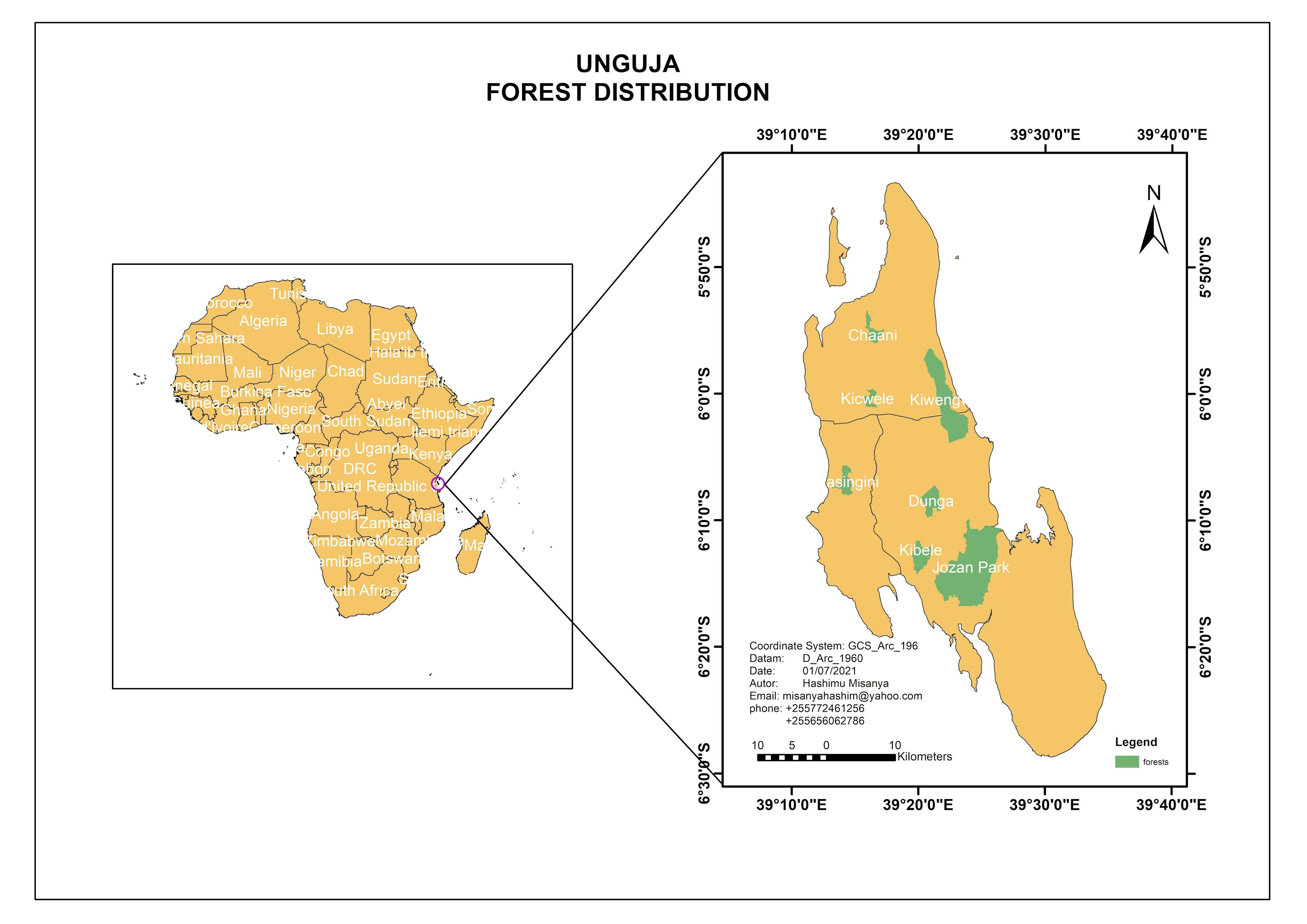
Tanzania coral reef in costal area


Tools used
ArcGIS Online
tags
Esri
More by Hashimu Misanya


You might also like


.jpg&w=3840&q=100)


Join the community!
We're a place where geospatial professionals showcase their works and discover opportunities.
Tanzania coral reef in costal area
More by Hashimu Misanya
You might also like
We're a place where geospatial professionals showcase their works and discover opportunities.