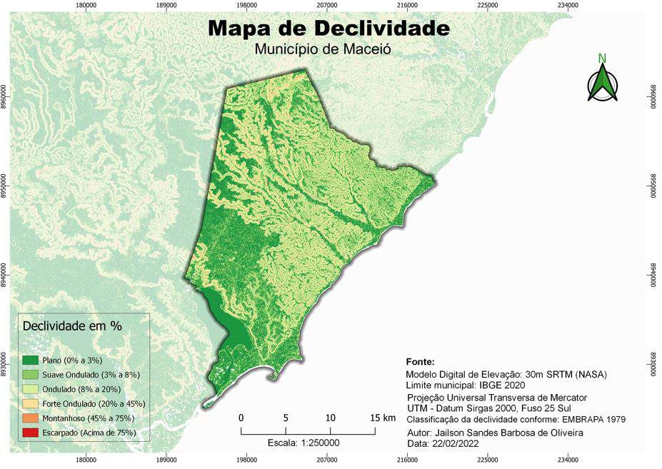
Feature extraction from existing maps.
Creation of custom symbols for points of interest and roads.
Extraction of contour lines from Digital Elevation Model (DEM).
Creation of overpass to visualise bridges.
Cartographic principles especially with colours and hierarchical organisation.


_page-0001.jpg&w=3840&q=100)


.gif&w=3840&q=100)