Sign up or log in to your Spatialnode account.

Takes less than a few seconds.

Warm Lake Idaho 2024

Michael Nau
Michael Nau•

September 24, 2024

Warm Lake Idaho 2024

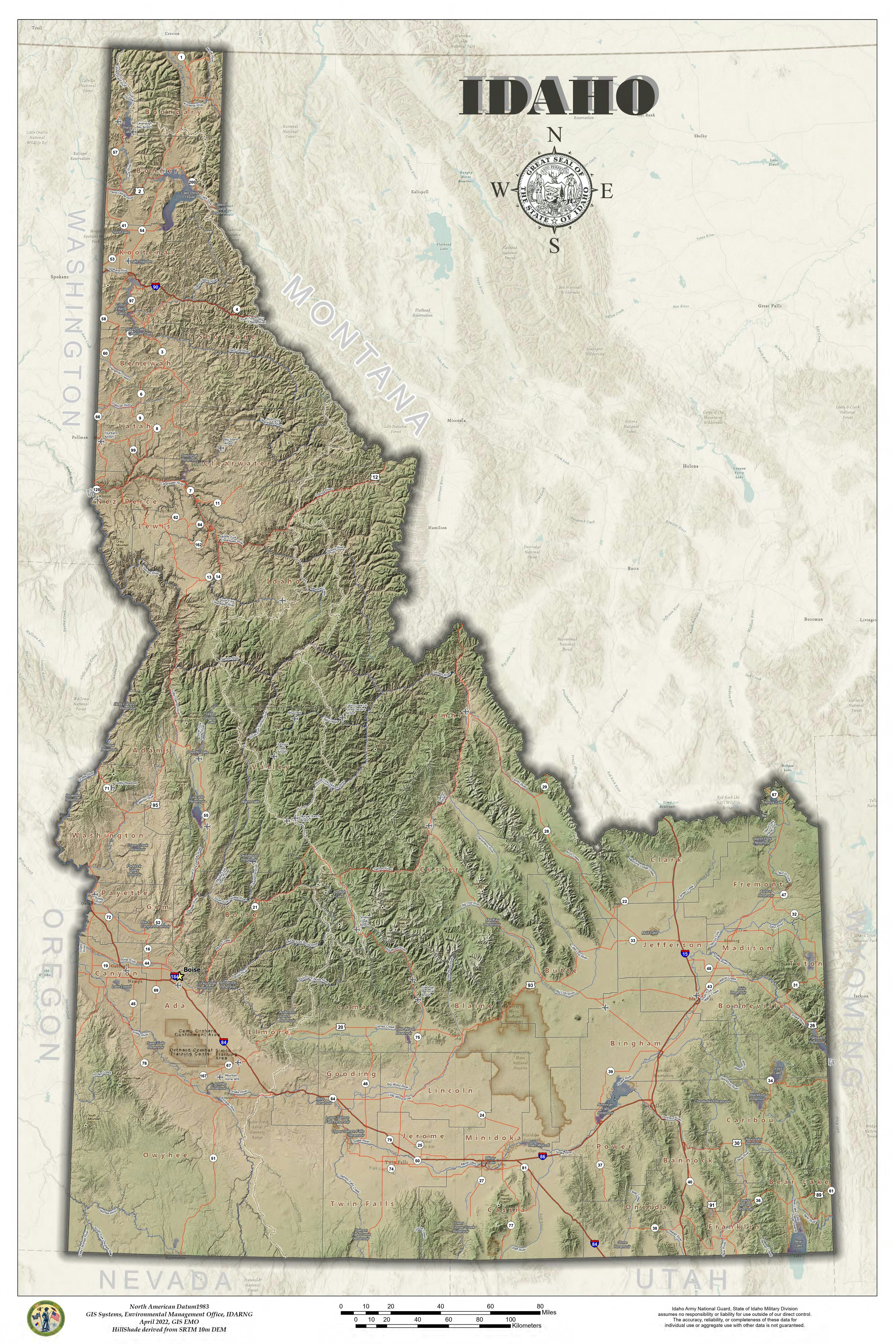
Basic imagery map with hand digitized roads and trails for the warm lake Idaho area.


Tools used

ArcGIS OnlineArcGIS Pro

Plug-ins used

Contour LinesSpatial Join

tags

Idahotopographic mapWarmlake

More by Michael Nau

Surface Drainage
Surface Drainage
87
PRISM Precipitation Data in Hex
53
Taste of Shed hunting
33
Wedding Seating Chart
38
Great State of Idaho
37
Heart of the Salmon River
60
USGS Topo 1909 Idaho Modern Hillshade
26
Story Board, Idaho Military Division
43
Historical shift 1943 to 2020
60
IdahoDarkRoads
IdahoDarkRoads
43

You might also like

Data Dev - Bat Conservation Strategy
Jeffrey Erwin
Data Dev - Bat Conservation Strategy
Jeffrey Erwin
10
Lithium potential & properties-MG-Brazil
Miriela Ulloa Santana
Lithium potential & properties-MG-Brazil
Miriela Ulloa Santana
64
Tsetse survey in Niger - Say & Gaya
Girma Kussa
Tsetse survey in Niger - Say & Gaya
Girma Kussa
18
DC Schools Safe Walk Map
Tyler Holmes
DC Schools Safe Walk Map
Tyler Holmes
7
Mapa de Densidade de John Snow
Sidney dos Santos
Mapa de Densidade de John Snow
Sidney dos Santos
115
Cobertura Arbórea-arbustiva Intraurbana
Patrícia Alves
Cobertura Arbórea-arbustiva Intraurbana
Patrícia Alves
29
Vancouver Nightlights Linear Regression
Michael Burnett
Vancouver Nightlights Linear Regression
Michael Burnett
18
Satellite data for land cover mapping
Kareen Bröker
Satellite data for land cover mapping
Kareen Bröker
48
Pontos de Coleta de Solo - EPAGRI
Hildeberto Macêdo
Pontos de Coleta de Solo - EPAGRI
Hildeberto Macêdo
11
6 Best GIS Software for Businesses
Stewart Berry
6 Best GIS Software for Businesses
Stewart Berry
37
Virginia Localities Estimated HDI
Alec Soltes
Virginia Localities Estimated HDI
Alec Soltes
106
Evolução da mancha urbana #02
Isabel Freitas Aniceto
Evolução da mancha urbana #02
Isabel Freitas Aniceto
11

Join the community!

We're a place where geospatial professionals showcase their works and discover opportunities.

Sign Up for free