.svg "Keran Nkongolo")

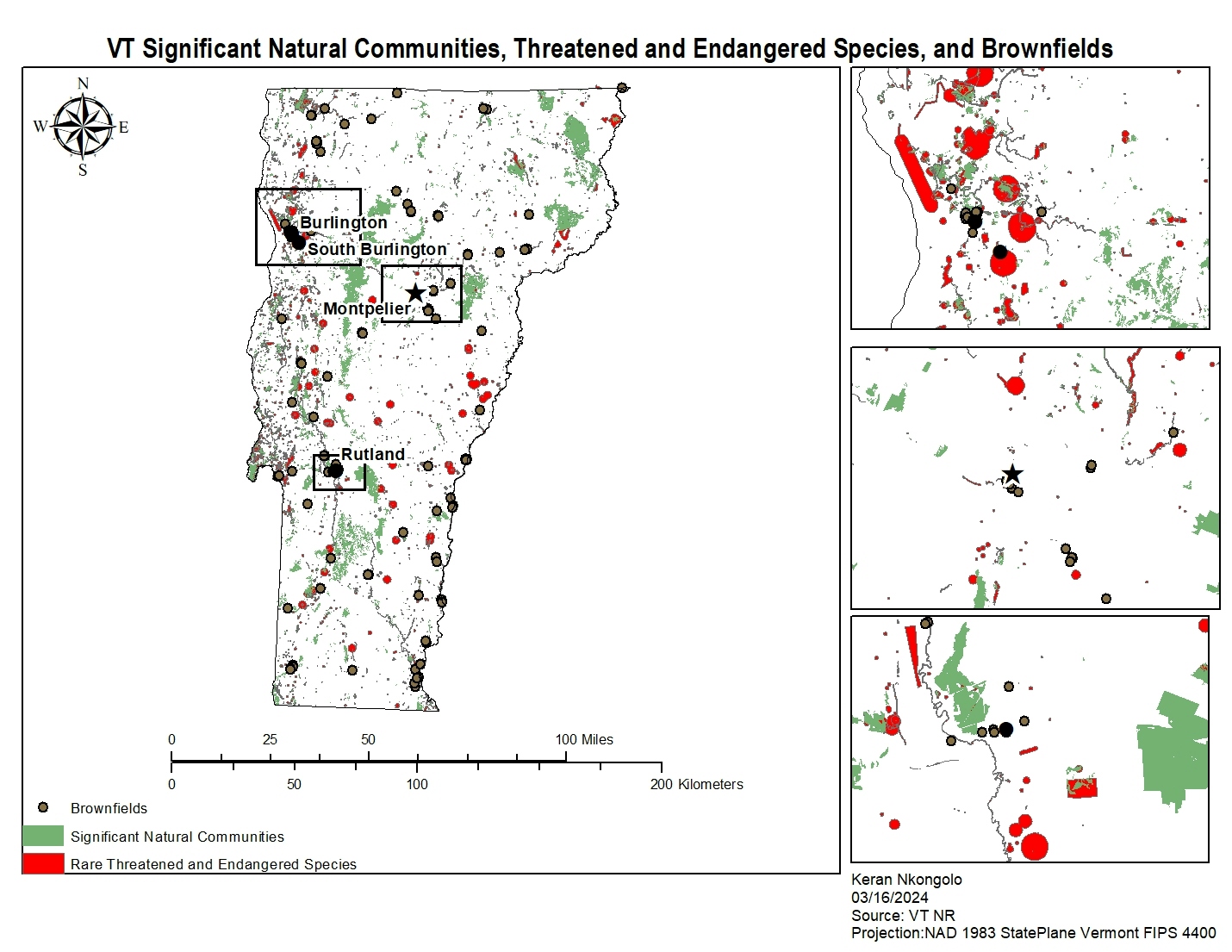
This project explores the relationship between High Risk Petroleum Tank Facilities, Low pH Contaminated Rivers, and Conservation Lands in Virginia.
VA Petroleum Sites
Plug-ins used
ArcGIS Pro
tags
ArcGIS Pro
More by Keran Nkongolo


You might also like


![Lexical Map of [Shovel] in Malay Lang](/_next/image?url=https%3A%2F%2Fstorage.googleapis.com%2Fspatialnodefiles%2Fprojects%2FPetaDialekCangkul1_9000385.png&w=3840&q=100)


Join the community!
We're a place where geospatial professionals showcase their works and discover opportunities.