AKUAPEM NORTH DISTRICT


tags
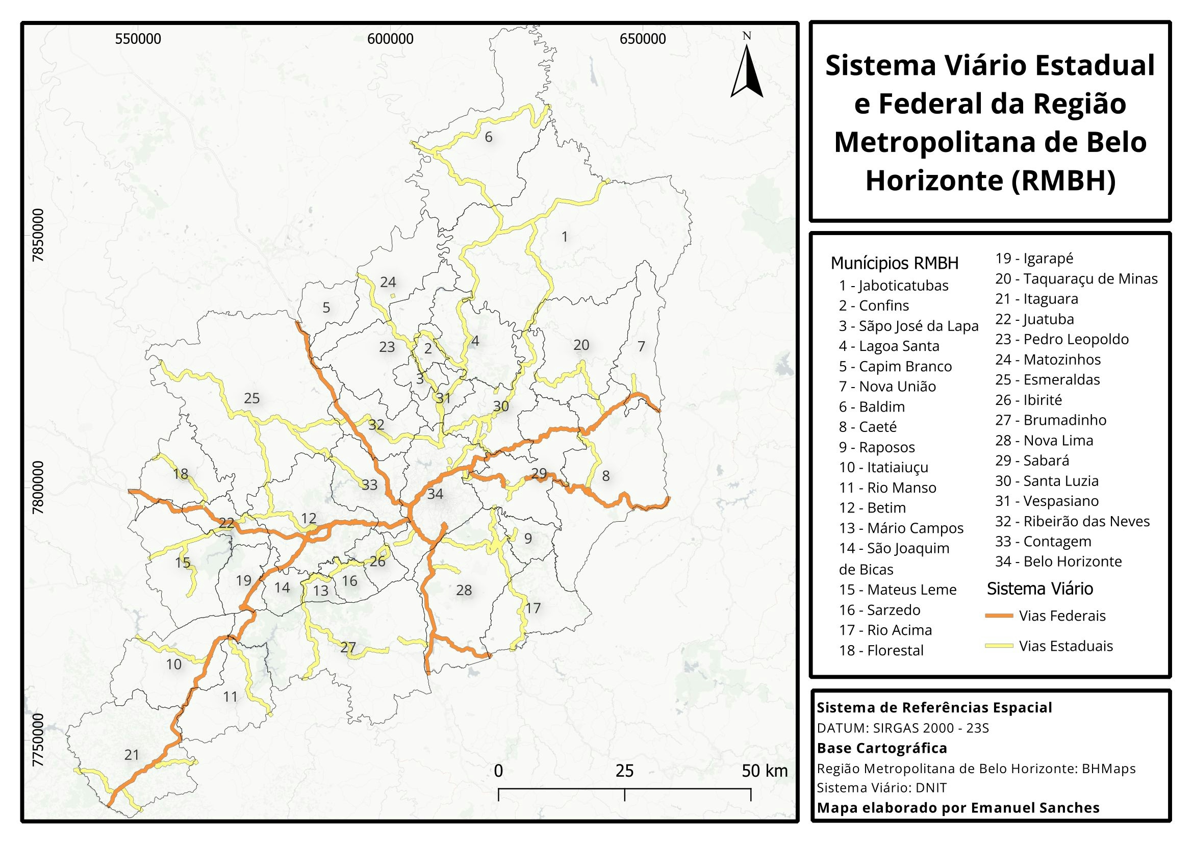
Study Area Map
More by Emmanuel Opoku
.jpg&w=3840&q=100)


You might also like


Join the community!
We're a place where geospatial professionals showcase their works and discover opportunities.
AKUAPEM NORTH DISTRICT
More by Emmanuel Opoku
You might also like
We're a place where geospatial professionals showcase their works and discover opportunities.