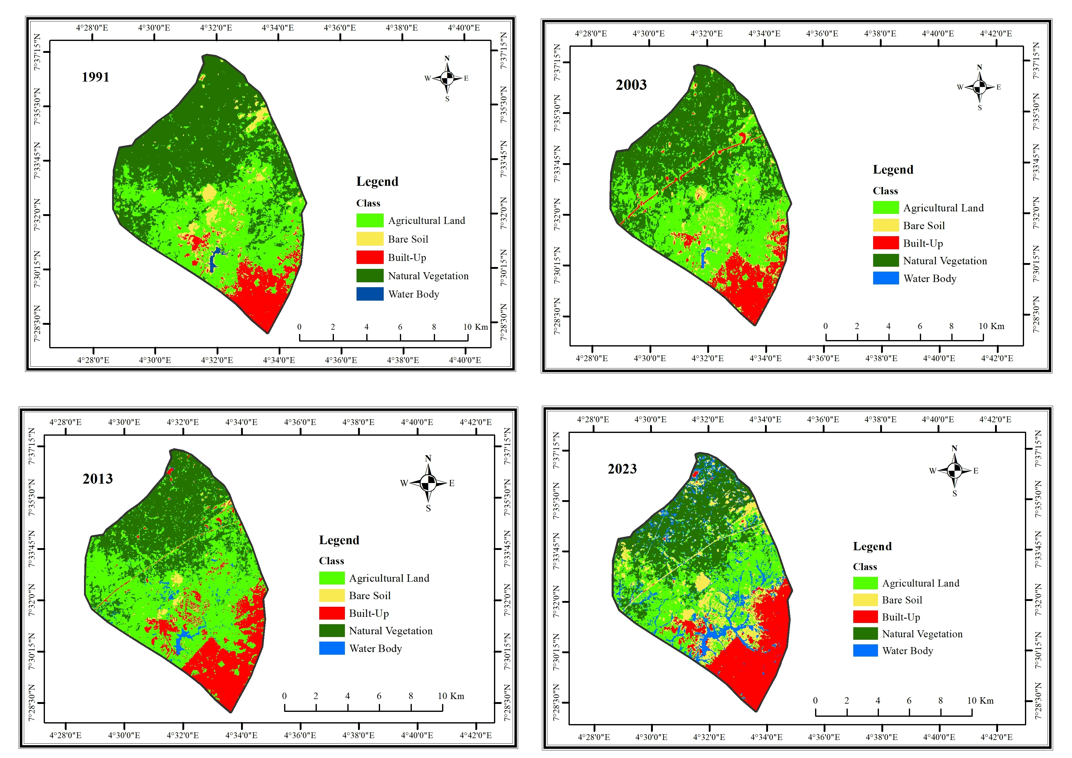
50 kilometer Buffer LULC (MOLE PARK)

.jpg&w=3840&q=100)
tags
LULCSpatial Analysis
More by Emmanuel Opoku


You might also like


Join the community!
We're a place where geospatial professionals showcase their works and discover opportunities.
50 kilometer Buffer LULC (MOLE PARK)
More by Emmanuel Opoku
You might also like
We're a place where geospatial professionals showcase their works and discover opportunities.