Developed an automated, cloud-based flood-mapping workflow in Google Earth Engine using Sentinel‑1 SAR to rapidly map Cyclone Amphan–induced flooding in Khulna, supporting disaster risk reduction and emergency response use cases.
Implemented SAR preprocessing (Refined Lee filter), pre/post-event backscatter ratioing, and a calibrated threshold to detect inundation robustly under monsoon cloud cover.
Integrated multi-source layers (JRC Global Surface Water, HydroSHEDS slope) to mask permanent water and steep terrain, reducing false positives and achieving a clean, operational flood product suitable for humanitarian and government partners.
Produced geospatial outputs (GeoTIFF, CSV area statistics) showing ~2.33% of the district flooded, directly usable for climate resilience planning, damage assessment, and flood-risk modeling.
GitHub: https://github.com/mohammadoney/Amphan-Flood-Mapping-Khulna-Bangladesh

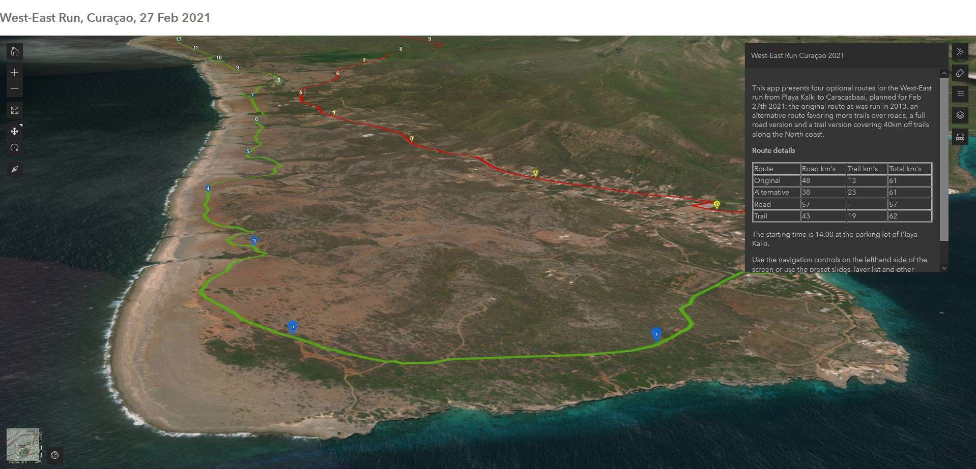
.png&w=3840&q=100)


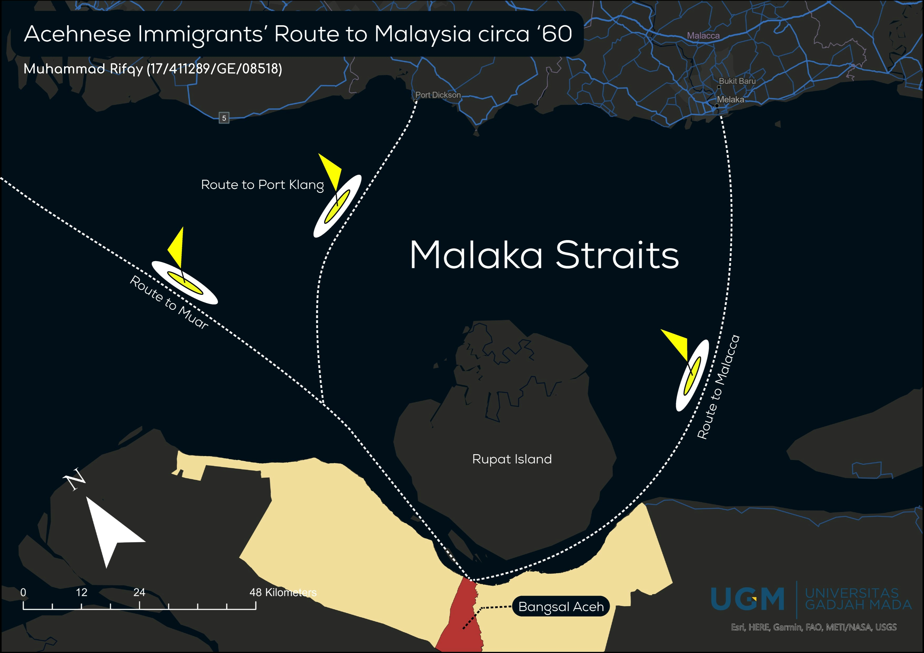
.png&w=3840&q=100)


.svg "Keran Nkongolo")